


A weekend loop trip…
22 minute read
June 12, 2024, 8:24 AM
From May 30 to June 1, I took a trip down to the Hampton Roads area in Virginia. Hampton Roads is by no means an unfamiliar place, even though I don’t get to go there nearly as much as I would otherwise like, but the way I got down there was a bit unconventional. Instead of going down the west side of the Beltway to I-95 in Springfield heading towards Richmond and then hanging a left on I-64 to go through New Kent, Williamsburg, and the like to get to my hotel in Newport News, I instead went down the east side of the Beltway to New Carrollton, where I got on Route 50 and took that over the Bay Bridge and then continued as far as Salisbury, where I made a right turn at US 13 to head down into Virginia towards the Chesapeake Bay Bridge-Tunnel. From there, I headed through Norfolk, through the Hampton Roads Bridge-Tunnel, through Hampton, and finally to my hotel in Newport News. I was also doing this trip completely unsupervised, as Elyse was going to a bus event up in Hershey that same weekend.
I made a few stops along the way, mostly to do some photography with the drone. My first stop was at a large park on the east side of the Bay Bridge, where I was planning to get some shots of the bridge itself:

Categories: Friends, Hampton Roads, Maryland, Photography, Roads, Today's Special
A proper visit to Charleston…
28 minute read
May 9, 2024, 10:14 AM
From April 17-19, Elyse and I made a weekend trip down to Charleston, South Carolina. It’s funny how this worked out. After our visit to Charleston last October, we both were left wanting more. We saw lots of potential in Charleston, and wanted to go back, but we weren’t sure whether we wanted to drive back again, vs. flying. Charleston is eight hours away, which is quite a long haul, and it’s almost entirely through rural areas once you get out of the DC region. In other words, not very exciting. But then when we looked at airfare, we realized that it was really expensive, and that with all of the goings-on at the airport plus multiple flights, we wouldn’t save any time compared to driving, plus we would be limited as to what we could bring with us, and would probably need to rent a car down there. All of that said, that pushed me into driving territory, because then we could bring whatever we wanted, go on our own schedule, and have fun on the way down and back. Plus then we would have the HR-V in Charleston.
On the southbound leg, I tried to keep the trip as close to all-business as I could. I only planned on making four stops: one in the Richmond area, one in Skippers, Virginia (the last Virginia exit on I-95), one somewhere in North Carolina, and then one at the Buc-ee’s in Florence, South Carolina. That would get us to Charleston at a somewhat reasonable hour as long as we kept to it.
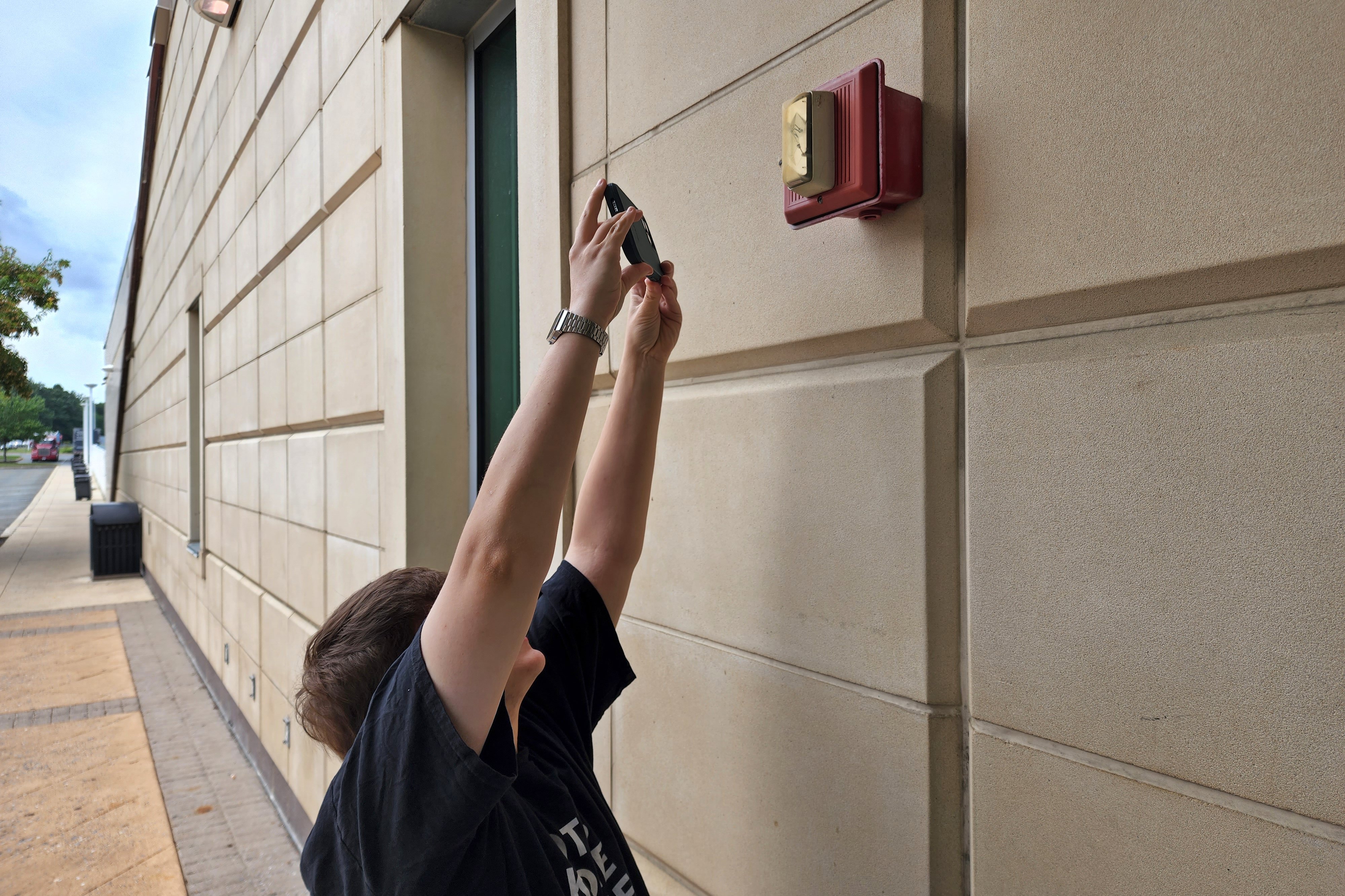
Richmond was intended primarily as a food stop. My original idea was to stop at the Sheetz at the Atlee exit, and do Sheetz, and I pitched that to Elyse a few days prior to our trip. It’s funny – when I pitched the idea, Elyse’s response was something to the effect of, “When were you going to tell me about this?” and my response was simply, “What does this look like?” Elyse said that she didn’t want to do Sheetz, because we always do Sheetz, and then suggested we find a barbecue place. I was like, “You had me at barbecue.” Looking it up, I found two places that weren’t too far off of I-95. One was a place called Q Barbeque up in Glen Allen, and then the other one was Oak & Apple right in downtown. I chose Oak & Apple, because it was right in downtown Richmond, and closer to the freeway. More or less get off of the exit, go like two blocks, and boom, there it is.
Categories: Converted buildings, Fire alarms, Netculture, North Carolina, Photography, Retail, Roads, Ships, South Carolina, Transit, Travel
A very transit-themed weekend…
14 minute read
April 11, 2024, 11:57 PM
On March 28 and 29, I had two very distinct transit-themed adventures. One day was a bus adventure, and the other was rail-related.
The bus adventure came first, on Thursday, March 28. That one has some background to it. First of all, every year for the past several years, I have had what I call a “tax party” with my friend Matthew, where we get together and we take care of our various taxes. Generally speaking, we go somewhere to eat, and then I sit down with the computer and do my own taxes, I do Matthew’s taxes, and I do Elyse’s taxes. This year, the tax party was done in two stages, as Matthew had to cancel at the last minute due to something unforeseen coming up, so I did the taxes for Elyse and me on the original date back in February (where I owed a ton of money because of my photography earnings), and then rescheduled with Matthew for a later date, impressing on him that he really shouldn’t postpone again, since the due date for taxes is a hard date, and you really don’t want to be a last-minute filer if you can avoid it. So we planned the date, and that was that. Now Matthew is also a bit of a transit enthusiast, and has pursued some opportunities in the transit field, but has always gotten cold feet when it came to the thought of actually operating a bus.
Now, along with Elyse, I am also on the board of directors for Commonwealth Coach & Trolley, which is a bus museum based in Roanoke, Virginia. Many of us on the board are in the DC area, and some of our vehicles do stay up in the DC area for various reasons. So I pitched the idea to have a small outreach event, taking a bus out for a spin and going to visit Matthew in that. So Elyse and I went down to where the bus was kept, parked the HR-V, and took out the bus. The bus that we had was former Fairfax Connector bus 7754, a 1991 Orion I, which we tend to call MATT, which stands for “Mobile Accessible Travel Training”. As I understand it, this bus originally operated as a regular Fairfax bus, and then was converted to a training vehicle to help older adults and people with disabilities learn to use public transit. I’m not exactly sure how it all worked, but it was fitted with some extra doodads like TV monitors, and has a desk with a swivel seat in the back of it, while the area forward of the rear door has updated seats.
Categories: Alexandria, Driving, Fairfax County, Loudoun County, Matthew, Transit, Washington DC, WMATA
I went to Ottawa…
6 minute read
May 24, 2023, 2:39 PM
From May 17-20, Elyse and I made a weekend trip to Ottawa. The primary objective was to go and see the Canadian Museum of History in nearby Gatineau, where a Sam and Muffy puppet from Today’s Special were on display as part of a larger exhibit about children’s television in Canada. The exhibit was amazing, with puppets and costumes from all kinds of Canadian-made children’s programming on display. We also explored around Ottawa and Gatineau. The latter was a particularly interesting experience as that was my first time in a place where the predominant language was not English. Ontario is largely English-speaking, and signage is largely bilingual, containing both English and French, but once you cross the border into Quebec, it’s like a whole different world, as everything is in French, and only French, and some people over there do not speak English. It was my first time experiencing a language barrier in a major way, and while I managed, remembering that a large amount of English words are derived from French, it was certainly a challenge nonetheless (but Google Translate helped a lot).
I am planning on doing a larger, more detailed photo set in Life and Times for this trip, so to avoid duplicating efforts, I’m just going to share a few photos here and let that be that for now.
Categories: Canada, Roads, Today's Special, Travel
A weekend in New York…
32 minute read
April 26, 2023, 8:33 PM
From April 12-14, Elyse and I took a little weekend trip to New York City. This was the new HR-V’s first road trip, and what better place to go to than New York, I suppose. It was definitely a different experience than the Soul’s first road trip, which was the trip home from Staunton the day after I bought it, as well as the original HR-V’s first road trip, which was a day trip to Philadelphia.
With this trip, I was looking forward to seeing how the new HR-V did on a long trip with the various smart features that it has built into it, such as the adaptive cruise control and the lane watch system. I had tested these things on my commutes to and from work on various occasions on a somewhat limited basis, but I hadn’t done a long drive with them yet. The good news was that these systems worked quite well together on our trip, which we took largely via I-95 and the New Jersey Turnpike. I think that this was probably the least stressful drive on I-95 that I’ve ever had, as the cruise control maintained a safe distance from the cars ahead of me, and it maintained my lane quite well, following the various curves in the road. That put me, as the driver, in something of a more “strategic” role, as I was responsible for navigating and making lane changes and such, as well as watching out for any hazards, but the car largely drove itself. I wouldn’t use these systems on city streets, but for a road trip on freeways, it was great. The thing to remember, though, is that these are driver assist features. This is not self-driving, and should not be confused with that. This does not absolve the driver from the responsibility of driving at the proper speed for conditions, and it also does not mean that you can kick back and play on your phone behind the wheel. Not at all – you’re still very much in charge, even if this does automate certain parts of it.
The trip up was fairly uneventful. We had to detour onto Route 1 from White Marsh to Joppa in order to avoid a backup, and there was a construction project on the Delaware Memorial Bridge, which had a direct connection to the Turnpike that crossed us over to the southbound span. Additionally, Maryland House, one of the two full-service travel plazas on I-95 in Maryland, was closed for emergency plumbing repairs. And then, of course, when driving on the New Jersey Turnpike, the speed limit signs are merely suggestions. Just keep up with traffic, and you will be fine. And if traffic is going 20 over the speed limit in a work zone, you’re going 20 over in a work zone, too. Otherwise, you become a hazard to traffic. Then upon arrival in the New York area, we got on I-278, where we followed roughly the same route that we did in our impromptu 2017 trip to New York, but in reverse. We parked on the street in front of our hotel, the Aloft, got checked in and brought all of our stuff up, and then I took the HR-V to its own hotel, which was on the next block over.
Categories: Driving, Family, Honda HR-V (2023), New York City, New York Subway, Photography, Travel
Making a weekend trip out of a delivery…
15 minute read
April 7, 2023, 10:00 AM
Recently, I was finally able to complete the last little bits of business related to the car accident from last October, and put it all behind me. On Thursday, March 30, I made the 175-mile journey to Stuarts Draft in the Scion – a trip that would leave it back home with my parents, where it belongs. And while I was at it, I made a weekend trip out of it, coupling it with a day in Richmond, where I did some photography. As such, I would traverse what I like to call Virginia’s “Interstate square”. If you look at a map of Virginia, the various Interstate highways in the state form something like a lopsided square, consisting of I-66 to the north, I-81 to the west, I-64 to the south, and I-95 to the east, and Strasburg, the DC area, Richmond, and Staunton at the corners:

Categories: Driving, Family, Harrisonburg, Howard Johnson's, JMU, Photography, Richmond, Roads, Scion xB, Staunton, Stuarts Draft, Travel
The taming of the stroad?
15 minute read
December 1, 2022, 10:00 AM
About three weeks after the accident that claimed my HR-V, I read on The MoCo Show about another accident that occurred on the same stretch of road at Russell Avenue, a block away from where my accident happened, that looked very similar to mine. Additionally, I remember an accident that occurred at the same intersection as mine in May 2020 that Elyse and I encountered while we were out and called in to 911. Taken together, it tells me that Montgomery Village Avenue (MD 124) between Interstate 270 and Midcounty Highway is a poorly designed road that probably needs to be rethought and redesigned in order to increase safety along that stretch.
For those not familiar, Montgomery Village Avenue, along with quite a number of other roads in Montgomery County, is what is often referred to as a “stroad“. Wikipedia defines a stroad as “a type of thoroughfare that is a mix between a street and a road”, and the word itself is a combination of the words “street” and “road”. Basically, it’s a road that wants to function as a local city street and as a major highway all at once, and often fails at both roles. These roads are typically designed for relatively high speeds, but their functioning as a city street with pedestrians and so many private accesses means that the posted speed limits are typically well below the road’s design speed. Do you remember that Journal entry that I wrote in 2013 about people who were getting run over at bus stops in Montgomery County? All of the streets in question were stroads. Georgia Avenue in particular is the textbook definition of a stroad, being a six-lane divided highway with private access, including single-family residential, directly off of the main road from Silver Spring to all the way to Olney. The speed limit for much of that road is 35 mph from Silver Spring to Leisure World, with a posted speed of 25 mph through Wheaton. I speak from experience from ten years’ time living just off of Georgia Avenue that it is very difficult to maintain that speed limit when traffic is moving well, and I often found myself exceeding the speed limit without realizing it and then having to slow down once I do notice. That’s because the road is designed for much higher speeds than traffic is actually allowed to go, and people tend to drive in a way that befits the road design, especially during off hours. They say that if you can speed on a road and not realize it, and not feel that your higher-than-allowed speed is actually dangerous, then the speed limit is too low for the design of the road. In other words, the usual go-to argument of, “LoWeR aLl ThE sPeEd LiMiTs!” is a major non-starter for me, if because the speed limit was already too low for the design of the road, and people weren’t following it anyway, what’s the point of lowering it further? They weren’t following it when it was 35, so what makes you think that they’re going to follow it at 25? I also find the way that people are so quick to blame drivers 100% for accidents to be problematic, because the design of the road can also be a legitimate contributing factor to accidents, such as roads that are designed for much higher speeds than anyone probably ought to drive. It’s kind of like how the “no u-turn” sign is often a symptom of poor road design, because with a better-designed road, you wouldn’t need signage that disallows obvious and mostly reasonable moves to get around the poor road design.
Categories: Driving, Gaithersburg, Montgomery Village, Roads
May the HR-V rest in peace…
13 minute read
October 20, 2022, 8:32 AM
In the early morning on October 9, I was involved in a car accident on the way home from work. At the intersection of Montgomery Village Avenue and Christopher Avenue/Lost Knife Road in Gaithersburg, the driver of a red Nissan Pathfinder on Christopher Avenue ran a red light at what appeared to be full speed as I was going through the intersection, and despite my slamming on the brakes, there just wasn’t enough space to stop in order to avoid a collision. As a result, my car got T-boned on the left side on the front fender and the driver’s door, with enough force to deploy the side curtain airbags and knock my car about 150 feet before it came to rest next to a curb.
After the impact, I remember that I was sitting in the car and noticed that the airbags had gone off, and also noticed that the windshield was shatered at the bottom left. Then I remember hearing a male voice telling me that I needed to get out of the car. I quickly realized that would probably be a good idea, because considering that the car had just gone through a pretty hard collision, for all I knew, it might be on fire. I tried to open my door, but I couldn’t get it open, so I ended up climbing out through the passenger side door. I was quite shaken, I was bleeding above my left eye, my left knee felt sore like it had been scraped, and I wasn’t wearing my glasses anymore for some reason, but nonetheless, I had managed to walk away from it. Then I saw the person who had been telling me that I needed to get out of the car. It was a gentleman wearing black eye makeup (kind of like what the band Kiss does) from an event that he had been at earlier who was also an EMT, and who had witnessed the entire thing. He also quickly told me that the accident was absolutely not my fault, which I appreciated hearing. There was also a woman present who had witnessed the accident, who also agreed that I was not at fault. One of them must have also called 911, because I certainly didn’t, but the police and EMS were there pretty quickly.
When EMS arrived, they quickly took care of me, wrapping some gauze around my head for the bleeding, and taking my blood pressure. Yes, they took my blood pressure. I’m standing on the side of the road next to my now-wrecked car, visibly shaking from the accident, and then the guy tells me that my blood pressure is “kind of high”, coming in at 172/116. I did not need to be told that. I’m usually pretty nice, but I just shot back, in a pretty sarcastic tone, “Gee, I wonder why.” He removed the blood pressure cuff from my arm and went away. Yeah, I just survived a pretty major car accident, got hit by an airbag, had to crawl out the other side of my car, was bleeding from my head, had no glasses, and was shaking. My blood pressure is high? No kidding. I would have been more surprised if it was 120/80 right then rather than some astronomical amount. I refused transport, feeling that it was unnecessary. Then the cops got my information, and took my statement. I also let Elyse know what had happened, and she quickly got an Uber to take her to the scene.
Categories: Driving, Gaithersburg, Honda HR-V (2018), Montgomery Village, Scion xB
A trip to New Jersey with Elyse and Woomy…
17 minute read
August 14, 2022, 7:57 PM
On Thursday, July 28, Elyse and I took a trip up to New Jersey. The main purpose of the trip was to visit the Scrub Daddy headquarters in Pennsauken, where the company has a retail store. Then we built a day around this in order to justify the trip. We were no stranger to Scrub Daddy by any means, as we had previously stopped by their facility on the last day of our Atlantic City trip back in January, just to see where it was. I remember how excited Elyse was during that visit to Scrub Daddy’s headquarters, and on that occasion, we just photographed the outside of the building, since the retail store wasn’t ready yet. I could only imagine how excited Elyse would be going in and actually seeing the place.
We left the house around 10:00 AM, and got as far as Delaware House by noon. This was to be our potty stop on the way up. Elyse noticed an Edwards Integrity on the outside of the facility, and got some photos of it:
Categories: Companies, Elyse, New Jersey, PATCO, Philadelphia, Products, Roads, Ships, Travel, Woomy
A day up in Pennsylvania…
17 minute read
July 22, 2022, 8:30 AM
On July 15, Elyse and I went up to Pennsylvania to photograph a very specific target: the western portal of the Kittatinny Mountain Tunnel, which is one of four tunnels on the mainline Pennsylvania Turnpike. I’ve been wanting to photograph a Pennsylvania Turnpike tunnel for a while, but distance plus operational challenges caused this to be back-burnered for a long time.
My first thought was to photograph the tunnels the old fashioned way: on the turnpike itself, from a vehicle. I did this on my shoot from 16 years ago where I photographed Breezewood and then did the turnpike to Carlisle. I do not recommend that anyone do this, at least not the way that I did, because I was driving with one hand and photographing with the other. At the relatively young age of 24, though, I thought that I was good enough to handle it, but looking back, I’m fortunate that nothing went wrong. If I had someone else with me doing the driving, this would have been a better option, but I didn’t have one. Of course, even then, you really only have one shot at it. The Pennsylvania Turnpike is a toll road, and a relatively expensive one at that, plus the exits are spaced fairly far apart. Thus, in the case of Kittatinny Mountain (and the adjacent tunnel through Blue Mountain), having to go back to take another crack at it would require about 25 miles of extra driving, considering that the exits on either side are spaced about 12 miles apart, plus the distance to actually turn around at both ends. Plus extra tolls and the fuel to do that round trip. Pulling over and shooting some photos from the roadside is also not a viable option, because as I understand it, the PTC does not look favorably on that. General rule of thumb is that outside of the service plazas, the PTC does not want you outside of your vehicle on their property at any time except if you absolutely have to, and will come check on you if you are outside somewhere that you’re not supposed to be. So that led me to do some research on Google Maps in order see if there were off-turnpike places to photograph any of the tunnels. Allegheny Mountain is too far west, being more than halfway to Pittsburgh, plus there’s no off-turnpike access. Tuscarora also had no access. No access at Blue Mountain, either. But at Kittatinny Mountain, Route 641 goes over the turnpike just west of the tunnel portals. Therefore, we have a winner.
Finding that, I then turned to Elyse and basically said, “Help me justify this outing by building a day,” and sent along a map of my target and the intended route there. That’s how so many of our adventures happen: there’s something that one of us wants to do, but we can’t justify the time commitment or expense of a trip for it it all by itself. So we add more stuff and make it into a full-on adventure that typically gets us home around midnight. Elyse wanted to see a siren and some other stuff in Shippensburg and Chambersburg, so there was the rest of our adventure.
Categories: Pennsylvania, Photography, Roads, Security, Travel
No more cutesy safety messages?
6 minute read
January 7, 2021, 5:18 PM
On January 4, 2021, the Federal Highway Administration (FHWA) issued a ruling providing “an official interpretation of the provisions of the 2009 edition of the Manual on Uniform Traffic Control Devices for Streets and Highways (MUTCD) related to changeable message sign messaging”. In a nutshell, this ruling bans all of those cutesy safety messages that highway departments love putting on those overhead message signs, such as this one:

Categories: Roads
Apparently, this happens to me once a decade…
6 minute read
September 20, 2020, 2:32 PM
Saturday night’s drive home was definitely a more eventful one than I would have preferred. Driving home from work (I currently work out of a division in Virginia), I tend to take Route 267 to the Beltway to I-270 and then to Route 355 (i.e. Rockville Pike) on my way north to Montgomery Village. The details in MoCo tend to vary depending on my mood. Sometimes I take 270 all the way to Shady Grove and cut over there, and sometimes I get off lower down and do more travel on Rockville Pike. Saturday night was the latter, where I got off on Democracy Boulevard and took Rockville Pike all the way from North Bethesda to Gaithersburg.
At the intersection with First Street (the one with the CVS and the Wendy’s with the glass sign), I was sitting at a red light in the middle lane, and I saw a car run the red light at a high rate of speed in the right lane. They were going quickly enough that I could feel their wake as they went by (and I felt them before I saw them). Then a few seconds later, just as the light turned green, a Maryland state trooper went past me, again at a high rate of speed, with lights off, to my left. I kind of assumed that they were related, and that I would see the trooper pull the other vehicle over at some point on my way home. So I had my eyes peeled, as I expected to see blue lights at some point.
Then, just before the intersection with Mannakee Street, a deer darted out in front of me, and with not enough space to swerve to avoid and not enough distance to stop, we made contact. I remember screaming as we hit, and I saw the deer sort of stagger away. I stopped the car immediately, right there in the center lane. I got out, looked at the front of the car, and saw a brand new hole where the grille used to be, pieces of the front of the car sticking out of the front, as well as bits and pieces of the Honda logo on the road. Then, realizing that the engine was still running, and seeing nothing dripping out from underneath, I moved the car to the parking lot of Cameron’s Seafood, and after letting Elyse know that I would be delayed, called 911 to report the accident. Surprisingly, 911 told me that for a deer strike, they weren’t going to send an officer to take a report, and just to follow up with the insurance.
Categories: Driving, Honda HR-V (2018), Rockville
Drive carefully, everyone…
3 minute read
May 17, 2020, 12:21 AM
You may have noticed the photo feature that is currently running on the front of the site depicts a vehicle on its side following its being involved in an accident. First of all, before you ask: we were not involved in this accident. Elyse and I saw a car with a bashed in front in the middle of the road and a second car on its side at the intersection of Montgomery Village Avenue and Lost Knife Road while we were on the way home from dropping off a package at a UPS locker, and, seeing no emergency vehicles around, stopped and called it into 911. Thankfully, no one appeared to be seriously hurt, as both drivers were able to walk away from their respective vehicles. However, I suspect that the driver of the smashed car hit her head on the windshield, as there was damage to the windshield consistent with that sort of impact. Additionally, both drivers did ultimately leave the scene in ambulances, presumably to get checked out.
Once we were finished talking with 911, we got some photos of the scene. Here are some of mine:

The overturned vehicle, an Acura MDX. The driver had not yet turned the car off when this photo was taken.
Categories: Driving, Montgomery Village
A trip out to Hampton Roads…
18 minute read
April 19, 2020, 10:15 AM
From April 3-6, Elyse and I made a trip to the Hampton Roads area of Virginia to visit friends and do some photography. The way I figured, the trip was already paid for, and so as long as we took adequate precautions, I saw no harm in running it as planned. After all, I go out every day to go to work transporting the public, so it’s not like we were “breaking quarantine” or anything, since I’m out in the environment on a regular basis throughout all of this. All that said, if you don’t like that we took this trip, keep it to yourself, because I don’t want to hear about it. On our trip, we stayed in Williamsburg, and had a fun time, mostly photographing architecture and infrastructure with friends Aaron and Evan Stone.
Meanwhile, leaving the house, I had the worst shotgun passenger ever:

I mean, despite his sour disposition, you really didn’t think that we’d take a trip without bringing Woomy along, did you? Elyse quickly threw him out of the front seat so that she could ride, and so Woomy rode in the cup holder.
Categories: COVID-19, Hampton Roads, North Carolina, Richmond, Roads, Ships, Transit, Travel, Woomy
Please don’t stop for me when I’m waiting to cross the street…
5 minute read
August 25, 2018, 1:51 PM
On Thursday, while I was waiting for a bus, I witnessed a near accident involving a pedestrian at a crosswalk on Layhill Road near Glenfield Local Park in the Glenmont area of Montgomery County. In other words, this location, seen from approximately my vantage point:

Image: Google Street View
This view is facing approximately south, putting the northbound lanes on the left and the southbound lanes on the right. There is a median in the middle of the road. Southbound traffic has a turnout for traffic making left turns into the park police station (entrance visible at left). There are wide bike lanes on either side of the road. There is also a Metro facility entrance at this location (out of frame to the right). This intersection is not a big one by any means. There are no signals. Ride On has a bus stop on either side of the road at this location.
Categories: Roads, Silver Spring