


A day up in Pennsylvania…
17 minute read
July 22, 2022, 8:30 AM
On July 15, Elyse and I went up to Pennsylvania to photograph a very specific target: the western portal of the Kittatinny Mountain Tunnel, which is one of four tunnels on the mainline Pennsylvania Turnpike. I’ve been wanting to photograph a Pennsylvania Turnpike tunnel for a while, but distance plus operational challenges caused this to be back-burnered for a long time.
My first thought was to photograph the tunnels the old fashioned way: on the turnpike itself, from a vehicle. I did this on my shoot from 16 years ago where I photographed Breezewood and then did the turnpike to Carlisle. I do not recommend that anyone do this, at least not the way that I did, because I was driving with one hand and photographing with the other. At the relatively young age of 24, though, I thought that I was good enough to handle it, but looking back, I’m fortunate that nothing went wrong. If I had someone else with me doing the driving, this would have been a better option, but I didn’t have one. Of course, even then, you really only have one shot at it. The Pennsylvania Turnpike is a toll road, and a relatively expensive one at that, plus the exits are spaced fairly far apart. Thus, in the case of Kittatinny Mountain (and the adjacent tunnel through Blue Mountain), having to go back to take another crack at it would require about 25 miles of extra driving, considering that the exits on either side are spaced about 12 miles apart, plus the distance to actually turn around at both ends. Plus extra tolls and the fuel to do that round trip. Pulling over and shooting some photos from the roadside is also not a viable option, because as I understand it, the PTC does not look favorably on that. General rule of thumb is that outside of the service plazas, the PTC does not want you outside of your vehicle on their property at any time except if you absolutely have to, and will come check on you if you are outside somewhere that you’re not supposed to be. So that led me to do some research on Google Maps in order see if there were off-turnpike places to photograph any of the tunnels. Allegheny Mountain is too far west, being more than halfway to Pittsburgh, plus there’s no off-turnpike access. Tuscarora also had no access. No access at Blue Mountain, either. But at Kittatinny Mountain, Route 641 goes over the turnpike just west of the tunnel portals. Therefore, we have a winner.
Finding that, I then turned to Elyse and basically said, “Help me justify this outing by building a day,” and sent along a map of my target and the intended route there. That’s how so many of our adventures happen: there’s something that one of us wants to do, but we can’t justify the time commitment or expense of a trip for it it all by itself. So we add more stuff and make it into a full-on adventure that typically gets us home around midnight. Elyse wanted to see a siren and some other stuff in Shippensburg and Chambersburg, so there was the rest of our adventure.
This adventure initially seemed cursed, though. We got a later start than I would have preferred, plus there were a number of traffic issues along our intended route. For those not familiar, our intended route was to take I-270 up to Frederick, get on I-70 and take that to Hagerstown, take I-81 up to Chambersburg, and then take a number of back roads to get to the tunnel portal. First there was an accident on 270, which caused us to divert to Route 355 at the Frederick County line. We ended up taking that into downtown Frederick and then going through the Golden Mile in order to avoid another jam on I-70 in Frederick. Then on 70, we encountered more slowdowns just past South Mountain. So we got off on Route 66 and took that and Route 64 into Waynesboro, Pennsylvania. We then took Route 16 to I-81, joining up with it in Greencastle. We were about to hit another slowdown due to construction near Chambersburg, but thankfully, our exit was right before the slowdown started. And we had no more traffic problems from there. We ended up getting to our destination around 3:30. That was later than I had intended, but it still worked out, because the sun sets to the west, and this was the western portal. Thus I still had plenty of sunlight.
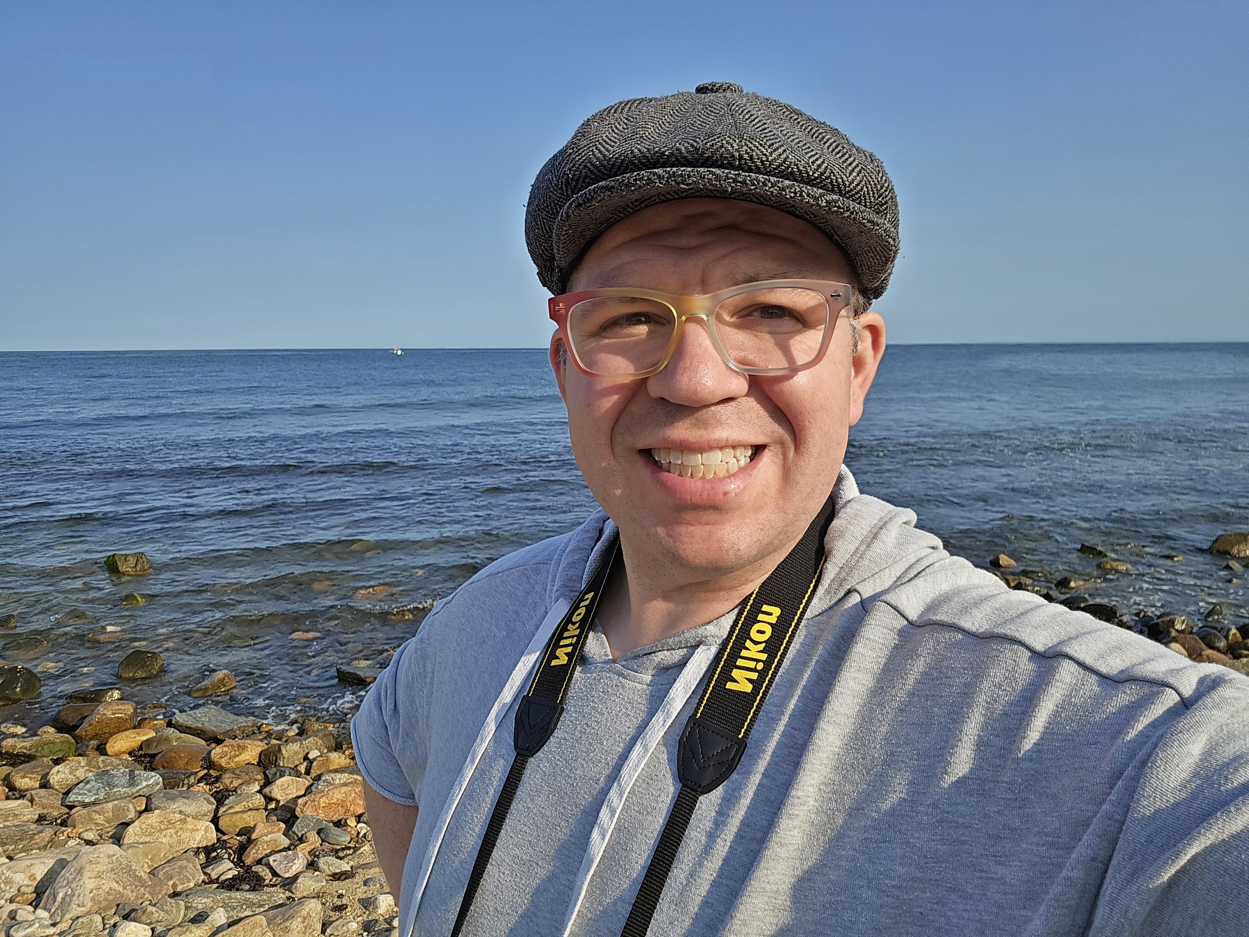
However, with the day’s being partly cloudy, I had intermittent periods of sun and shadow. When I was ready to get started, we were in shadow, which required waiting it out. So imagine driving two hours to Pennsylvania, just to stand on the side of the road and play with your phone. But what else was I supposed to do? I did get a nice selfie of myself in the process:

And one of Elyse:

And this is the cloud that I was waiting to move:

That’s the thing about a partly cloudy day, I suppose. I like shooting under partly cloudy skies because the little bit of clouds tends to balance the light just a little bit, while completely cloudless days tend to give the photos a little bit of a tinge that I have to fix later. But they do occasionally block the sun. And when that happens, you just have to wait for them to pass.
Once the cloud moved, I got going:


Then I went for a walk along the bridge in search of another vantage point to shoot from. My first thought was to go to the other end of the fence along the sides of the bridge and shoot from there, but as it would turn out, there was a short fence that stuck out on that end, presumably to prevent people and objects from getting down to the turnpike that blocked my view. I understand why it was there, but it still was annoying, because it just stymied that effort. So I started visually skimming over the fence, looking for openings in the fence that I could get my zoom lens through.

Elyse got a photo of me checking the fence for openings.

Lining up a shot after I found a sufficiently large opening to see through.
And then this is some of what I got from this other vantage point:


I liked this angle better because it provided a more straight-on view of the tunnel portal, even though it was harder to shoot because of the fencing. The fence was something that I had considered when I was planning this adventure, but I ultimately didn’t act on. In some of the early planning for this shoot, I thought about bringing a ladder that I had bought at Lowe’s for some home improvement projects back in 2020, in order to see over the fence. Elyse was against it, but I was determined to do it. However, once I got down to the basement to get the ladder, I had a realization: this was one of those versatile ladders that would do a million and a half different positions, and I didn’t know how to use it on account of the fact that I never did the projects that I bought the ladder for. In other words, I would be taking a ladder that I had never actually used before, and therefore wasn’t familiar with, on a road trip and setting this brand new ladder that I hadn’t even taken the tags off of yet on the roadside and climbing up in order to get past a fence. In short: bad idea. The ladder stayed home. I ended up taking a small two-step stepladder that I’ve owned for many years on our adventure with us, but as soon as I saw the height of the fence, I realized that it was too small to be of any use to me, so it stayed in the car.
After I got back from taking these photos, I put my real camera away and pulled out the drone:

In planning this flight, I was very cognizant of my surroundings. I had very good line of sight on my drone from everywhere that I was going to go, and I was very careful not to overfly the highway itself. After all, if one is going to fly, one must fly responsibly. You’re not allowed to overfly people or vehicles just in case your drone falls out of the sky (it’s happened to me before, when my old Mavic Mini threw a propeller blade in mid-air), plus this is a major highway at the entrance to a tunnel that people are going through at 55 mph. Under no circumstances was I going to do anything to possibly cause any problem for traffic. Therefore, I overflew the bridge that had practically no traffic on it until I got out to the median, and then went straight out over the median. So in the event of a failure, the worst that would happen is I lose my drone, but no one’s safety would ever be in question.
And so here’s what I got:

Overhead view of the tunnel portal.

Slightly lower view of the tunnel portal.

Close-up of the “Kittatinny Mountain” sign. For some reason, I always thought the tunnel names were carved into stone, rather than metal lettering.

Then I backed off from the sign and dropped down a little bit in order to get some low angles, to simulate the view that I would get if I was walking around there.

I then got some low views of the tunnel portals, still well within the median. This is the tunnel for eastbound traffic, which was constructed during an expansion project in the 1960s.

Tunnel for westbound traffic. This is the original tunnel, first bored for the South Pennsylvania Railroad in the late 1800s but never completed, and later repurposed for use by the turnpike.

High-level view of the tunnel portal, from approximately above the bridge where I was standing.
I also got a two-minute video of traffic moving in and out of the tunnels from overhead:
Then as I was repositioning to get another angle, I saw a white truck moving up the service road along the eastbound mainline. This service road heads up to the road that we were on, and provides service access for the tunnels. I figured that either (A) they were just going about their business, or (B) they were not pleased with my flying around the tunnel and came to bother us. As it would turn out, it was the second option, but I didn’t know that yet. So I was still flying around and doing my thing, while the person in the truck was talking to Elyse. Then I got a call on my phone from Elyse, telling me to come back over because the gentleman in the truck was yelling at her. So I started to bring the drone back. Then, while I was landing, I saw a Pennsylvania state trooper show up. I couldn’t help but think that things had just gone from bad to worse. I then got another call from Elyse, but all of them were going to have to wait until the drone was out of the sky, because it was becoming abundantly clear that my flying time at this location was over.
Once I got the drone down, I walked over, and was mentally bracing myself for what I expected would be an unpleasant affair, especially since I was the last one to arrive, as well as the subject of the scrutiny. As it would turn out, though, it wasn’t a confrontation at all. The trooper had told the turnpike employee to get back in his truck by the time that I got there, and the trooper was actually apologizing to me about having to show up at all, because when an employee calls something in to the PTC, they have to respond as a matter of procedure. Fine by me, because it meant that this would be an easy encounter. As it turned out, according to the trooper, the turnpike employee had seen my drone buzzing around outside, and figuratively wet his pants over the camera. That usually means that the employee is actually worried that they’ll be caught doing something that they’re not supposed to be doing, and, true to form, rather than admit that they don’t want to possibly be caught doing something that they weren’t supposed to, they cite “terrorism” or “homeland security” as their justification for making a fuss. I suppose that they think that it makes them sound big and important, but it also serves as an indication to me to stop listening to them, because they’re just spouting off nonsense. According to Elyse, the guy came at her all riled up, and started yelling at her, while she was sitting in the car plucking stray hairs with a tweezer while I was down the way doing my thing, and ranting and raving about “homeland security” to her as it related to my drone. She directed him to my location, but he wouldn’t come over to talk to me, even though Elyse had nothing to do with the activity that got his attention in the first place. In any event, the state trooper figured out pretty quickly that I (A) knew what I was doing, and (B) was following all regulations governing drones to the letter. We discussed potential concerns over flying on PTC property because it is generally closed to the public except for very limited use (i.e. you can drive the highway and stop at the service plazas, but you’re not allowed to go anywhere else), but as any drone pilot knows, a property owner does not control the airspace over their property, meaning that I was in the clear there. Our being on Route 641 was not a question, because that was not part of the turnpike system. The trooper also brought up something that the employee had considered as his “homeland security” concern, that I could possibly see inside the building. Turns out that no, I couldn’t possibly see inside, because to get close enough to even potentially see inside the building would pose too much of a risk to my drone, plus there was too much light outside. The trooper also brought up something else that the turnpike employee was ranting and raving about, about the potential to cause an incident on the road. I’m getting this secondhand via the trooper, but according to the employee, there had previously been an incident where a drone pilot had crashed their drone near a tunnel entrance, which caused damage to someone’s vehicle, that in turn caused an incident on the turnpike. My response was, “Oh, why didn’t you bring that up in the first place?” because that was a legitimate concern. Turns out that as described to me, the pilot in that instance was not following the rules closely enough, as federal regulations prohibit flying drones over cars and people for that exact reason. And since I was being careful to avoid such “no-zones”, I was good. In any event, the conclusion was that the turnpike employee was nuts, but it was probably wise to conclude operations at this location. Plus Elyse wouldn’t let me fly anymore, insisting that I pack up and leave.
All in all, that was a very positive encounter, and I think that I caught the trooper off guard when, after he said that he had never flown a drone before, I responded, “You want to?” I was perfectly willing to let him go up for a short flight under close adult supervision. I don’t care if you have a state trooper uniform on. Have some fun. He laughed as he declined, saying that he didn’t want the liability. Fair enough.
However, the problem with this encounter in general was the chilling effect that it has on safety. For someone who was allegedly so concerned about safety, the turnpike worker, by harassing drone pilots, actually has the practical effect of making this sort of thing less safe. This flight was the gold standard as far as drone operation safety went: close to the subject, maintaining visual line of sight at all times, and no overflying of cars or people, even accidentally. Everything that I was doing was 100% legal, so there’s nothing that he could do legally to stop me. The cop knew that. and he said as much, that he was only responding because he was required to. But no one wants to be harassed like that – especially when they’re yelling at the wrong person, and won’t even go over to talk to the correct person. If I think that I’m going to be bothered for my flights, I’ll position myself so that it’s harder to see me so that any potential bothers will be less likely to find me. In other words, I can see everything that I need to see in order to be compliant, but others can’t necessarily see me or know where the drone is being flown from. That’s less than ideal (I prefer to do it openly), and it makes things harder overall, but that’s how it’s got to be sometimes so that I can go about my business unimpeded.
In any event, after this, we headed to this little store in Roxbury that we spotted on the way out, where we each got ourselves a banana and some drinks. I also spotted two things on the ground that piqued my interest:

“Our Country Neighbor” written in the cement, dated 1989. This could have been the original construction of the building, or at least the last time the sidewalk was done. Either way, I found it interesting.

USGS benchmark next to the entrance to the store.
We then continued until I spotted a really weird sign on the side of the road, and stopped to attend to it:

Let’s just say that as road signs go, there is NO way that is MUTCD-compliant. Not a chance.

The same property also had a collection of bells visible from the roadside.

And there was also this sign, with a clearly off-model rendition of Mickey Mouse saying “Hello, Roxbury”.
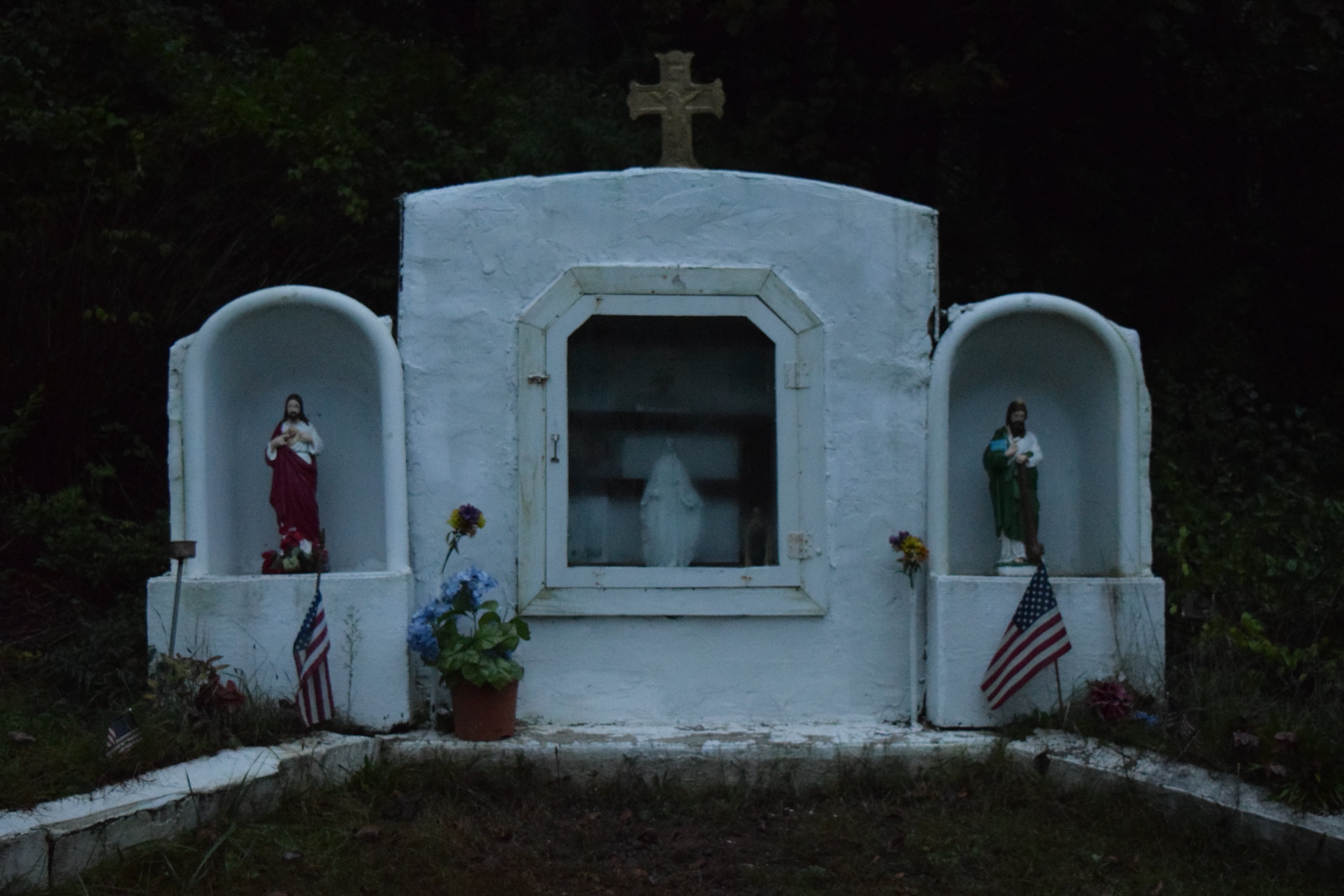
This sort of stuff, by the way, is one of the fun things about driving around in rural America. You never know what kind of interesting stuff that you might come upon. The Byrnesville Shrine of the Blessed Mother near Centralia immediately comes to mind as an interesting thing in rural America.
We eventually found our way to a military surplus store near Letterkenny Army Depot, where Elyse found a chicken fajita MRE:

One thing that I find interesting about MREs is that the contents last for so long. There were contents in this MRE that were packed on March 23, 2009. That was Schumin Web’s 13th anniversary. The site has now been around for 26 years. This food was still good as ever, prepared more than 13 years ago.
Also, for those wondering about Elyse’s shirt: this is a standard Schumin Web logo t-shirt out of the online store, which Elyse later tie-dyed. I think that the combination of my logo and the tie-dye looks pretty awesome, but unfortunately, none of the various vendors offer tie-dye out of the factory.
We then went over to Shippensburg, where Elyse wanted to visit the downtown area, and see a siren. Here’s the siren:
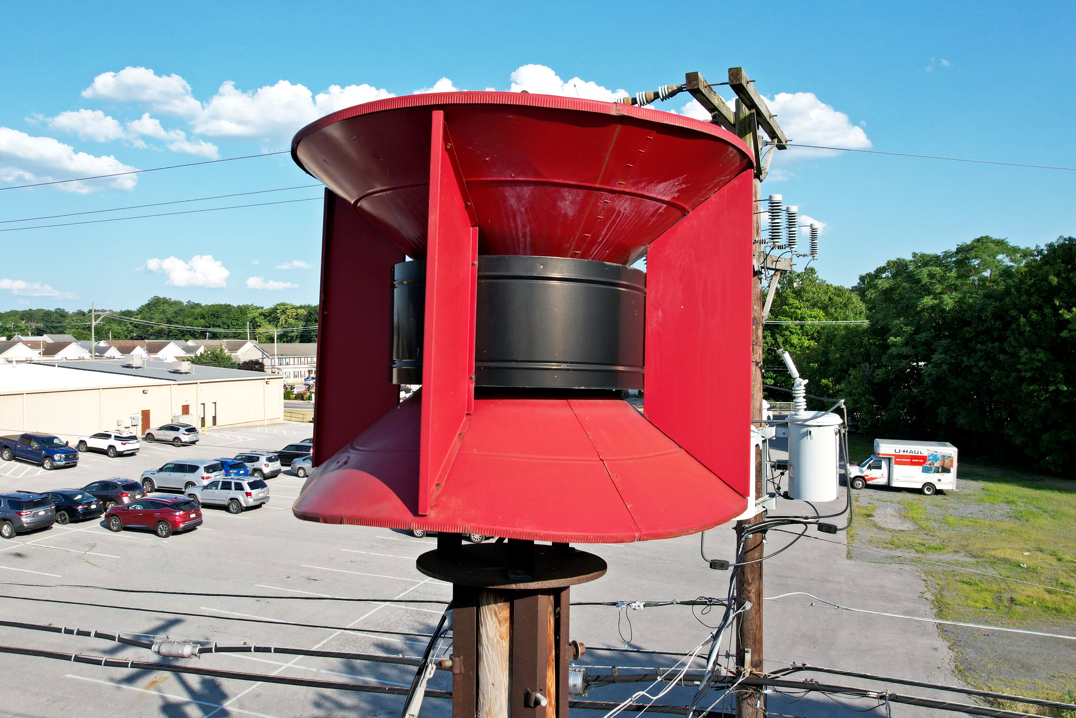
This siren is a Federal Signal SD-10, behind the fire department.
While we were there, we spotted a big pile of horse poop in the parking lot. Since I already had the drone up in the air in order to photograph the siren, I just hovered over said horse pucky with the drone. I figure, the drone has a pretty good camera on it, and with the drone, I don’t have to worry about shadows from my body, nor do I have to worry about accidentally getting my feet in the shot. So here’s the pile of whatsit:

The horse cookies on the ground. As Elyse would say, “Big poopies.”

Speaking of Elyse, she was thoroughly amused about the way that the drone’s propellers handled the dung. That turd was not exactly fresh, and as such, most of the water in it had evaporated. When I hovered the drone over it, chunks of horse feces started blowing all around, which amused Elyse thoroughly. I couldn’t resist getting a photo of her laughing over it.

We then went to a local pharmacy, where Elyse posed for a photo with a basket of Giant Microbes toys.
We later headed over to Walmart so that Elyse could do a little grocery shopping, and then we checked out the former Lowe’s nearby. That Lowe’s had been of interest to us for a few years, ever since a friend of ours had gotten inside after it had closed, and photographed the interior. It took us this long to get up here mostly because I found it hard to justify a trip that far just for a former Lowe’s. It’s along a section of I-81 that we really don’t have any reason to ever take, because past a certain point, it makes more sense to take US 15 up via Gettysburg rather than going out to 81. Shippensburg is not really a destination in and of itself, just because there’s not a whole lot there to see. Thus I would couple it with something else, and its being in that no-man’s land where any place that we would likely use as a destination beyond it would get the 15 routing rather than the 81 routing meant that it’s hard to find a reason to go past there. But with the visit to Kittatinny Mountain, it fit, and thus a visit became practical.
In any event, the Lowe’s was no longer vacant, as it was in the process of being converted to a casino. According to concept art that I’ve seen, it is expected that it will still strongly resemble the Lowe’s. I took the drone up for a flight around the former Lowe’s:


Note that while the canopy was retained, the pitched roof was removed.


Eventually, I found something more interesting than the Lowe’s: the heavy equipment in front of the building. Seriously, the drone was already up and moving, so I just went in low like it was my real camera and got some shots of the heavy equipment. One thing that I had to contend with here was a large amount of dust. When I got close to the ground, my propellers kicked up a lot of dust. There was nothing that I could do whenever that happened but wait for it to dissipate.


From there, we went to a nearby Sheetz for dinner, and then we started making our way home. Before leaving Sheetz, though, we spotted this in the parking lot:

“Jesus loves you.” I’m sure that I’m not the only one who finds that mildly creepy, like Jesus is some kind of crazy stalker or something.
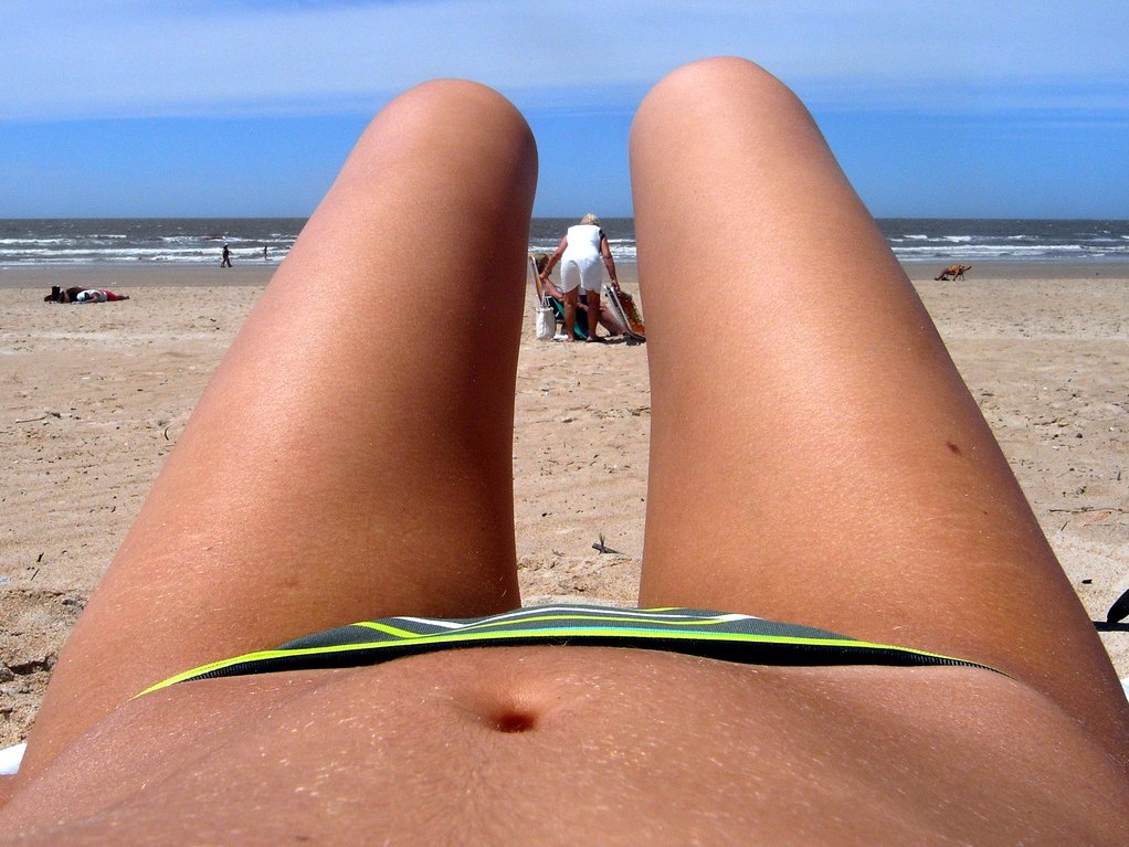
We took Route 11 from Shippensburg to just south of Chambersburg, and eventually rejoined I-81 at Exit 3, Molly Pitcher Highway. We stopped in Hagerstown so that Elyse could get some elevators. We visited the Courtyard by Marriott and the TownePlace Suites by Marriott, both on the Valley Mall property. While Elyse filmed the elevators, I found ways to entertain myself. At the Courtyard, I entertained myself by doing the “beach knees” thing with my Maryland flag leggings:
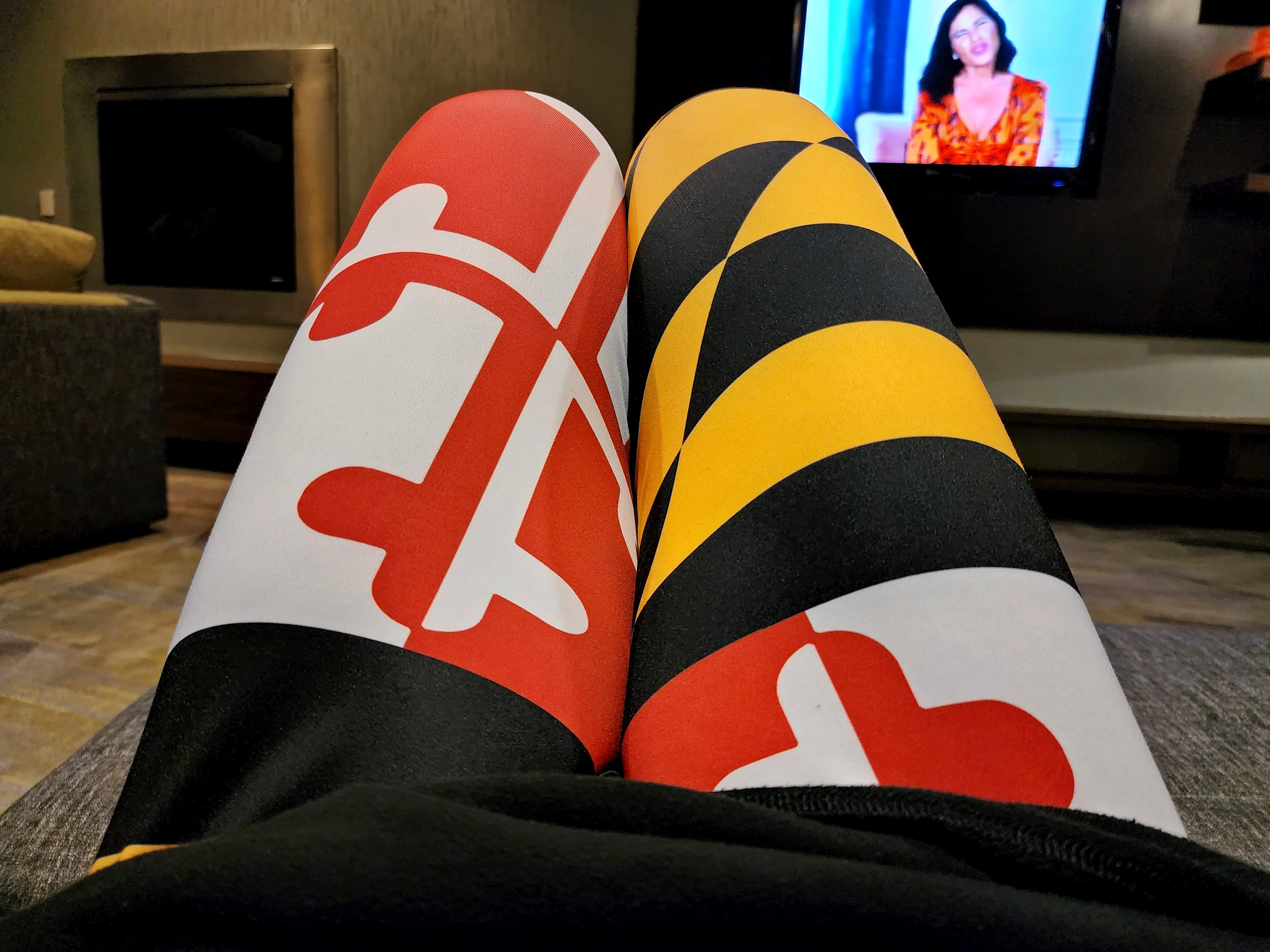
These are the same flag leggings that I’m wearing in the splash photo for this month, and I absolutely love these things. And I know that I have a winner when Elyse doesn’t like when I wear them. See, with Elyse, in theory, I’m allowed to have fun outfits, but then when I actually enjoy wearing them, then I’m not allowed to wear them anymore. But since I’m the one who is wearing it, I take her recommendations into consideration and then wear it anyway. Plus I paid enough for these Maryland tights that I’m wearing them until they fall apart.
Then we made one more pit stop on the way home, at another Sheetz, so that Elyse could get some food for herself (for some reason, we can never get our food stops in line). We got a fruit cup while we were there, and spotted two tiny little grapes in there:

I love those tiny grapes and such, because they always pack a big punch when it comes to flavor. Unfortunately, Elyse nabbed both of those things before I could get them. Meanie.
And that was our adventure. All in all, I’d say that we had a good time. I like these little day trips, and Pennsylvania is surprisingly easy to get to. These trips are a whole lot of fun, and I usually get decent material out of them.
Categories: Pennsylvania, Photography, Roads, Security, Travel