A “lost” photo set of sorts…
9 minute read
November 6, 2016, 10:10 AM
In doing the writing for an upcoming photo set for Life and Times about a trip that Elyse and I recently made to Pittsburgh [update: photo set published in January 2017], I quickly realized that much of the discussion about the trip up builds on a photo set that I shot in May 2006 with the intention of publishing in Photography, but that I ultimately never completed.
In this case, the subject of the “lost” photo set was Breezewood, Pennsylvania. For those not familiar, when one travels to Pittsburgh from the DC area, one of the places that you go through is Breezewood, a settlement best known for a quarter-mile stretch of US 30 that carries Interstate 70 traffic to the Pennsylvania Turnpike – a stretch of road that is loaded with gas stations and motels and restaurants. I first traveled through Breezewood in 2003 during the LPCM trip to Pittsburgh, and it piqued my interest – even more so when I later learned that there was an abandoned stretch of the Pennsylvania Turnpike nearby, including two tunnels. I discussed a potential trip to Breezewood for a photo shoot in 2005, and then made a trip from Stuarts Draft to Breezewood – a three-hour drive each way – on May 2, 2006. About the only bit of evidence of the trip on here was five photo features showing Breezewood, a short Journal entry with no photos, plus a few things here and there on Wikipedia and Panoramio, as was my practice at the time. The intended Photography set, with the working title “Town of Motels”, was never made. Kind of a shame that, for a trip that was that far away and entirely dedicated to photography, so little was actually published from it.
I’m pretty sure that I never published the set because I didn’t feel like the photos were up to par, even for the (lower) standards that I operated under at the time, and thus couldn’t find the inspiration to complete it. Most of the photos had a yellow cast over them, and I clearly didn’t take enough time in composing my shots. In hindsight, while I had fun doing the shoot, the idea was something of a loser. After all, it was, for the most part, just a clustering of chain businesses along a unique stretch of highway. The road configuration, created due to regulations in place at the time that precluded the use of federal funds to build direct connections to toll facilities, was what was unique, but that wasn’t the focus of my photography. I focused mostly on the chain businesses themselves, which weren’t particularly unique. The chain businesses looked a lot like “Anytown USA”, i.e. they were much the same as you would find anywhere.
In any case, after ten years, I now need it to provide context for more modern work. I suppose that this set’s publication was inevitable, as I would eventually need to build on that experience, so here it is, more or less in the order that it was photographed.
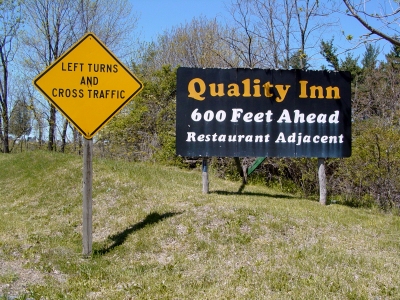
Taken just east of the Breezewood strip on Route 30, this signage was the first indication of Breezewood. According to Google Street View, the Quality Inn sign is now gone, having disappeared some time between 2009 and 2012.
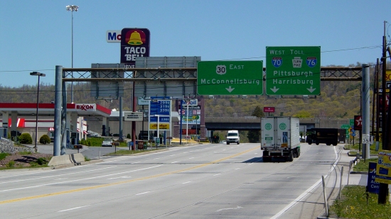
The Breezewood strip, facing east, taken from approximately halfway down.
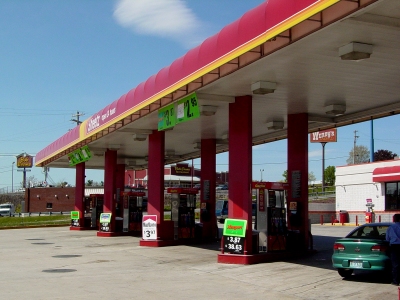
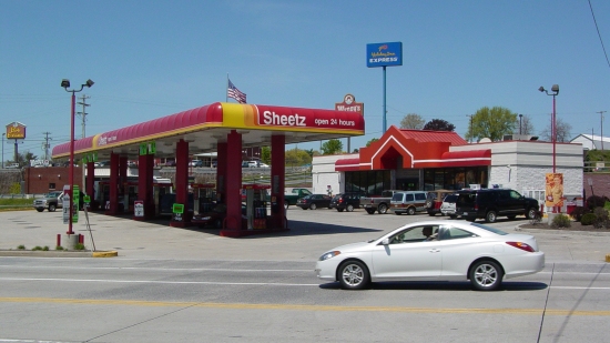
The old Sheetz in Breezewood. This same area looks different today, as the building is now boarded up, having closed some time between 2011 and 2013 when the Sheetz moved two doors down the road. Additionally, the gas canopy has been demolished.
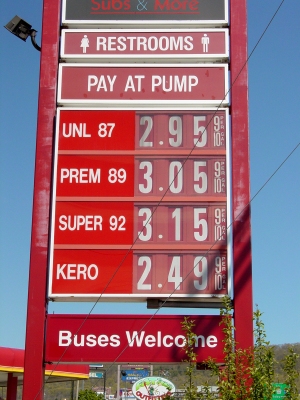
Gas prices at Sheetz on the day of the 2006 shoot. My recollection is that these were relatively high for the time. Prices were in the $2.40 range when Elyse and I went through recently.
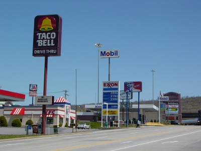
North side of US 30, facing east, from halfway up the strip. Taco Bell, Exxon, KFC, Mobil, and Gateway Travel Plaza. Not much has changed here, other than the closure of the KFC and the conversion of the Mobil station to Valero.
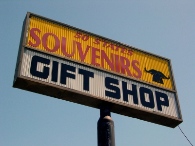
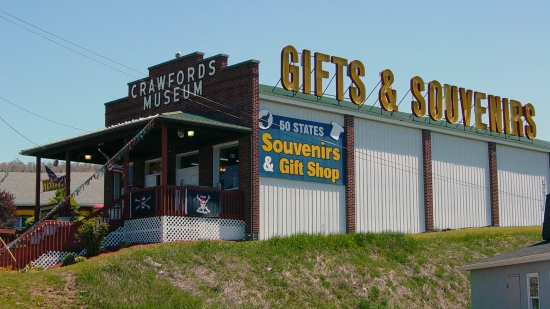
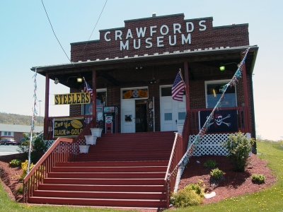
Crawford’s Museum, on the south side of US 30 in Breezewood. Still there today, and looks exactly the same. Interestingly enough, though, the owner of Crawford’s was convicted in 2015 of selling knockoff sports merchandise, and sentenced to five years’ probation, house arrest, restitution, and community service.
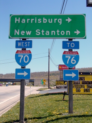
Signage directing I-70 travelers onto the Turnpike. Yes, this stretch of road through Breezewood carries an Interstate designation!

The Breezewood KFC, now vacant, having closed some time between 2011 and 2014.
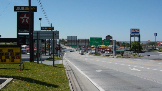
US 30, facing west, showing, more or less, the full Breezewood strip.
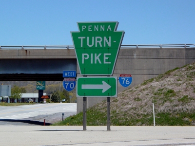
Big Pennsylvania Turnpike signage.
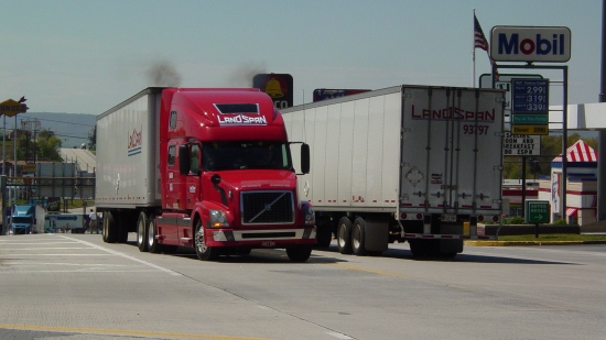
Trucks along Route 30. Owing to this road’s technically being an Interstate, it gets a lot of truck traffic.
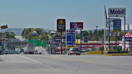
The Breezewood strip, viewed from the Turnpike entrance.
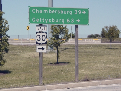
Mileage sign at the Turnpike entrance.
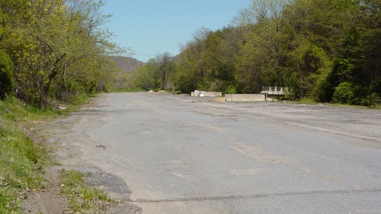
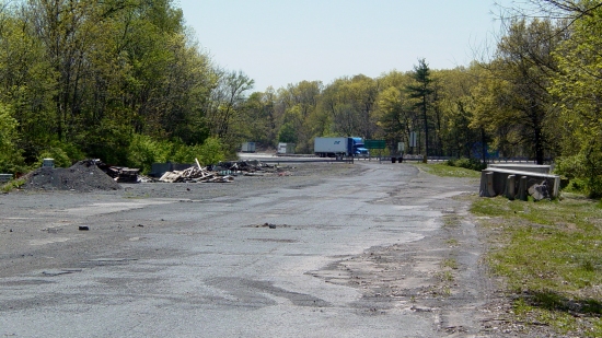
Stub end of the abandoned turnpike, though this area is still owned by the Turnpike Commission. The Breezewood exit ramp, which uses part of the old turnpike, is visible in the distance in the top photo. In the lower photo, the road used to lead to the rest of the abandoned turnpike, but was truncated when a bridge over Route 30 was demolished, separating the PTC-owned section, and the Pike-to-Bike trail that the remainder became.
This, by the way, left me quite confused. I was told prior to this trip that access to the abandoned turnpike was via this road behind the (now closed) Ramada Inn, and was checking this out for a potential future trip to see the abandoned turnpike, and the tunnels therein. A stub-end like this was not what I had expected to see. I was left questioning whether I had gone to the right place or not. Only later did I learn of the bridge removal, which occurred not long before my visit, which confirmed that I was in the right place, but that what I was led to understand was no longer the case. I still want to do a trip to see the abandoned tunnels, but such a trip is not currently planned.

Gateway Travel Plaza, one of two truck stops in Breezewood.
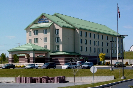
The Holiday Inn Express in Breezewood. Since this photo was taken, the hotel built a one-story addition on the right side of the building, adding an indoor pool and gymnasium facility.
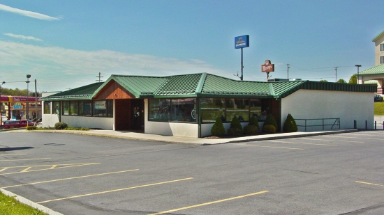
Fat Jimmy’s Outfitters, housed in a former Howard Johnson’s restaurant. I considered this a strange place to have an outdoors store, considering that Breezewood is very much a gas-eat-go kind of area. After Fat Jimmy’s moved to a different location, a bar and grill moved in and did some heavy remodeling.
I don’t know about you, but a bar seems like a strange thing to have here, considering that Breezewood’s whole existence is based around drivers who are just passing through. Having a drinking establishment in Breezewood seems incredibly out of place, and so I’m not surprised that such a place was short-lived.
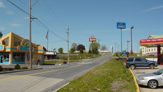
Sac’s convenience store, Sheetz (since relocated), Wendy’s (now closed), Holiday Inn Express, and then country beyond. Recognize that Breezewood is basically just the strip, with open land all around.
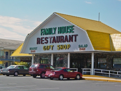
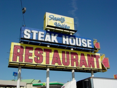
Family House Restaurant. All of this is now gone, as the restaurant closed around 2008, and the new Sheetz was in operation on the site by fall 2013.
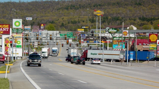
The Breezewood strip, viewed from the western end. This photo is on display at The Henry Ford, a museum in Dearborn, Michigan.
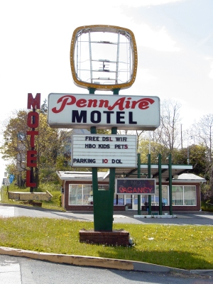
Vintage sign for the Penn Aire Motel, at the western end of the Breezewood strip. This facility is now abandoned, though it was once quite nice.
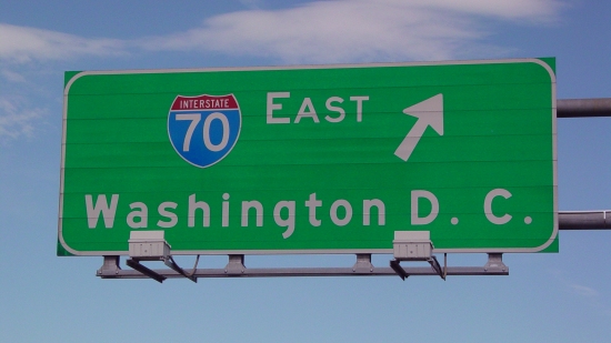
Overhead sign for I-70 facing eastbound Route 30. Funny that it lists DC as the control city, since Interstate 70 goes to Baltimore, not DC. Mind you, Interstate 270 breaks off at Frederick and heads towards the Beltway, but I-70 proper takes a more northerly route and ends up in Baltimore.
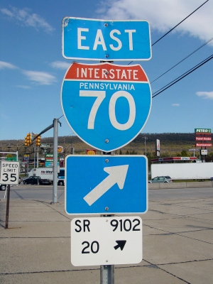
Signage for Interstate 70. I believe that the numbers on the white sign at the bottom are part of Pennsylvania’s Location Referencing System (LRS).
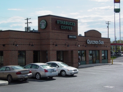
The Starbucks in Breezewood, where the staff graciously allowed me to park for the several hours that I spent shooting this set.
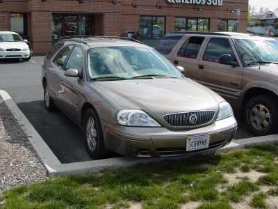
The Sable, with Virginia plates. That really dates this set, doesn’t it? I had owned the Sable for less than three months when I did this trip. The Sable has now been gone for nearly five years.
Leaving Breezewood, I took the scenic route home. Considering that this trip revolved around the Pennsylvania Turnpike, it only made sense that I take the Turnpike. I also got some photos of the three tunnels that I went through on the way:
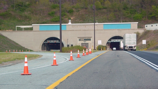
Western portal of the Tuscarora Mountain Tunnel.
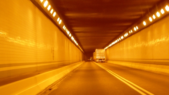
Inside the eastbound tunnel at Tuscarora Mountain. Note the sodium lighting, which was unique to this tunnel complex at that time.

Eastern portal of the eastbound tunnel at Tuscarora Mountain.
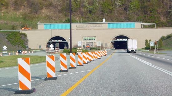
Western portal of the Kittatinny Mountain Tunnel.
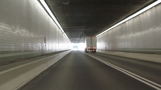
Inside the eastbound Kittatinny Mountain Tunnel. Note the fluorescent lighting.
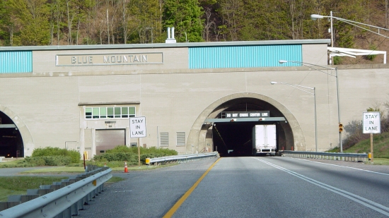
Western portal of the Blue Mountain Tunnel. The Kittatinny and Blue Mountain tunnels are back-to-back (only 600 feet apart), separated by the Gunter Valley. This was taken at Kittatinny’s eastern portal.
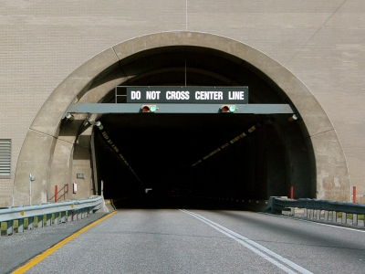
Western portal for the eastbound tunnel at Blue Mountain.
I vaguely remembered going through back-to-back tunnels on a road trip from Arkansas to New Jersey in 1987, and I remembered the name “Blue Mountain”. I was glad to get some confirmation on what I saw as a child. These Pennsylvania Turnpike tunnels were also the first highway tunnels that I ever went through.
Also, please don’t do what I did in taking these photos. I took them while I was driving, i.e. one hand on the wheel, the other hand on Big Mavica, and eyes not entirely paying attention to the road because I was lining up a shot. In hindsight, what I did was very unsafe. So don’t do it.
And lastly, I stopped at the Cumberland Valley Service Plaza after the tunnels:
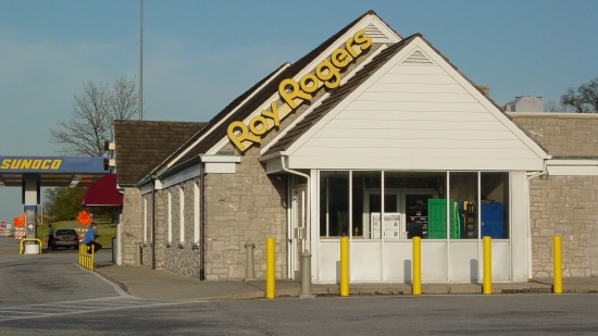
Cumberland Valley Service Plaza building. This building, along with all of the service plaza buildings, has been demolished and replaced with a larger, more modern building. Also, note the Roy Rogers sign. Growing up, I always associated Roy Rogers with road trips, because at that time, the only time that you saw a Roy Rogers restaurant was in a highway service plaza like this one.
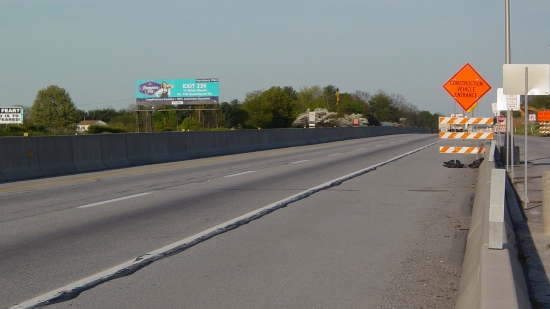
The Turnpike next to the Cumberland Valley Service Plaza, part of a 12-mile straightaway between the Blue Mountain Tunnel and the Carlisle interchange.
From Carlisle (home of another Breezewood-like strip between the Turnpike and I-81), I took I-81 all the way down to Staunton, and that was the end of the trip.
And that’s my “lost” photo set of Breezewood and such from 2006. I suppose that the missing piece of the puzzle has been placed, as these decade-old photos finally make it to publication, though I would have never guessed that they would end up being published in the Journal.
Categories: Breezewood, Photography, Roads, Schumin Web meta
