


And then we visited Winchester…
7 minute read
July 8, 2013, 11:50 PM
So in our last episode, I was discussing a trip that my friend Pete and I made to Harpers Ferry, West Virginia and to Winchester, Virginia on July 4. I got as far as the end of Harpers Ferry, when I realized that the Journal entry was running quite long, so I cut it off and promised to continue at a later time. And now for part two.
Leaving Harpers Ferry, we soon came to Charles Town (not to be confused with Charleston, the state capital). For those not familiar, Charles Town is the place where people in Harpers Ferry go to go grocery shopping. For out of town folks, it’s also the home of the Hollywood Casino at Charles Town Races. I’ve never been gambling before, but it might be fun to do one time. But in this case, Pete and only stopped for lunch, and then it was at a Martin’s grocery store, where we each got salad. Funny how you can get pretty decent food on the go from grocery stores these days. But we did just fine at Martin’s. They had a decent-sized salad bar, and there was also an eating area. All in all, not bad.
Then from there, we continued along to Winchester. That took us on Route 340 to its intersection with Route 7, and then we took Route 7 the rest of the way into Winchester. When I first made a close pass to Winchester some time in the 1990s, I was a little bit underwhelmed by the size of the town. Understand that Winchester is listed as a control city for I-81 for quite some ways – more than 100 miles when traveling northbound. In my experience up to that time, I had only seen bigger cities as control cities for highways, like Little Rock or Richmond. Thus I figured that Winchester was a really big city. Surprise: Winchester is, while by no means tiny, also not a big city by most measures. It’s comparable in population to Staunton.
Categories: Friends, July 4, Photography, Places, Recreation/Exercise
Here’s a tip for you: don’t go hiking in flip-flops.
7 minute read
July 7, 2013, 11:58 PM
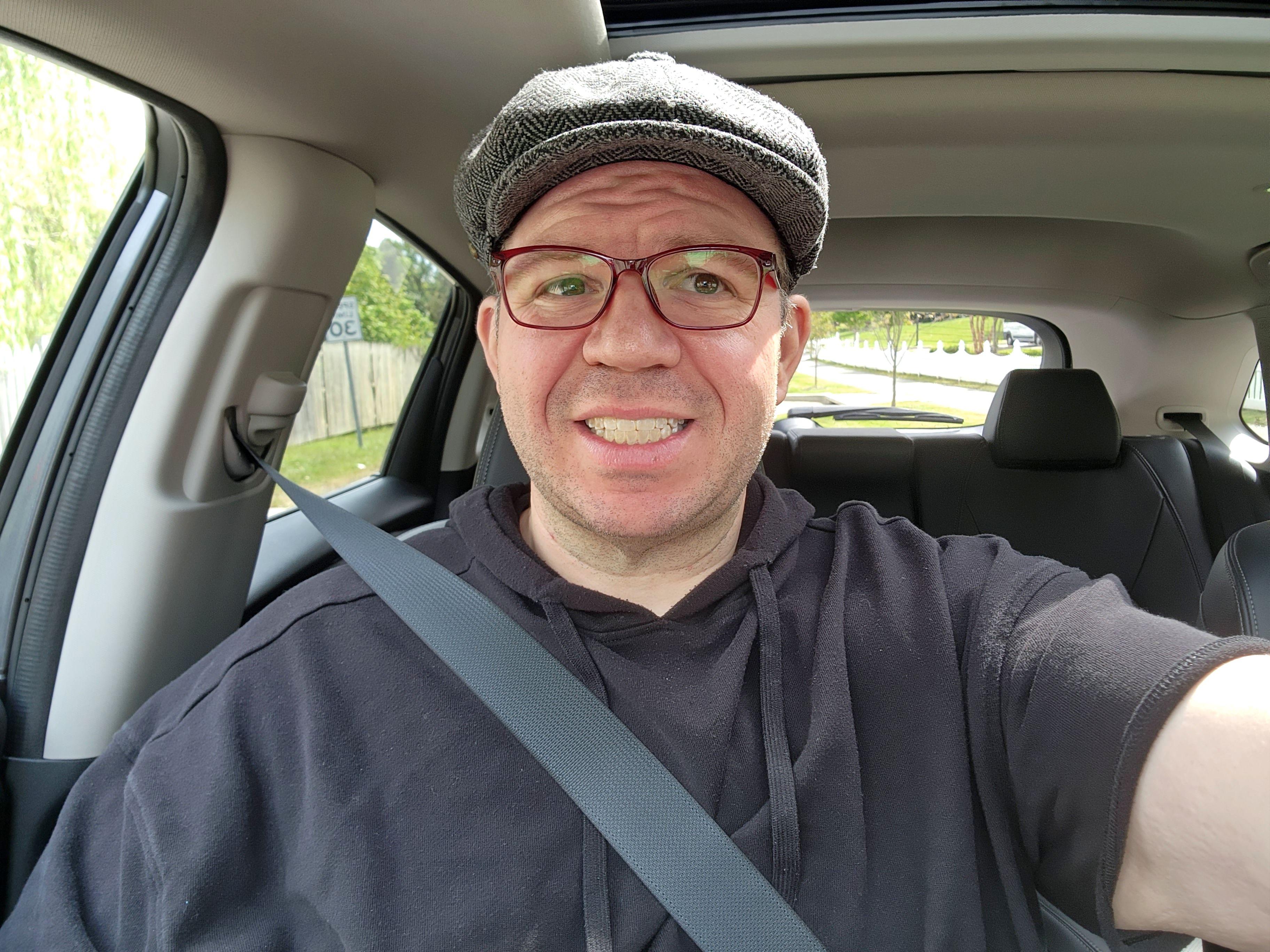
First of all, I hope everyone had a lovely July 4. I know I did. I got together with my friend Pete (whom you may remember from the Confirmation Demonstration and White House to Quantico photo sets), and we went on something of a road trip. We both figured that with living in the Washington DC area, and considering how July 4 is in DC, that was a good day to get out of town.
So we decided to go on a trip to Harpers Ferry and Winchester. Prior to this trip, I had only been to Harpers Ferry by train, and then only passing through. As far as Winchester went, I had only been to Winchester once prior, and that consisted of driving around at night trying to find the downtown area, and a stop at the Apple Blossom Mall and the local Walmart. So this was going to be fun.
I met up with Pete at Glenmont Metro, and then we were off. To get from the Aspen Hill area where I live to Harpers Ferry, you drive up I-270 to Frederick, and then from there, you take I-70 for about a mile, and then take US 340 (yes, that 340) the rest of the way to Harpers Ferry. The drive is beautiful. The first bit of beauty is just outside Frederick, where there is a “Scenic View” wayside on 270. We wouldn’t ordinarily have stopped there, except that was a good place to stop and put the phone into GPS mode for the remainder of the distance to Harpers Ferry, since we were both kind of fuzzy on the exact way to get there. While we were stopped, I got a few photos of the area:
Categories: Friends, July 4, Photography, Recreation/Exercise, West Virginia
Your Montgomery County tax dollars at work…
5 minute read
May 30, 2013, 6:42 PM
Yes, fellow Montgomery County residents, your tax dollars pay for what I’m about to describe here. First of all, let me show you what the original problem was:

Yep… a bulb on a traffic light is out. This is the corner of Veirs Mill Road and Edmonston Drive in Rockville. It’s the solid green light on the left turn signal for northbound Veirs Mill drivers turning left onto Edmonston (right here). I consider a light out on a left turn signal to be a very serious matter, because in many cases, there’s only one of them, and it has many different combinations that can be displayed that all mean different things. It can be a very dangerous situation if part of that light isn’t working, and therefore unable to signal drivers on how to proceed, since its operation is more complicated than a conventional signal. Plus, there are usually at least two conventional signals at an intersection anyway, so if one is not working, the other one picks up the slack. But when there’s only one left turn signal, it has to be running at 100% all of the time.
Categories: Rockville, Some people
And then there was Baltimore…
5 minute read
April 20, 2013, 12:54 AM
The day after my trip out to Annapolis, I was back in the car again and headed out to Baltimore. It’s kind of funny how things work out. This vacation kind of reminded me of spring break in 2002 and 2003 back when I was in college. I planned out the vacation week with five or so different destinations in the eight days that I had available. In 2002, my destinations were (in this order) DC, Richmond, Norfolk, Charlottesville, and Roanoke, with a day in between all but Richmond and Norfolk (which involved a hotel stay). Then in 2003, I did (in this order) DC, Richmond, Norfolk, Covington/Clifton Forge/Lake Moomaw (one outing, all three destinations), Roanoke, and Charlottesville/Blue Ridge Parkway. I only took two “off” days in 2003, between DC and Richmond, and Norfolk and Covington. Now, ten years later, I had the luxury of spreading it out over two weeks, and did Stuarts Draft (intended to do Roanoke, but it got snowed out), DC, Richmond, Cumberland, Annapolis, and Baltimore. I also scouted out Glen Echo Park as a potential photography destination (spoiler: not high up on my list). And with two weeks and a few destinations planned, I kept a close watch on the weather, and that affected my plans. Richmond was moved up a day to take advantage of sunnier weather. Cumberland was similarly scheduled to take advantage of optimal weather (that’s how Glen Echo Park got included – to fill a gap in the schedule from Cumberland’s placement). And then Annapolis fit the schedule, though weather was less important there, since it was mostly to get a feel for the area and determine further location work (probably).
And then there was Baltimore. I was out exploring Fells Point on this particular day. I chose Fells Point based on an episode of Bar Rescue. One episode featured J.A. Murphy’s, which was located in Fells Point. That bar, renamed “Murphy’s Law” during the show’s makeover, had closed, but I knew that going in. No worries, though. I wanted to explore. I parked on the street (in front of Dogwatch Tavern, also featured on the episode), and went to work. In getting the lay of the land of this area, I ended up dividing it into three sections. First area was south of Thames Street. This was the harbor area. Then the next area was Broadway from Thames Street to Broadway Market. The street around Broadway Market was a bit of a choke point due to construction on either side of the building that took away the sidewalks. Then the third area was the block of Broadway between Fleet Street and Eastern Avenue. I could have gone further north, I suppose, but owing to time considerations, I cut it off there.
Categories: Baltimore, Photography, Travel
I went out in search of places with harbors…
6 minute read
April 13, 2013, 5:54 PM
And this is the rest of the photo stuff that I did while I was on my vacation a little more than a week ago. I wanted to do something related to water on my vacation, as I had already done snow and Stuarts Draft, suburban places, urban places, and mountainous areas. The early plans for this involved a trip up to New Jersey to do this, but I determined that New Jersey was more than I wanted to pull off, owing to the other trips. One day, perhaps, I’ll do the Jersey shore. Stepping down from New Jersey, I thought about day tripping it out to Ocean City or Rehoboth Beach, but realized that if I was going to go all that way, I might as well just go to New Jersey. That brought me to looking at Maryland locations that didn’t involve going over the Bay Bridge. I narrowed it down to Baltimore and Annapolis, and then decided that with two days available, why not do both? So I did. I went to Annapolis on Thursday, April 4, and Baltimore on Friday, April 5. Not bad.
In going to Annapolis, I was kind of surprised at what I encountered. I knew that Annapolis was a smaller town as state capitals went, but exactly how small it was surprised me. Realize that every state capital that I had been in or through (Little Rock, Richmond, Boston, Providence) has been its own metropolitan area. Annapolis reminded me of Staunton, Virginia with a harbor on it. It was a cute town, for sure.
By the time I did Annapolis, I had done a lot of photography. By my accounting, by the time I set foot in Annapolis, I had taken 1,971 photos. So I had pressed the shutter button quite a bit. I wasn’t that interested in doing a cohesive photo set, though if I ended up getting a cohesive photo set out of it, that would be a plus. Honestly, I was just looking to see what caught my interest and looked interesting to photograph. What I ended up doing was wandering through the downtown area a bit, wandering around the harbor, and then going around the Maryland State House. I had a good time, photographing signs, architectural details, birds, some boats, and (of course) fire alarms. I feel as though I probably took more fire alarm photos in Annapolis than I did anywhere else on my two week vacation. The reason was that in Annapolis, unlike in other cities that I photographed, a lot of buildings had fire alarm notification appliances on their exteriors. Most were just bells, but I did spot one horn/strobe on the exterior of a jewelry store.
Seeing Cumberland from the ground…
11 minute read
April 7, 2013, 12:28 AM
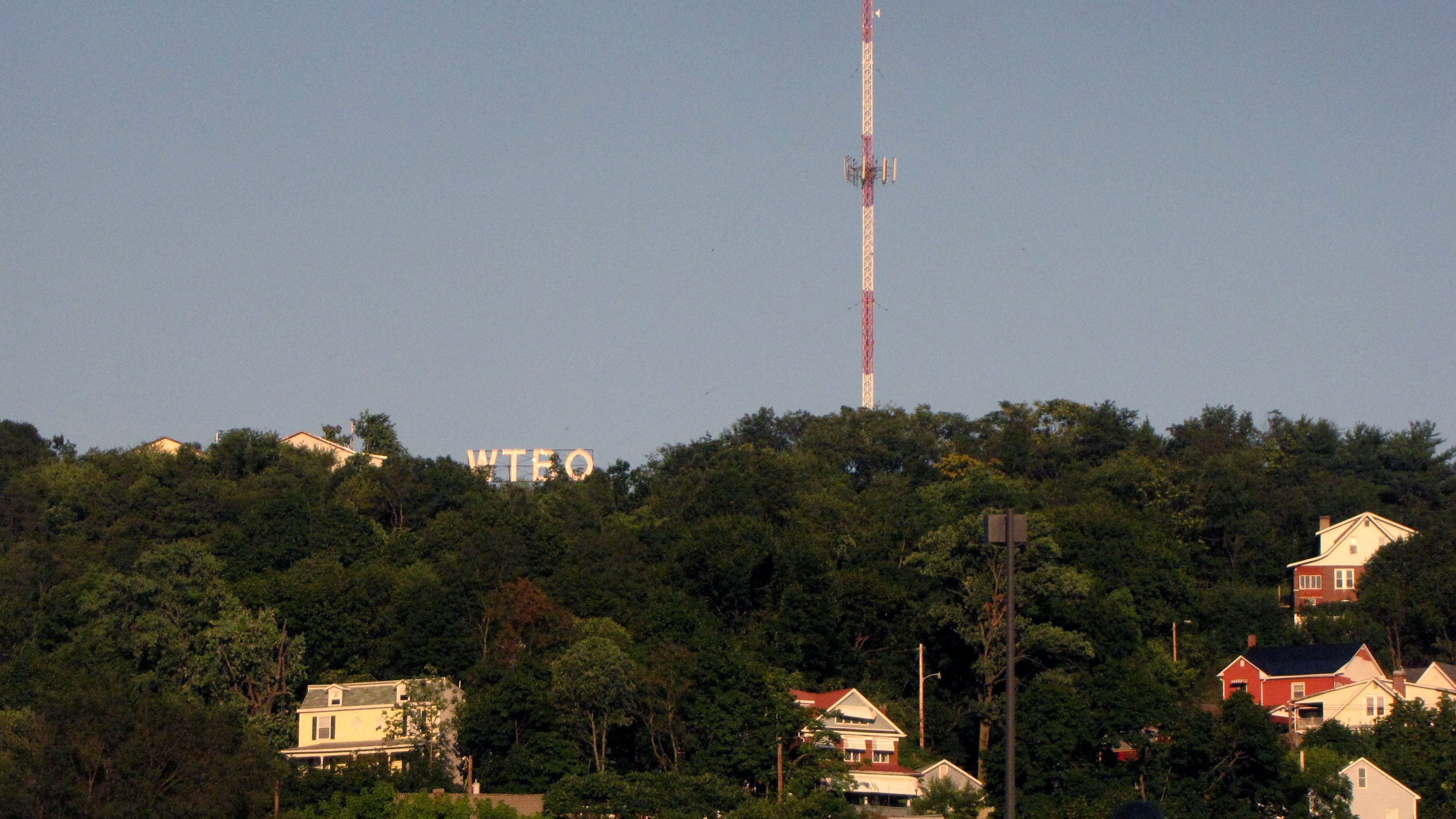
You may be familiar with Cumberland, Maryland. Whenever Mom and I go to Chicago, we take the Capitol Limited, and that train travels a route that goes through Martinsburg, Cumberland, Pittsburgh, Toledo, and South Bend, among other locations. When I take train trips, I like to look at the scenery. Some of it intrigues me, and it leads me do more research on it later. Take the Koppers facility in Green Spring, West Virginia. I always found it interesting to see these piles of neatly stacked lumber along the tracks. I researched it, and I enjoyed learning a bit more about what I had seen from the train. Towns are a similar idea. These little towns that the trains either pass through or stop in make me want to do more research. Unfortunately, many of these little towns are beyond my reach without incurring a lot of travel expenses, but for the places that I can reach, if they interest me enough, I’ll pay them a visit.
Cumberland was one of those places. The Capitol Limited spends a lot of time in Cumberland. Going west, the first thing that they do is a crew change, where they exchange engineers. Then they continue a little further west and do the passenger stop. That stop takes about ten minutes, and is also a “smoke stop”, where passengers who smoke are permitted to get off of the train and have a cigarette. While on the train waiting through the crew change and the longer passenger stop, I got to take an extended look at Cumberland. And I liked what I saw. I saw a town with some character to it, and I saw a few places that I would love to explore more deeply. I saw houses, I saw churches, and I saw the WTBO sign on Wills Mountain. And I was sure that there was much more that was interesting beyond what I could see from the train.
So this past Tuesday, I did exactly that. I grabbed the camera bag, got in the car, and headed off to Cumberland. This, by the way, is not exactly a short trip. Amtrak gives three hours and nine minutes to take the train from Union Station in DC to Cumberland. Google Maps gives two hours and 123 miles driving from my house in Aspen Hill to Cumberland Amtrak station by car. That’s going via the Intercounty Connector and I-370 to Gaithersburg, I-270 to Frederick, I-70 to Hancock, and then I-68 to Cumberland. I’ve done the drive on I-270 to Frederick a number of times in the past, and so I knew what to expect there. Interstate 70 through to Hagerstown took me over a number of hills and past the Appalachian Trail. I had taken I-70 west the rest of the way through Maryland when I went to Breezewood in 2006. Then I-68 was really awesome. The first thing you do is go through a highway cut through Sideling Hill, and then you go over a number of mountains before you arrive in Cumberland – directly in the middle of downtown.
Categories: Amtrak, Cumberland, Photography, Railroads, Travel
Richmond was fun…
6 minute read
April 1, 2013, 11:05 PM
So on Saturday, I headed down to Richmond to visit an area that I had not visited in about ten years: the Canal Walk. You may recall that I first featured the Canal Walk in 2002 in a three-part set in Photography. Then I visited the area again in 2003 for the Richmond portion of An Urban Comparison. I photographed the Canal area again with Big Mavica since I was already in the area, but I never really did much with the photos. There were three Photo Features from that day: one of the Reynolds Tobacco building, one of the skyline, and one of Riverfront Plaza. Now, ten years later, it was time to get new photos. I didn’t expect that the Canal area would change much, but I had changed quite a bit. My Canon Powershot SX10 IS is a far superior camera to Big Mavica, and my technique has also improved. I also have a polarizing filter that I got in January, and I wanted to give that another spin. The Sandy Point photos that I took in February (photo set from this on its way before too long) came out wonderfully using it, and so I wanted to give it a spin again in a city environment.
I did the same thing that I did ten years ago, parking at the east end of the Canal and walking to the other end. Like in 2003, I walked down the Canal and then headed over to the Belle Isle pedestrian bridge. I also explored Belle Isle just a little, which I had never done before, as I had previously just gone to the end of the bridge and then turned around.
The biggest take from this trip was that the Canal area had grown up in ten years. There were some new buildings, and there were new businesses in some of the older buildings. The area had flooded in 2004 due to the effects of Hurricane Gaston. I also noticed a lot more character in the area. One semi-enclosed section of the Canal Walk now had all sorts of murals painted on it. There was also a lot more life along the Canal itself, with recently constructed housing nearby, and shops and restaurants fronting the Canal. Previously, the Canal was somewhat disconnected from the surrounding neighborhood, with not much to do on the Canal Walk except to walk. Not anymore.
Categories: Photography, Richmond, Travel
I can now add “commode critic” to my resume…
4 minute read
March 28, 2013, 12:44 PM
So I got back Tuesday night from a trip to Stuarts Draft. That was fun, though not the fun that I was expecting. I got to visit my friend Bergit in Charlottesville, and then spent two days spending time with my parents. The original plan was to go to Roanoke with Mom on Monday and also visit friends and see transportation-related stuff, but that unfortunately got snowed out.
But first, though, in case you’re wondering what the deal with the title is, let me explain. My trip started out with proof that my kidneys do great work, and that having a cup of coffee before a three-hour road trip is inadvisable. Yes, I took far more restroom breaks on this trip than I normally would. I ended up stopping at the rest area on I-66 near Manassas, Sheetz in Madison, the new Trader Joe’s in Charlottesville, and then the rest area on I-64 near Ivy. Usually I can make it on one restroom break. But, noooooo… my body decided that this was the perfect time to unload a bunch of water. And I was not shy about discussing restrooms on social media on the entire trip. This from the Sheetz in Madison:

And I accompanied this on Instagram with the following caption: “This road trip has been brought to you by the letter P, and by the number 1.” Yep… that kind of day.
Categories: Driving, Family, Stuarts Draft, Winter weather
What is Afton Mountain, anyway?
8 minute read
March 21, 2013, 5:58 PM
A friend of mine recently sent me a link to this article by Dr. Christopher M. Bailey, a geology professor at The College of William & Mary. The article discusses the name of a place that many people in the part of Virginia that I grew up with are most likely quite familiar with: Afton Mountain.
The article is titled, “Mind the Gap! Where is Afton Mountain?” and discusses the geology of the area, specifically Rockfish Gap, and a few quirks of the local culture. First, for those not familiar, Rockfish Gap is a wind gap in the Blue Ridge Mountains, which separate the Shenandoah Valley and the Piedmont region in Virginia. Because it is the lowest gap for quite some ways traveling both north and south, the area became an important way to travel east and west. Today, Interstate 64 and US 250 carry travelers through Rockfish Gap.
Technically speaking, this is Rockfish Gap, seen here in a 2003 Schumin Web file photo:

Categories: Afton Mountain, Nature, Roads
This is a problem where the biggest step towards a solution is not police, but signage and paint…
7 minute read
March 12, 2013, 10:16 PM
According to an article on Patch.com, since January 22, four pedestrians and one cyclist have died in collisions with cars in the eastern part of Montgomery County. The cyclist was struck in downtown Silver Spring. The pedestrian fatalities all occurred outside the Beltway. One involved a woman’s being struck while on the sidewalk, and the other three were struck and killed while attempting to cross major arterial roads in the county – specifically, Columbia Pike (US 29), Connecticut Avenue (MD 185), and Georgia Avenue (MD 97). Ken Silverman, an analyst for county councilwoman Nancy Navarro, created a map showing the location of the accidents.
Now in looking at all of this, I latched onto the fatalities related to crossing the arterials. I am on each side of the pedestrian-driver coin in Montgomery County at various times, and so I am familiar with both driving around pedestrians, and walking around cars. I have also crossed Georgia Avenue on foot many times. In these instances, the Columbia Pike incident happened in the southbound lanes at the intersection with Oak Leaf Drive in White Oak. The Connecticut Avenue incident happened at the intersection with Everton Street, in the Wheaton area. The Georgia Avenue incident occurred at the intersection with Heathfield Road in Aspen Hill. I looked at these areas, and there are some common factors in all of them:
- All three incidents occurred after dark
- All three incidents occurred at unmarked crosswalks (any intersection is considered a legal crosswalk in Maryland whether it’s marked or not)
- The main roadway in all three locations is a six-lane divided highway with three lanes on each side
- There are bus stops on both sides of the road at all three locations
- There is street lighting on the side of the road where the incidents occurred (Columbia Pike and Georgia Avenue have lighting on only one side in these areas, and Connecticut Avenue has lighting on both sides)
Categories: DC area local news, Silver Spring
This really isn’t rocket science, I promise…
6 minute read
January 10, 2013, 1:28 AM
Correct me if I’m wrong, but the act of placing groceries in bags and giving them back to the customer is really not rocket science. And in Montgomery County, Maryland, a jurisdiction where there is an excise tax on disposable shopping bags, i.e. a financial incentive to use reusable shopping bags, I don’t believe that it is unreasonable of me to think that a grocery store cashier should know how to handle reusable shopping bags. Apparently this is an unreasonable expectation. I went to the Safeway store in Olney this evening after I went swimming, and the cashier did not understand how to handle reusable bags.
This what I bought:

(And for those of you who are wondering, I took this photo in the store with the intention of posting on Instagram.)
Categories: Olney, Retail, Safeway, Some people
The Walters Art Gallery and Great Falls…
4 minute read
January 6, 2013, 9:42 PM
So as promised, this is the photos-from-Baltimore-and-Great-Falls post. Right after Christmas, Mom came up to visit for three days. We certainly had fun while we were out. We went out to Montgomery Mall, we went to Baltimore, we went to Arundel Mills, we went to Great Falls, and we had dinner with friends.
Montgomery Mall was pretty much what you would expect. After-Christmas sales and all that jazz. Mom did, however, leave me a bit scandalized when she went into Abercrombie and Fitch just to pay the five-cent bag tax to get one of the bags with the picture of the guy with the six-pack abs on it. I commented:

This must somehow be payback for all the times that I may have embarrassed her in the past. Especially when I brought the little green reusable bags that I take with me to go grocery shopping.
Categories: Baltimore, Family, Nature, Photography
ZooLights!
7 minute read
December 23, 2012, 2:10 PM
You can tell that my life has been busy lately. This happened a week ago and only now am I finally getting a chance to write about it. Nonetheless, though, I had fun last weekend. I got together with my friend Melissa, who I know through a few Anons, and who I first met at the Silver Spring Zombie Walk in 2011. We went around the mall in Wheaton a bit, and then headed into DC for ZooLights at the National Zoo. That was a lot of fun.
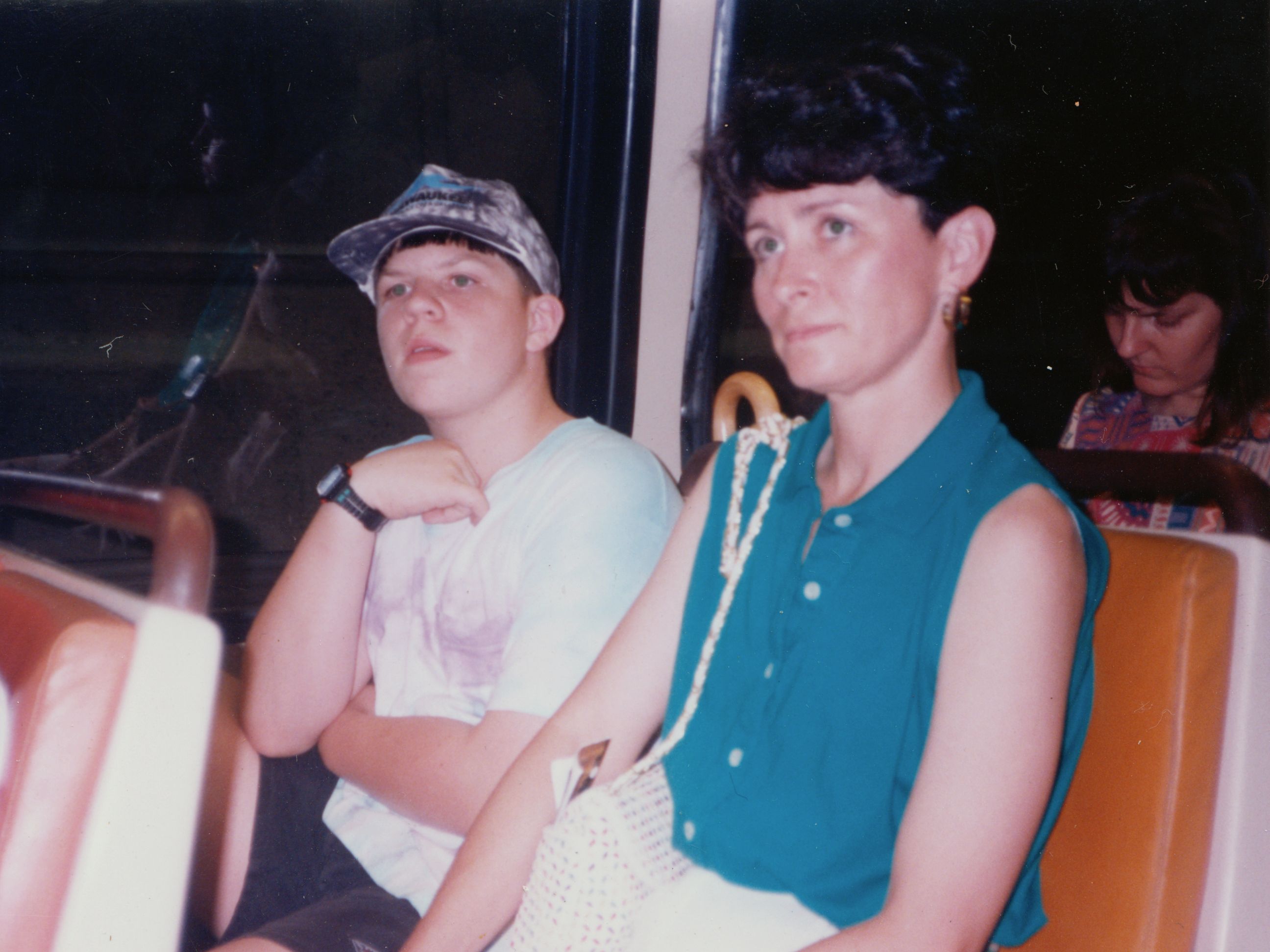
First of all, I had not been to the National Zoo in ages. I think that the last time I was at the zoo was, I believe, the summer of 1996. Back then, Mom and Sis and I went on a weekday, and I remember its being my first time ever making any sort of Metro transfer, and my first time on the Red Line. Prior to that trip, we had been to Washington a few times, but never before had we done anything other than one train. I took the Blue Line on my first trip, and several Orange Line rides. That first transfer was interesting, because I had never been to Metro Center before, nor had I ever transferred. It had never crossed my mind that one line crossed over the other. Then when we got to the zoo, I recall our being not so impressed with it at that time. But at the same time, it was also really hot out and I was not doing well on the hill that the zoo is built on due to my being somewhat out of shape.
Back in the present, though, I’m in really good shape, and it’s time to see Christmas-themed lighting. I will admit that I had some fun (in a mean way) with the identity of the main sponsor for ZooLights: Pepco. Pepco, you may recall, is the for-profit utility that has the notoriously unreliable power grid in DC, Montgomery County, and PG County, and that keeps asking for permission to raise rates. My comment was that with Pepco sponsoring it, I was somewhat surprised that the lights were even on, considering that they often have problems with that.
Categories: Christmas, Melissa, Retail, Washington DC, Wheaton
Driving in Virginia on Thanksgiving morning…
6 minute read
November 22, 2012, 7:04 PM
First of all, greetings from Stuarts Draft, where I will be through Sunday. And so far, so good. The drive went surprisingly well, and then Thanksgiving dinner was absolutely wonderful.
Considering how well my drive went today, though, I don’t know why anyone would want to go driving on the day before Thanksgiving. Seriously, this was one of the easiest drives to Stuarts Draft that I’ve had in a long time. I left the house around 8:45, and it was more or less smooth sailing the entire way. Georgia Avenue in Montgomery County, from my house to the Beltway, was no problem.
On that note, by the way, does anyone know what’s going on with the Freestate gas station on Georgia Avenue at Layhill Road? This is how it looked this morning:

Categories: Clothing, Driving, Family, Kia Soul, Language, National politics, Sheetz, Silver Spring, Thanksgiving, Weight loss
Zombie night in Silver Spring!
5 minute read
October 28, 2012, 11:00 PM
So October 27 was the night of the annual Silver Spring Zombie Walk. Except this year, for various reasons, there was no actual zombie walk through the downtown area of Silver Spring. It was just zombie night, where there were a bunch of events for kids and adults, but no single, unifying event like in years past. I knew this going in, and knowing there was no specific zombie walk but rather just a night of zombie-related fun and festivities, I decided to just see what I could see.
Not surprisingly, it was a little bit underwhelming. I wasn’t about to hit the bars and take pictures of adults drinking in zombie costumes. The best players in last year’s zombie walk were the kids, and so I tried to stick to the areas where most of the family entertainment would be held, around Ellsworth Drive, while still getting around the full downtown area a bit.
On Ellsworth Drive, in the “Downtown Silver Spring” development, the younger set was out and about. Some of them were remarkably scary/creepy specifically because they were kids and looked a little too wholesome to be spattered with blood and looking all undead. Like these two:

Add the blank expressions to the mix, and you have nightmare fuel right there. Great costumes, great playing of the part, but still creepy. Good work.
Categories: Halloween, Silver Spring