


What is Afton Mountain, anyway?
8 minute read
March 21, 2013, 5:58 PM
A friend of mine recently sent me a link to this article by Dr. Christopher M. Bailey, a geology professor at The College of William & Mary. The article discusses the name of a place that many people in the part of Virginia that I grew up with are most likely quite familiar with: Afton Mountain.
The article is titled, “Mind the Gap! Where is Afton Mountain?” and discusses the geology of the area, specifically Rockfish Gap, and a few quirks of the local culture. First, for those not familiar, Rockfish Gap is a wind gap in the Blue Ridge Mountains, which separate the Shenandoah Valley and the Piedmont region in Virginia. Because it is the lowest gap for quite some ways traveling both north and south, the area became an important way to travel east and west. Today, Interstate 64 and US 250 carry travelers through Rockfish Gap.
Technically speaking, this is Rockfish Gap, seen here in a 2003 Schumin Web file photo:

This view, facing east, shows Interstate 64, viewed from a bridge over the highway at the junction of the Blue Ridge Parkway and Skyline Drive. There is no signage identifying Rockfish Gap on Interstate 64, even though you go right through it. If you travel on US 250, you do see signage for it, as US 250 in Augusta County is called “Rockfish Gap Turnpike” from the eastern border of Waynesboro all the way to the border with Nelson County. Additionally, there is a small sign on US 250 at Rockfish Gap denoting the name of the feature and the elevation. It’s right here:

Image: Google Street View
As you can see, it’s so small that if you blink, you might miss it. Then it’s also marked at the junction of the Parkway and Skyline Drive, as one would expect:

Image: Google Street View
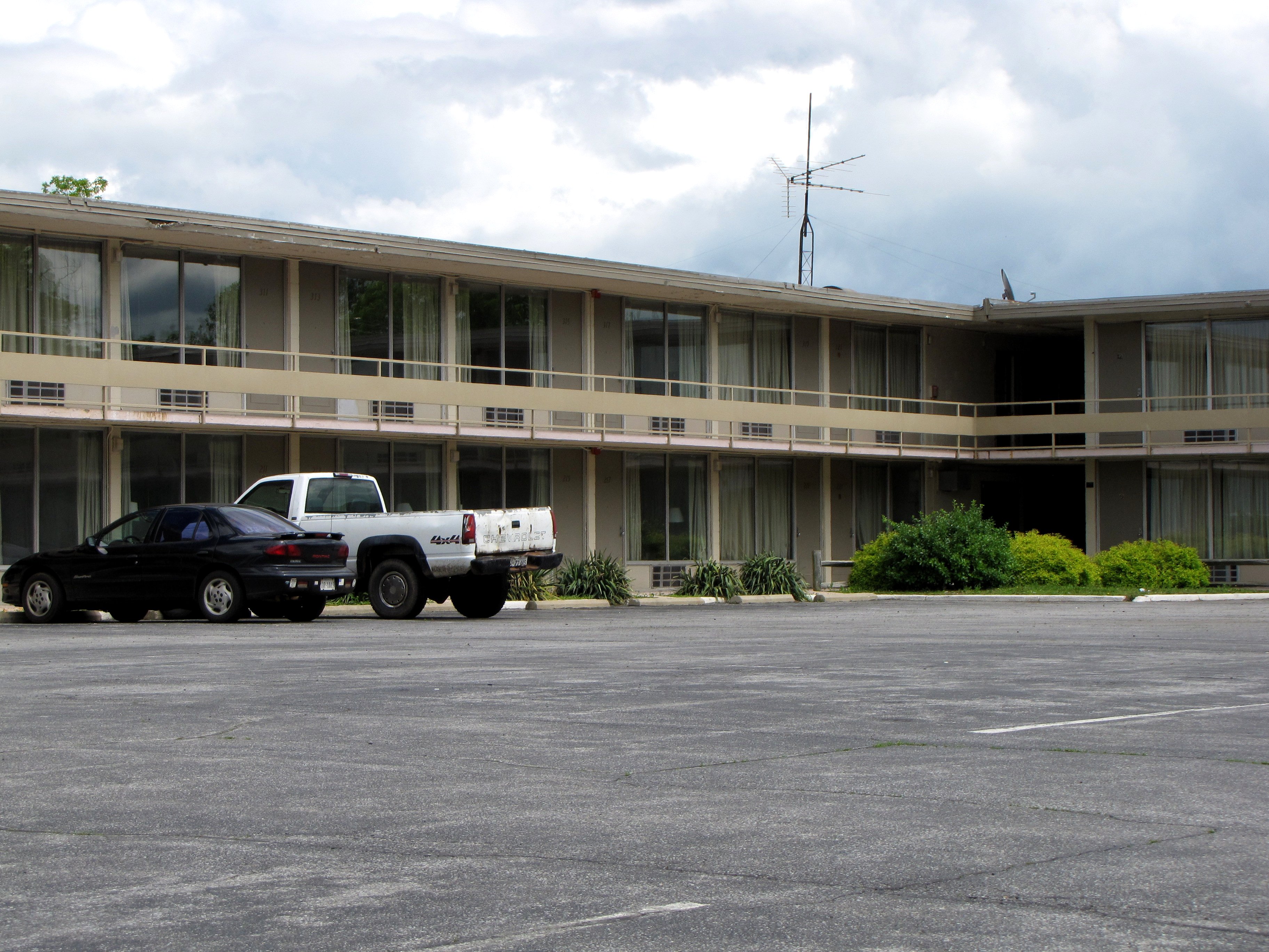
However, if you look around that area using the links to Google Street View that I provided, you will find some familiar structures nearby. You may remember them from various features on Schumin Web, such as Photography sets done in 2003 and 2011, and also various Journal entries over the years. Yes, folks, we’re up on Afton Mountain. And, as I think many longtime residents of the area will be surprised to find out when reading the article, what we think of as “Afton Mountain” is technically a misnomer.
As Bailey points out in his article, there are a few things that make the “Afton Mountain” name, as it’s commonly used, a misnomer. First of all, geologically speaking, the defining feature of the area that we refer to as “Afton Mountain” is a wind gap. There is no mountain peak in that area, but rather, a low spot in the Blue Ridge Mountains.
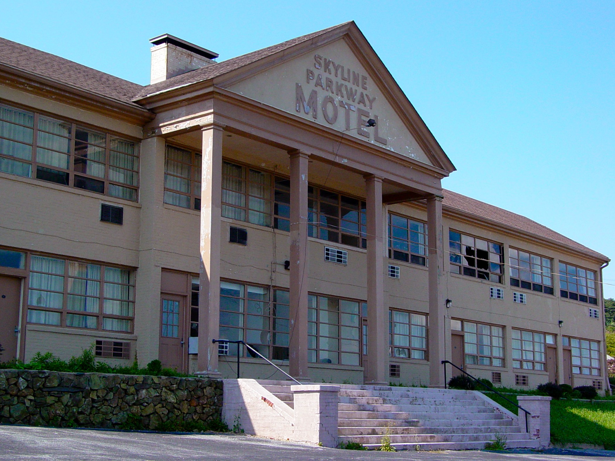
Second, the area that we refer to as “Afton Mountain” is not generally considered part of the community of Afton, Virginia. The community of Afton is firmly within Nelson County – not straddling the line between Augusta and Nelson Counties. I should point out that all of the (mostly abandoned) buildings that I have shown you on the mountain are in Augusta County. The boundary runs just east of Dulaney’s property, adjacent to The Inn at Afton and the former Skyline Parkway Motel. To reach Afton from Rockfish Gap, you take US 250 a short distance, and then make a right turn onto Route 6, and go down the mountain. There, you will find the community of Afton, about two miles away, according to Google. The area that people refer to as “Afton Mountain”, according to photos that I’ve tagged on Panoramio, is “South River, Virginia” (see example). Don’t worry – I’ve never heard anyone use “South River” to refer to that area, either. Bailey’s article indicates that Interstate 64 east of Rockfish Gap is located on the south side of Scott Mountain. I’ve never heard anyone use the name “Scott Mountain” to refer to that area, even though that is technically more accurate.
I would also guess that many people in the area most closely associate the term “Rockfish Gap” with Rockfish Gap Outfitters, a local outdoors store (similar to REI) on the eastern outskirts of Waynesboro.
And third – and I didn’t know this prior to reading the article – there is actually a summit named Afton Mountain according to the United States Geological Survey, but it is approximately two miles southwest of what is popularly referred to as “Afton Mountain”, i.e. Rockfish Gap. But there’s an interesting twist to this: that name is only around fifteen years old. The U.S. Board on Geographic Names was petitioned to name a mountain “Afton Mountain”, and they did. Bailey mentions that based on the location, calling it “Swannanoa Mountain” would be a better fit, and I agree. Calling that peak “Afton Mountain” was a poor decision, considering the local usage of the term. The designation seems to muddy the waters a bit. So naming an actual peak “Afton Mountain” came much later than popular use of the term to describe Rockfish Gap.
Having lived in Stuarts Draft for fifteen years from 1992-2007, I think I might be able to shed some light on where the “Afton Mountain” name came from in the context of Rockfish Gap, and what it means. First of all, the term was already common when my family moved to the area in 1992. Additionally, for those who have lived in or are familiar with the area, it is generally understood when one says “the mountain” without qualifying the term, it means Rockfish Gap. To get to Charlottesville from Augusta County, you go over the mountain. Yes, the Blue Ridge Mountains are referred to locally as “the mountain”. I use this terminology on Schumin Web like it’s the most natural thing on Earth, such as in a 2011 Photo Feature that is titled “Broken window on the mountain“, and in a 2011 Journal entry where I say “the mountain” without any qualification first, and say “Afton Mountain” later. And it all refers to Rockfish Gap.
I also wonder how many people use both terms. I use both “Afton Mountain” and “Rockfish Gap”, and I use them to mean different things. In reading Bailey’s article and then looking at my own writings, I came up with a good explanation of the two usages. For me, I say “Rockfish Gap” to refer specifically to the passage, more along the lines of naming a landmark. I use “Afton Mountain” as a place name to describe the general area, much like how neighborhoods and communities have names. Think “Ridgeview Acres” and “Sherando” here. I consider the place known as “Afton Mountain” as the areas along the Interstate 64 and US 250 corridors, beginning in the places where the elevation starts to go up. In other words, this is the area that I would call “Afton Mountain”:

Image: Google Maps
This saxophone-shaped area is that which I would refer to as “Afton Mountain”. It starts at the Waynesboro city limits (right after Exit 96 going east on I-64), and encompasses the two roads’ paths until the roads reach the bottom on the other side in Albemarle County. It includes Rockfish Gap itself, it includes the abandoned buildings and The Inn at Afton, but it does not include the Blue Ridge Parkway or Skyline Drive. Thus once you hit the Parkway, you’re not in an area that I would consider to be “Afton Mountain” anymore, despite being on the same mountain ridge.
How I differentiate between the two terms is best exemplified in this quote of mine from the Humpback Rock Photography set. There, I said, “The site is approximately six miles south of Rockfish Gap (and the abandoned buildings on Afton Mountain), accessible via the Blue Ridge Parkway.” I said “Rockfish Gap” to refer to the landmark along the Blue Ridge Mountains as one passes through along Skyline Drive and the Blue Ridge Parkway. Then I said “Afton Mountain” to refer to the general area.
The distinction that I draw between the two terms may be lost on some. And I admit that I say “Afton Mountain” way more than I say “Rockfish Gap”. But it does rectify the discrepancy between the geological feature and the popular name for the area.
Now how the area got to be called “Afton Mountain” in the first place is a bit of a mystery. I did a Google search and came up with an article about the history of the area, as well as a timeline, but no one mentions how the “Afton Mountain” name came to be applied to the I-64/US 250 corridor through Rockfish Gap. The best explanation that I can come up with is that the term originated with Interstate 64, which opened in September 1971. There are few references to Rockfish Gap on US 250, which predates Interstate 64 (and the “Rockfish Gap Turnpike” name on the Augusta County side only dates back to the early 1990s), and there are no references to Rockfish Gap at all on I-64. There is only one exit on the mountain, Exit 99, at Rockfish Gap. It’s signed as such, as seen on Google Street View:

Image: Google Street View

Image: Google Street View
The first image is a sign on eastbound I-64, seen as one is climbing the mountain on the Augusta County side. The second is at Rockfish Gap itself, on westbound I-64, just before the exit. Of the two town names seen on Exit 99 signage, Afton is unique to Exit 99, and Waynesboro is also listed with top billing on the previous two exits: Exit 96 (Waynesboro/Lyndhurst), and Exit 94 (Waynesboro/Stuarts Draft). Additionally, when traveling eastbound, one passes a sign that says that one is leaving Waynesboro. Then the next exit is Exit 107, signed for Crozet, and by the time the first sign for Exit 107 comes up, one has been off of the mountain for a while. So from this information, it is reasonable to think that Exit 99 is located in Afton. Signage on the exit ramp does not seem to contradict this perception. Turn left for Waynesboro, and turn right for Afton, and eventually, Charlottesville. And the first sign of civilization that you see when you turn right is the mostly-abandoned lodging and restaurant complex. So it is reasonable to think that this must be Afton. But for those who stay on the highway (like those going to Charlottesville to shop), there is no signage to mark the features that the road is traveling over, and “Waynesboro” is shared with two other exits. This leaves “Afton” as the only term that drivers see that is unique to the mountain. The use of “Afton Mountain” reasonably follows from that, and there is no signage to contradict this assumption. And then I would also assume that once the term became common, it took on something of a life of its own. This would make sense, since it is the de facto place name for that area.
Thus far, I have found nothing to contradict my theory that Interstate 64 gave birth to the “Afton Mountain” name. The Inn at Afton, which dates to the 1960s (predating I-64), was a Holiday Inn until the mid 1990s, when it took its current name – thus it’s consistent with the theory. Afton Mountain Vineyards, a locally-owned producer of wine, according to what I’ve found, dates back to the late 1970s. No contradiction there, either. Afton Mountain Bed & Breakfast only dates back to 2002. No problems there. The only proper name that I have found in documented use for places in that area prior to Interstate 64 is “Skyline Parkway” on some old postcards that someone scanned and sent to me, for some now-abandoned motel properties (you know which ones). That name is clearly derived from the nearby Skyline Drive and the Blue Ridge Parkway. The location of the places depicted on those cards is described as the intersection of US 250, the Blue Ridge Parkway, and Skyline Drive. No mention of “Afton” or “Afton Mountain” anywhere.
So if anyone can find evidence to contradict my theory for how Afton Mountain, as the name is most commonly used, became known as such, please let me know and leave a comment. I would be interested to hear about it. So far, that’s the best I’ve got to describe how the area came to be called “Afton Mountain”, despite that the name really is a misnomer for a number of reasons.
But, hey, no one ever said that local names for places had to make sense, right?
Categories: Afton Mountain, Nature, Roads