


A little adventure in Virginia, mostly in the woods…
26 minute read
October 6, 2022, 8:06 AM
From September 13-15, Elyse and I had a little weekend adventure in Virginia, where we went down to Augusta County stayed in Staunton like we usually do. This one was a little different than most because it was partly a solo adventure. Prior to this trip, Elyse had been down in Roanoke attending to business related to a nonprofit that she volunteers with, so she traveled up from there on Amtrak, and we met up in Charlottesville. My original plan was to go the easterly route down, taking I-95 to Fredericksburg and then taking Route 3, Route 20, US 15, and a few other routes that would take me through Locust Grove, Orange, and Gordonsville. However, at the last minute, I had a change of heart, deciding that (A) I didn’t feel like wading through traffic on the Beltway or 95, (B) that easterly track would get me to Charlottesville far too early, meaning that I would have to kill time before Elyse would arrive, and (C) I had ideas that necessitated taking other routes. So I took the westernmost route, which primarily utilizes I-81, and took the “alternate” version of that, which goes through Harpers Ferry and Charles Town in West Virginia via US 340, and then taking Route 7 to meet I-81 in Winchester. Yes, I’m going north to head south, but the distance and time for going out to Harpers Ferry is almost the same as it is to go through Northern Virginia on I-66, so it works.
My first point of interest was a relatively obscure sign in the middle of a field in Verona:

Image: Google Street View
This is a brown highway-style sign in the middle of a field, well off of Interstate 81 between exits 227 (Verona) and 225 (Woodrow Wilson Parkway). It says “Augusta County Industrial Sites” on it, and has a phone number on it that goes to Augusta County’s Community Development department. It’s just kind of there, and I’ve always found it a bit curious. Most people in Augusta County know about it, because it’s easy to see off of the highway when traveling southbound, and because it’s so unusual. I did a little research on its location ahead of time, and figured out how to get to it. Then it was just a matter of driving out there and doing my thing. For those curious, you go down Mill Place Parkway next to the Hardee’s in Verona, and then make a left on Centerview Drive, next to the Sumitomo facility. There, you go to a park that’s at the end of that road, park your car, and walk along the path past the little pond until you reach the top of the hill. There, you start walking into the field that you’re next to for about 1,000 feet or so until you reach the sign, which is down near the bottom of said field. In other words, this, as viewed by my drone:

Basically, just follow the arrow, and walk from there to the sign.
I initially thought that I would just do the photography by remote with the drone, i.e. “do I really want to walk all the way down there” and all that. So I went up for a flight, and started with some overview shots of the area:
.")
Facing east. Interstate 81 runs across the middle of this shot, and the sign is to the right in the field (you’ll probably need to click through to the enlargement to see it).

Facing northeast.

Facing west, towards the Augusta County Government Center.
Then I went in for more detailed shots.

Overhead view of the sign.

The sign. This is an angle that I like to call “cheating”, because I shot it with a drone, but it looks like I did it with a regular camera.

Another overview of the field. The sign is approximately at the center of the photo.
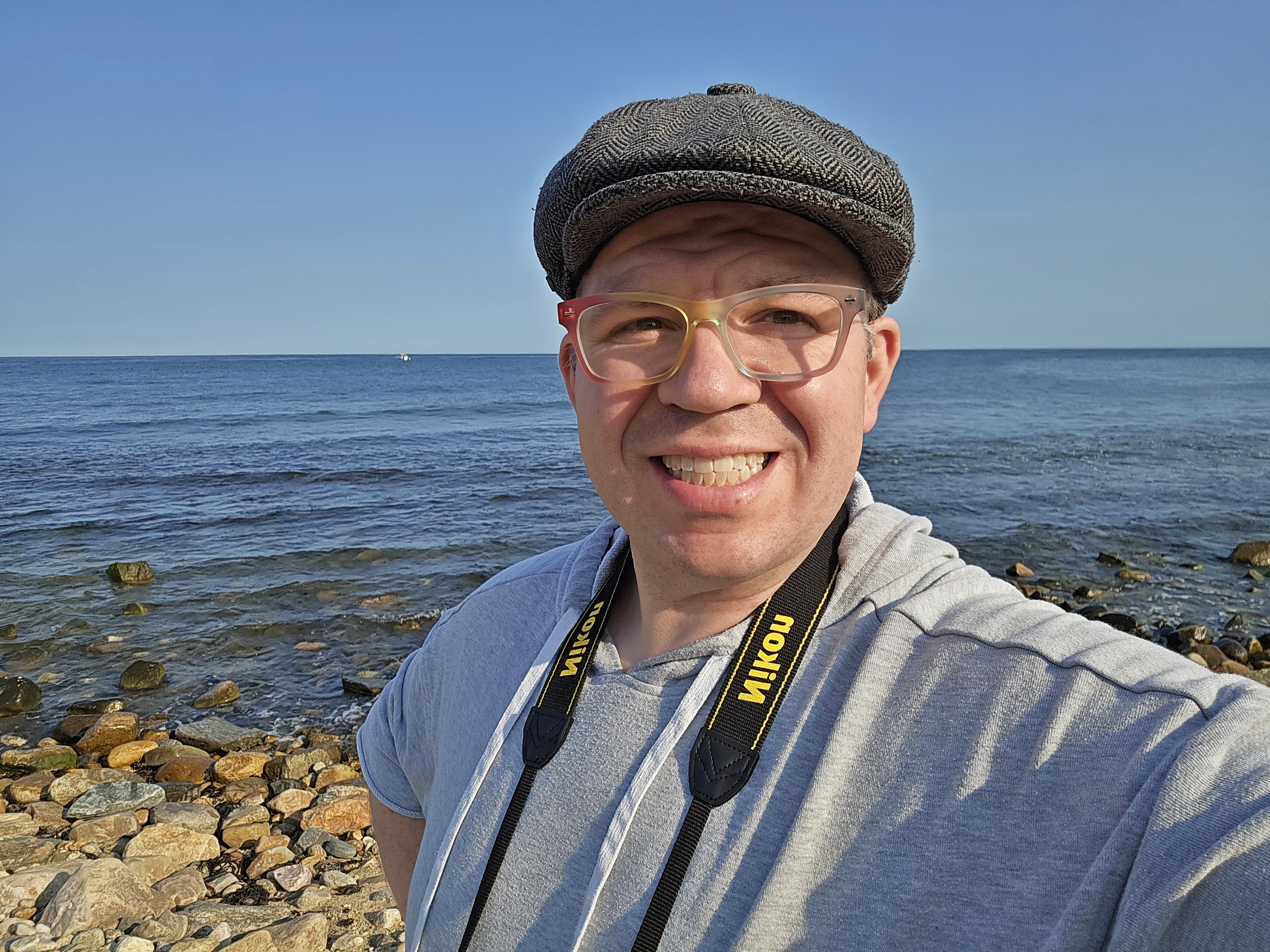
Then I took a few selfies with the drone before I put it down, because I was wearing my Pixsy shirt and wanted to show it off, with the intention of using it as a splash photo:

A pretty conventional pose.

This was an attempt to show off the back of the shirt, which says “Exposure doesn’t pay the bills,” and also smile. It didn’t work out too well, and the expression looks like I was trying too hard. I didn’t even realize I was doing a thumbs-up thing until I saw the photo afterwards.

Better shot of the shirt, but now you can’t see my face. I figure that if I ever run any of these as a splash photo, I’ll probably combine the first one and this one to get something.
I wasn’t too pleased with the drone’s detail shots of the sign, and so if I wanted to do better, I had to physically go out to it. That involved walking about 1,000 feet into this field, where the grass from many past mowings had been matted down, making for a more challenging walk than I expected. But I made it out there, and here’s the sign:


Then, of course, I got a selfie:

I figure, I went all the way out there, so, you know, you’ve got to get a selfie.
From here, I headed down to Hotel 24 South and got checked into the room. That was a quick in and out: check in, drop the luggage, and then keep it moving. After all, I was in Staunton, and there was a mall that was coming down, and it needed an update.
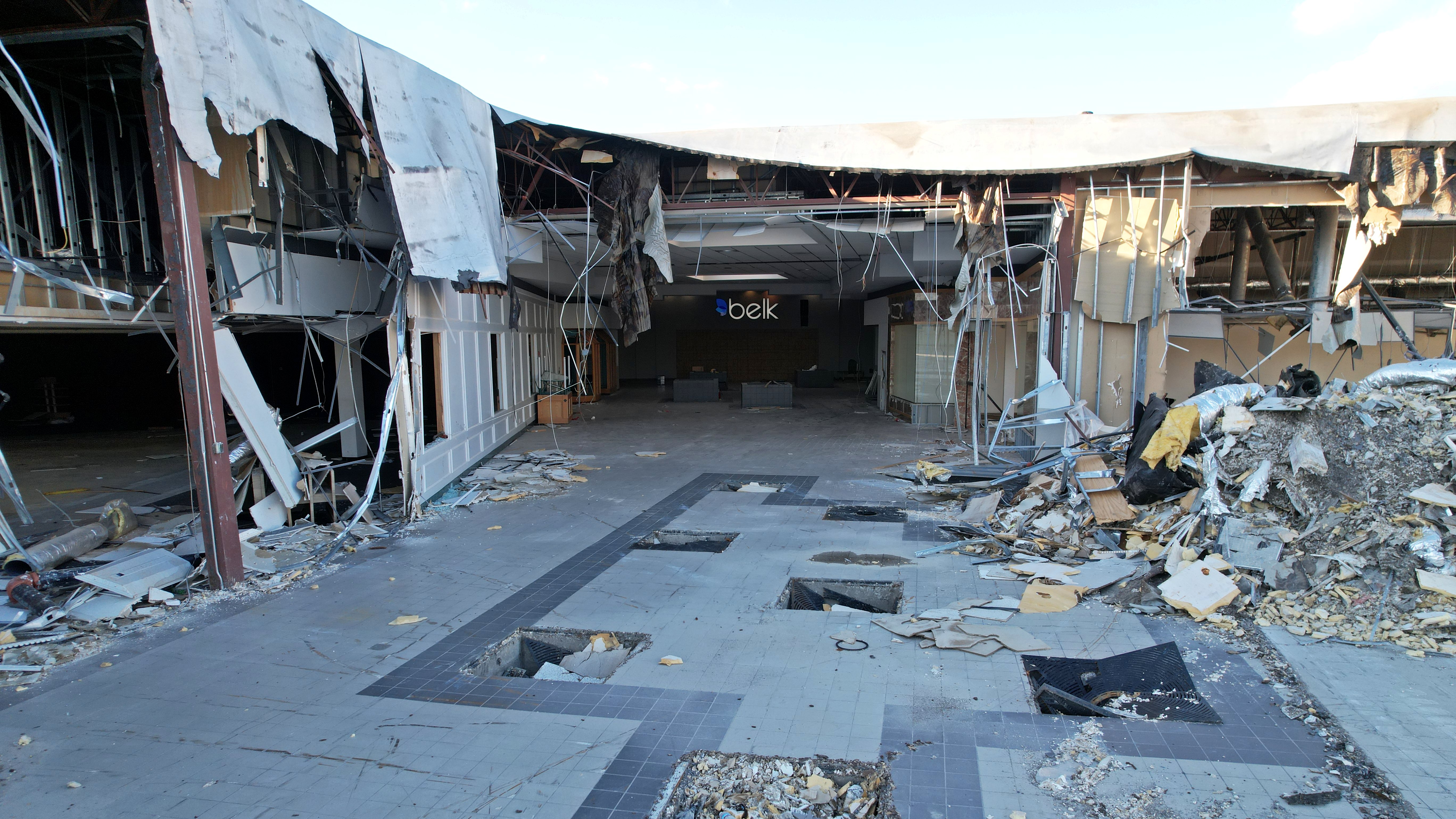
At Staunton Mall, the change from August to September was not nearly as dramatic as from June to August. More of the movie theater building had been demolished, and what remained of the Belk wing was about half the size that it was in August. There was no change to most of the rest of the mall, which had mostly been reduced to the exterior walls.
First, though, I got the southeast corner of the JCPenney building, which I had missed in August:


Much of the back of the building has been demolished, and there is a big hole in what remains. Note that the first “n” in “JCPenney” is dangling by its wire.
Then I repositioned myself and investigated the movie theater building:


From the looks of it, the building only has one theater left, down from six originally. I imagine that it won’t be long before the movie theater building is history.

I then raised my altitude and looked back towards the Belk wing. Note that the Wards building is demolished save for the exterior walls, and the Belk wing has been further reduced in size.
I then repositioned again to the front side of the mall. Here, I spotted workers still on the site. I knew what I wanted to get, and also knew that this was my only opportunity to get it on this trip, and I didn’t want humans and my drone to interact under any circumstances. So I got the attention of one of the workmen, and he got his foreman over. We talked about what I wanted to photograph and my history of photographing the mall, and I emphasized that I didn’t want to get in their way. Turns out that they were more or less done for the day, and so I had the run of the place.

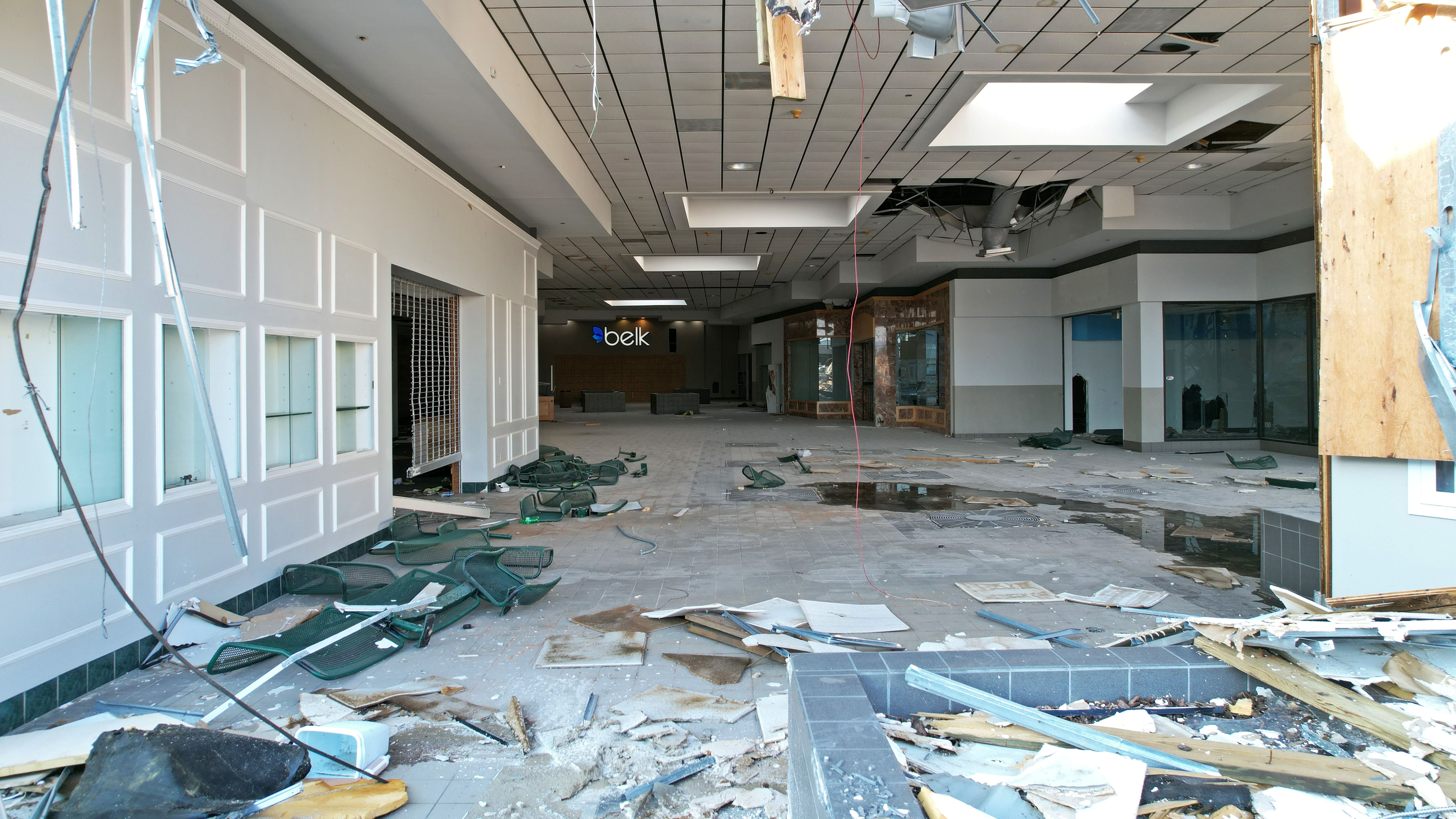
Belk wing mall entrance. Books A Millioin is starting to come down, and the mall corridor next to BAM is missing.

No more mall corridor around Books A Million. Just a month prior, this was still indoors.
Demolition progress on the Belk wing, viewed from the closest point that I could safely access with the drone in August.

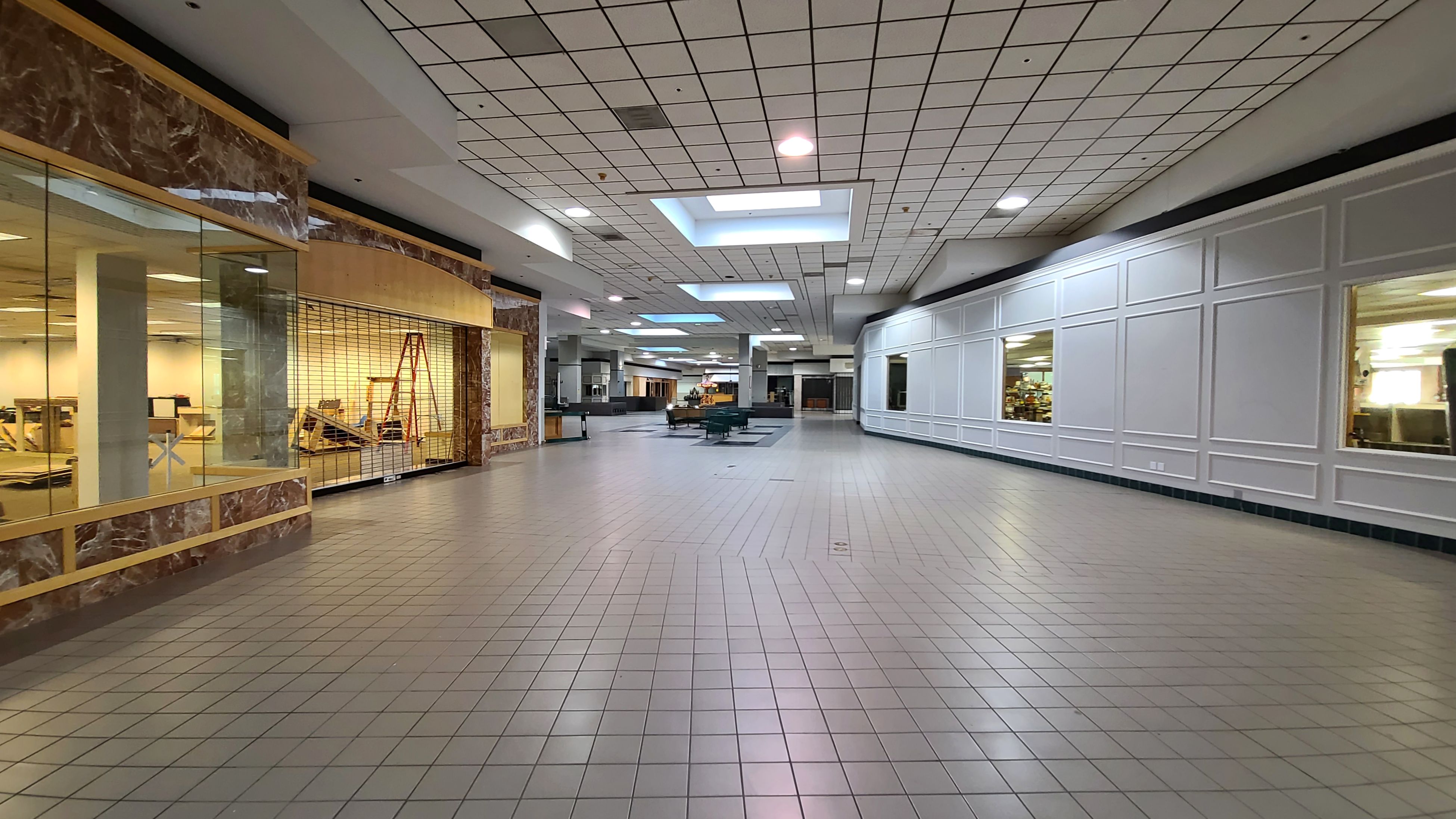
The final bit of mall still remaining, from the Hallmark store to Belk.

Since there wasn’t anything major dangling from above this time, I was able to fly in for a little closer look at what was left. Here’s the mall corridor from the north end of Books A Million.

The former Hallmark store, with the south wall now missing. Note that the Hallmark logo is still visible as a labelscar.

Atlas Tuxedo, still looking the same as it did while the mall was open, at least for now.

Looking south from the end of the Belk wing, next to the now-boarded-over Belk entrance.

View south from the former Hallmark store. Compare to the same view while the mall was still open.
So that’s Staunton Mall as it currently stands. Slowly but surely, the old mall is coming down, and it will soon be a part of history. I wonder what it will look like the next time I update.
After Staunton Mall, I headed over the mountain to Charlottesville to scoop Elyse from the Amtrak station. We later went to the Taco Bell near Barracks Road, where we had dinner. I had a quesadilla, while Elyse only had a cheesy roll up, claiming that she wasn’t hungry. Yeah, about that…


Clearly, someone was hungrier than they thought, as they ate half of my quesadilla along with their cheesy roll up. And when I asked for it back, she gave me the finger. From there, we went back to Staunton, and that was that.
The next day, we headed out for a day mostly in the great outdoors. The plan was to head up to the Blue Ridge Parkway and take that down to Love Gap, stopping at a few overlooks in the process. Then we were going to visit Sherando Lake, which is part of George Washington National Forest, and then we were going to do a hike to Mills Creek Reservoir, which is out in Big Levels (also in George Washington National Forest), and then from there, since we would be close by, we would go and see my parents.
Our first stop was Afton Overlook, which is the first overlook on the Blue Ridge Parkway:


I feel like the trees are taller than they were the last time I was at this overlook, but at the same time, I don’t think that I ever paid that much attention to this overlook, though I did get those nighttime photos that looked like daylight that one time. Back when I worked at Walmart and would go up on the Parkway to mentally unwind after work, I tended to avoid the first overlook, because it was right off of the Interstate, and therefore easy for various unsavory characters to access. People would come up here to drink, and one time, when I was sitting on the back of the Sable with the hatch open, looking at the stars and the piedmont below and trying to unwind, I got propositioned by a man for sex. Nothing like hearing a rough-sounding voice say, “You want some dick?” to completely kill the mood. I politely declined his offer and quickly left after that. After that, I figured out that if you go further down the Parkway, like two or three overlooks in, you didn’t get the riffraff like you did on the nearer ones, and I could get the tranquility that I desired.
After finishing at the first overlook, we headed down to the second overlook:

Not a bad place. We then went to the Humpback Rocks visitor center and looked around the gift shop before continuing. We then stopped at the Stone Fences overlook, where I got some shots of the Shenandoah Valley:


I also got this really cute shot of Elyse looking out of the window of the car:

It is worth noting that my favorite moment on this overlook was on New Year’s Eve at the end of 2003, where, after work, I drove up to this overlook, and watched people in the valley below set off fireworks as the clock struck midnight. It was really neat to see.
We then headed to our last overlook on the Blue Ridge Parkway, which was my favorite: Raven’s Roost. This is typically my last overlook going south, and I have a good view of places that I’m familiar with, so I often will spend the time picking out various things that I can see there. This visit was no exception, as I used a pair of binoculars to spot landmarks and then get back to them with the camera for a shot.

The Hershey facility in Stuarts Draft, viewed from Ravens Roost. Recall that I photographed this facility with the drone back in June.

View of the west end of Waynesboro. The Waynesboro Walmart, where I once worked, is at the center.
 and Waynesboro (more back right).")
Overview of the area, looking towards Stuarts Draft (kind of middle left) and Waynesboro (more back right).
 runs left to right across the middle of the photo.")
 runs left to right across the middle of the photo.")
Mountain ridges in the Sherando area. Mount Torrey Road (Route 664) runs left to right across the middle of the photo.

This spot used to contain a plaque that told you what you were looking at in various directions.

This is what the plaque looked like when it was still in place, photographed by me on October 9, 2006. I wonder when it was removed, and why it was removed.
All in all, Elyse and I had a good time on the Blue Ridge Parkway. I’ve photographed these views many times before, and I feel like my photography this time around was a bit uninspired because of it. Generally speaking, I tend to do better with photography further down the Parkway going towards Buena Vista. I think that I probably would have been more inspired had I been able to take my drone up, but as the Blue Ridge Parkway is a national park, that’s a no-go with the drone (there has been a blanket ban on drones in national parks since 2014), so I felt a little uninspired, since I couldn’t do much more than I had already done up there.
We got off of the Parkway at Love Gap, and headed down the mountain and into Sherando via Love Road. On the way down, we spotted a rather unusual mailbox:


Way up on a long pole, this mailbox is for “air mail”. I thought it was rather clever. While I recognize that this is intended as humor, I imagine that with the right kind of drone, one probably could actually deliver some mail to this box.
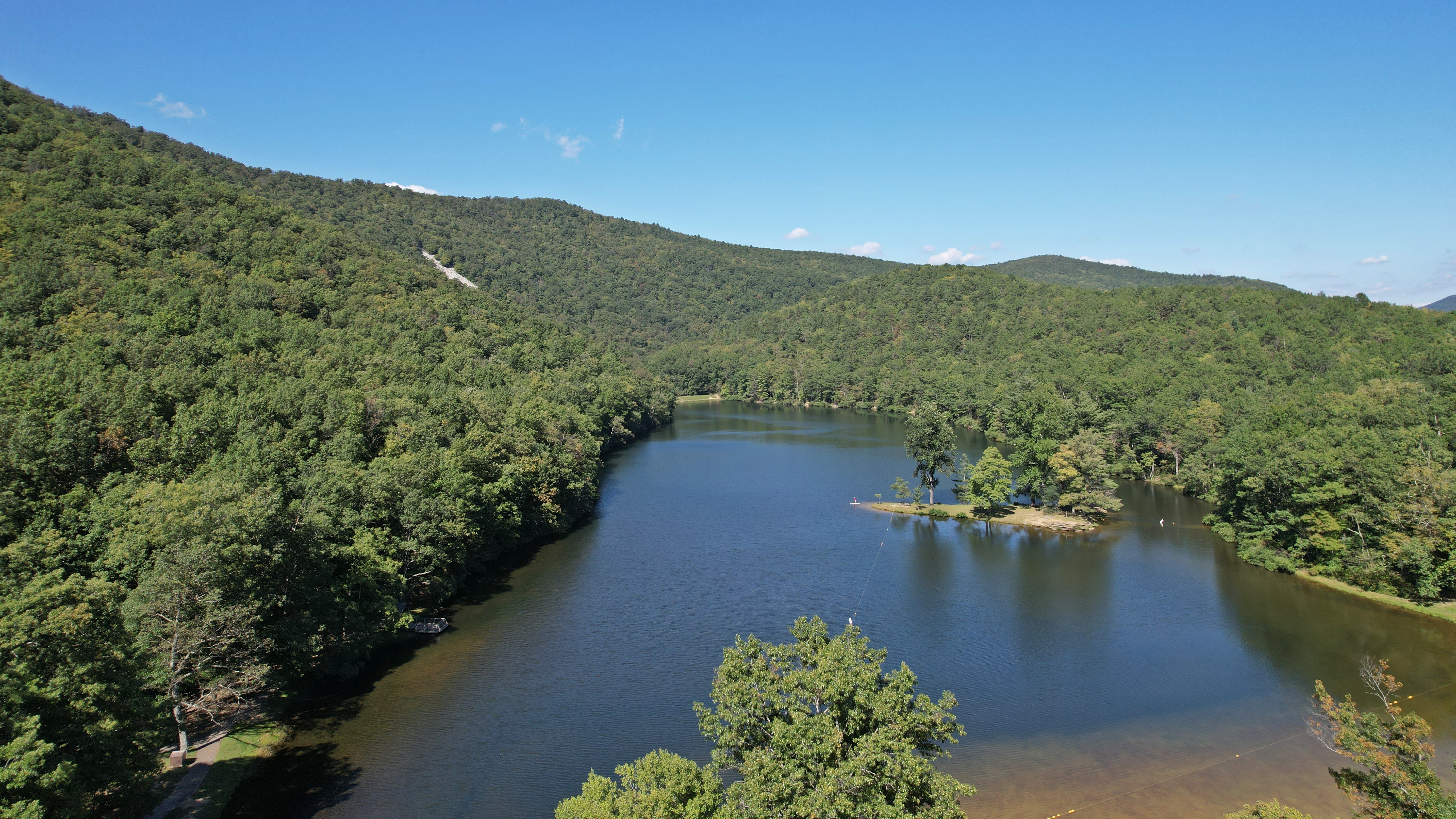
We then continued down the mountain and on to Sherando Lake. That’s national forest, where, unlike national parks, drones are allowed. I had not been to Sherando Lake since the nineties, so it was good to revisit the location. And here it is:

Sherando Lake is a picturesque little manmade lake in the midst of George Washington National Forest, built in the 1930s by the Civilian Conservation Corps, which was part of the FDR-era New Deal. In flying my drone, I wanted to get some photos of the lake both in overview and up close. I also managed to shoot two short videos skimming across the lake:
I admit: I am a rank amateur when it comes to videography, because I don’t do it a whole lot. I imagine that I would be better at it if I did videos more often, but since I feel that I can communicate much more effectively in writing and with still photos, it means that I default to that rather than video. And I fly the drone like my individual movements don’t count, since I’m only capturing a single frame. The first video, lasting eleven seconds, has a pretty good startup, but then comes to an abrupt stop at the end. The second one, lasting about a minute, is a little better, but has some noticeable course corrections in it. But, hey, I tried.
And then here’s what I got of the lake:

Sherando Lake from high above, in context with the mountains and the forest. View facing appoximately north.

I believe that this is the dam for Sherando Lake, which, if I’m not mistaken, would make it an embankment dam. Unfortunately, we did not have time to investigate this further.

The lake, facing south.
Another view of the lake, facing approximately north, from a lower angle.

A small island in the middle of the lake.

Another view of the lake, facing north. A woman doing stand-up paddleboarding has come onto the water.


Two more views of the lake, facing west.
At this point, I was just about out of battery, so I brought the drone in for a landing, just as the paddleboarder was landing on the shore. I intentionally ran this flight on a partial battery because I needed to maintain a schedule, and this enforced that time constraint, because when the battery ran out, it was time to reel it back in. After I landed, I remarked to the paddleboarder, “And there you go!” referring to the just-completed flight. After all, most people find it at least mildly interesting to see someone flying a drone, and it’s often a nice conversation starter, because I love discussing what my drone can do, and how regulations impact what one can and cannot do with it.
That would not be the case here. Apparently, my drone really triggered this woman, because she went full-on “Karen” on me over my drone, telling me that I was “flying in [her] face”, claiming that the motors were making a whole lot of noise when she wanted quiet, accusing me of spying on her, and then finished by telling me that I should leave. She also claimed that she had tried to splash water on my drone, which coincided with my raising my altitude and returning to base, and she assumed that I was watching her on purpose and getting out after I saw her try to attack my drone. Truth be told, I can’t see that level of detail on the live feed at the distance that I was from her, and the only way that I found out that she was trying to splash my drone was when she admitted as much to me. For what it’s worth, interfering with a drone is actually a federal offense, and is, in the eyes of the law, treated the same way as it would be if you were trying to interfere with a commercial airliner – so don’t do it. I’ll bet that she didn’t consider that she was admitting to having committed a federal crime that, if convicted, comes with fines and prison time, when she told me that she tried to attack my drone.
Regardless of what she claimed, though, I knew better. I intentionally kept my distance from her while flying, giving her a very wide berth in the name of safety. I didn’t want to inadvertently cause injury to her if my drone got too close or dropped out of the air, and I didn’t want her to accidentally (or in her case, intentionally) hit it, because in either instance, I’d be out a lot of money as a result, either for an injury, for damage to or loss of my drone, or both. I nonetheless took an apologetic stance, stating that I intended to keep my distance, and that if she was made uncomfortable, I was sorry. I figured that ought to take care of it, but she was still very butthurt over it. Once I realized that I was not dealing with a rational person, I just said, “Have a nice day,” in that certain kind of tone that really means “go away,” and ceased any further communication with her. After all, there was no reason that we both couldn’t use the lake in our own ways and be in full compliance with all laws and regulations involving lake usage, airspace, and whatever have you, and there was no point in arguing with someone who thought that the entire lake belonged to her.
After that, I found Elyse, and she showed me the toilets in the bath house:

The toilet in the bath house, which is a commercial version of the weird square Eljer toilets that my parents have.
As we came out of the bathroom and headed back to the car, Karen was back, this time filming us with her phone and ranting and raving about how I did not have her permission to use any photos of her, that she had my license plate number, and that I had better delete any photos of her “or else”. We ignored her as best as we could, but I couldn’t help but think about how nuts she was. After all, I was on public land and flying over public land, she was on public land as well, i.e. anyone was allowed to be there. Additionally, and she was out in plain view, visible from all around. She had no reasonable expectation of privacy whatsoever. But I wasn’t going to even try to tell her how wrong she was, because it wasn’t like she was going to listen to me anyway.
That said, here’s the most detailed image that I have of Karen, cropped from the other photo:

It sure would be a shame if this photo went viral because of that little fit that she pitched, wouldn’t it?
Then on the way out, we spotted a rather unusual stop sign:

Upon seeing this sign, I couldn’t help but think about a forehead slap. You know that there is no way that this complies with the MUTCD, and this is the federal government itself doing this.
Leaving Sherando Lake, we headed to B&R Grocery for a quick pit stop, and then it was off to our next destination: the Mills Creek Reservoir. This was something that we had wanted to do on our June adventure, but had to cut due to time considerations when we discovered that we couldn’t drive right up to it, and would have to walk the last mile and a half from the Coal Road to the reservoir. We were by no means prepared for that in June, but this time around, that three-mile round trip was part of the plan. So we parked at the trailhead, and began our journey. That meant a mile and a half of this:

That’s what the whole thing looked like, nearly the entire way down. Two tire tracks and a whole bunch of woods. About the only excitement was when the trail started to go uphill as we approached the reservoir. Other than that, if you’ve seen one section, you’ve seen it all. And I was carrying my camera bag and the drone case all the way down. As an aside, I really need to get a shoulder strap for my drone case if I’m going to carry it on adventures like this.
The dam, meanwhile, was a bit different than the dams that we visited in June. It was an embankment dam like Coles Run, but it didn’t quite have that “mountain reservoir” feel to it in the same way that Coles Run did. I wonder if it’s the way that we came up to it, and the reservoir’s position relative to that. Here’s how we came up on it:

We came in where those tire tracks are in the back of the shot, and which led to this big plaza. I climbed up a relatively steep embankment, where I took this photo. The reservoir is behind me and to the right, down a hill. The hills are much lower here, and the reservoir was also much lower down relative to our position, which likely contributed to the less-than-majestic perception.
Regardless, I fired up the drone and took a look:

Mills Creek Reservoir, facing northeast.

Mills Creek Reservoir, facing southwest.

Overhead view of Mills Creek Reservoir, showing the reflection of the clouds on the surface of the water.

Skimming over the surface of the water.


This large concrete object on the water, which I assume has something to do with the way that water passes through the dam.


The dam for this reservoir is an embankment dam, with grass growing on both sides.

One of several depth markers in the grassy area near the lake. This made me think that the water level was relatively low at the time of our visit, and that water does sometimes come up to this area.

View of the mountains from above Mills Creek Reservoir, facing southwest.

View of the mountains from above Mills Creek Reservoir, facing northeast.
Then after I set the drone back down, I got some other shots:

This dedication plaque from the dam’s 2013 rehabilitation bothered me a lot. It is skewed, and there is no reconciling that skew, i.e. it does not correspond with anything considered “level” anywhere. I couldn’t help but think that they spent all that money rehabbing the dam, and they couldn’t even be bothered to hang the plaque properly.

Elyse looks at something on her phone while I do my thing.
I admit: I wasn’t all that pleased with the results from Mills Creek Reservoir. We got here a tad later in the day than I would have liked, and that affected the light that I had to work with. I also found this reservoir to be a little underwhelming, and that affected my shots as well. But at least we got a good three-mile hike out of it.
From there, we headed out of Big Levels via Lake Road and went past Shenandoah Acres on the way to my parents’ house. We got with them, and then had dinner. I also had a whole bunch of old photos that I had scanned from a box of prints that they had sent up with me a while back, and we all looked at those. There are a lot of old photos of me in there from when I was very little, and some of them are downright amusing. I’m sure that some of them will make it onto here in due time.
The next day, the plan was to head to Charlottesville and spend the day out there before coming home. As things turned out, we got to Charlottesville… eventually. We ended up spending more of our day in Waynesboro than anywhere else, but we still had a good time.
We started out by checking out the Blackburn Inn, which is on the former Western State/Staunton Correctional Center property. We had always been curious about this property, being another independent hotel in Staunton. I felt like, architecturally, it was a nice facility, but it felt a little too fancy for my tastes, plus it’s not in as walkable of an area as Hotel 24 South, where we usually stay. So our curiosity was satisfied, and I got some photos:


My favorite part of the Blackburn Inn was this vintage spiral stair into the building’s cupola. This leads to a door that goes to an outdoor balcony. Various urban explorers have posted photos of this stair before the building was renovated for the hotel, and it really shows how good of a job they did with the renovation.

The balcony around the cupola at the top of the stairs, with a decent view of the surrounding city.


In a compartment over a staircase is the signature of Thomas Blackburn, the architect who designed the building. This, as I understand it, was a surprise find during the building’s renovation. We found it when we saw this compartment overhead and just had to see what it was. We expected nothing, and so we were pleasantly surprised to find this.
We then headed to Waynesboro, where Elyse needed to get a few things at my ex-store, i.e. the Waynesboro Walmart. I got to chat it up with one of the cashiers there, whom I worked with back when I was still there. That was fun, since I hadn’t seen her in person in quite a while, though we interact on Facebook all the time. We then headed downtown, where we went to Sam’s Hot Dog Stand, which is a locally-based chain of hot dog restaurants. In thirty years’ time being familiar with the area, I had never been to a Sam’s Hot Dog Stand before, so this was a new experience. I didn’t get anything, but Elyse had a hot dog, and said it was quite good. We then went down the street to Luke’s Hobbies, where Elyse likes to go to get RC car parts and other odds and ends. I usually use Elyse’s visit to Luke’s Hobbies as an excuse to go photograph something, and this was no exception. I decided that I was going to fly around the former DuPont/Invista plant, now branded as just Lycra.
Flying the former DuPont facility was pretty straightforward, in that it was clear airspace according to B4UFly, and there were plenty of good places to fly from. The trick here was to find a spot that was nice and inconspicuous, in order to keep whatever private security that they might have from finding me and then subsequently bothering me in the event that someone were to spot my drone. Nothing that I would be doing would be illegal, and because of the presence of lots of overhead power lines and other relatively narrow obstructions, I was flying from a pretty high level in order to make sure that I cleared it all. So the idea of protecting trade secrets or whatever is kind of a moot point. The idea is that if whatever they’re doing is that big of a secret, it shouldn’t be out in plain view. But nonetheless, I just want to fly and be left alone, and don’t need any industrial Karens getting in my way.
That said, any sites directly across the street from the former DuPont facility, along Delphine Avenue, were too conspicuous. They were perfect sites for flying, but it would be too easy for someone to spot me, making me an easy target for harassment. That said, my original plan was to fly from Constitution Park, which is on the opposite side of the facility from Delphine Avenue, and park in this little parking lot along McElroy Street. However, since the last time I was at Constitution Park in 2014, the city had made some changes to the street grid in that area. McElroy Street and that little parking lot had been removed, and they created Race Avenue a bit further back as a replacement street. That wouldn’t work, since Race Avenue had no parking along it, and was too far away. I ended up finding a large parking lot just to the south of this spot that used to be a DuPont/Invista parking lot, but has since become part of the park system. Perfect! It was close by, and it kept me out of sight of prying eyes. That said, whirlybirds away!
Here’s DuPont:
 facility in Waynesboro")
 facility in Waynesboro")
 facility in Waynesboro")
 facility in Waynesboro")
 facility in Waynesboro")
 facility in Waynesboro")
While I was flying around the former DuPont facility, a cloud passed in front of the sun, casting a shadow over my subject. Since I was already in the air with lots of battery left, I passed the time photographing said clouds.


I also took a look at a power line reservation nearby:

This power substation, meanwhile, was the reason for a lot of the power lines through this area:

And then this is the parking lot that I flew from:

My car is that little speck in the center of the photo.
After I finished up there, Elyse was finishing up at Luke’s Hobbies, and we headed down the street to Benny Stivale’s. That’s one of those places that serves those giant slices of pizza that require two plates to fully contain, so we shared a slice. Capt Crabs, however, was not so pleased about the sign on the door that said that his species was not welcome:

However, the staff was nothing less than welcoming to him, explaining that the sign was intended as humor. Like Woomy, most people just love Capt Crabs when we bring him places.
We then went up the mountain and checked out the usual cluster of abandoned buildings up there:

The Howard Johnson’s restaurant was quite overgrown once again. Apparently, it gets like this from time to time, as it was overgrown in 2013, then it got cut back, and now it’s overgrown again. But it’s still a far cry from what it looked like when I first photographed it in 2003, and has definitely deteriorated beyond economic repair.


The Howard Johnson’s sign is now quite overgrown. Most of the “WELCOME” lettering from the sign is gone now, and then the Howard Johnson’s sign face has been gone for something like 17 years at this point. It blew out one day and then was just never replaced. Compare to how the sign facing eastbound traffic looked in 2013, how the sign facing westbound traffic looked in 2003, and how the main sign looked in 2003.

The building is also now completely open, as one of the front doors had no glass anymore, and the inner doors were unsecured and shattered.

Interestingly, the missing glass from the front door was still fully intact, though now laying to the side of the entrance, a few feet away from where it hung for 70-some years. That it is still intact like that makes me think that the glass was removed on purpose by someone who was supposed to remove it. But who knows.


Two drone shots showing The Inn at Afton with the view that it has. That amazing view is currently just going to waste, occupied by a defunct former Holiday Inn. So much squandered potential there.
From there, we headed down I-64 to Charlottesville. We got to Charlottesville just as it was getting dark, and met up with our friend Tristan at a Giant Food store in Pantops. I’ve known Tristan since the mid 2000s, though we’d lost contact for a time. We got back in contact more recently because Elyse and Tristan both are involved with the same nonprofit. Tristan also lives in the DC area, about an hour’s drive away from me on the complete opposite side of the metro area. On this particular occasion, we were heading back to Maryland while he was heading down to Roanoke to do some work related to the nonprofit, and our paths would cross in Charlottesville. That was fun.
Then after that, we got on 29 and headed back up towards Washington, making a grocery stop at the Hydraulic Road Kroger (which made the news back in 2013 after someone brought in a loaded AR-15), and then another pit stop later on at “the third Sheetz” in Bealeton. There are several Sheetz locations along 29 between Charlottesville and I-66, and they each have a number based on their location along the route. The first Sheetz is the one in Ruckersville, the second Sheetz is the one near Stanardsville, and then the third Sheetz is Bealeton. I came up with these designations while I still lived in Virginia – thus the south-to-north numbering. Then Sheetz opened up a new location this year on 29 near the airport in Charlottesville. We call that the “zeroth” Sheetz in order not to mess up our longstanding numbering, because it would get confusing if Bealeton was no longer the third Sheetz.
And that was pretty much it. We got home in the 1:00 hour (that’s typical for these sorts of adventures), and then we both went to bed. Not a bad trip.
Categories: Afton Mountain, Augusta County, Blue Ridge Parkway, Charlottesville, Nature, Recreation/Exercise, Some people, Staunton, Staunton Mall, Stuarts Draft, Travel, Vintage business, Waynesboro