


Flying over the Shenandoah Valley…
8 minute read
August 27, 2020, 11:25 PM
Recently, Elyse got a copy of the new Microsoft Flight Simulator game, which, among other things, features real landscapes based on map data. However, it’s not without its issues, since, if it doesn’t have good data for buildings and such, it attempts to fill in the gaps by rendering a building, taking a guess as to what kind of building it’s supposed to be. When there is good building data, the buildings look correct, as is the case in much of Howard County, Maryland. Down in Augusta County, that’s not the case, and most of the buildings are rendered by the game, doing its darndest to make a good guess. To accomplish this evening’s field trip, Elyse dropped us at Eagle’s Nest Airport, which is a privately-owned airport just outside Waynesboro. I didn’t have to fly the plane. Rather, we left the plane on the runway, and just flew around with the camera. I didn’t want to have to fly an airplane, after all. I just wanted to have a little eye in the sky. So from Eagle’s Nest, I quickly got my bearings, and made a beeline to Stuarts Draft.
First thing that I took a look at was my old middle school, Stuarts Draft Middle School:

They turned it into a three-story factory building. My first reaction was, “If only the school was this big in real life.” All three years I was there, the school was ridiculously overcrowded, even after they built an addition onto the building during my sixth grade year. Three stories? No problem. They would have never had to build Wilson Middle School in the mid 2000s if Stuarts Draft Middle School was this big. Compare to the actual school in this image from Google:

In real life, it’s a typical one-story school. Then go up the hill to Stuarts Draft High School:

Another three-story factory. Also, who needs a gym or the Ag Building? Those two buildings are just markings on the ground. The building itself appears to end at the cafeteria. Then here’s the building in real life, seen here in 2007:

Another one-story rural high school. There’s the new gym in the left half of the photo that the game didn’t bother to render. Recall in my 2011 photo set when I visited the renovated Stuarts Draft High School, I said that the second gym was probably unnecessary. Funny that the flight simulator agreed with me.
Then I went down the road to the intersection of US 340 and route 608:

Compare to Google Maps:

So the flight simulator game turned a gas station, a Dairy Queen, and a small strip mall into two houses and a three-story apartment building.
Then my old church, Finley Memorial, is a very long house:

Compare to real life:

That’s the right shape for the building footprint, but definitely not the same. The circular drive is still there, as is the additional parking added in 1993 and the sidewalk in front, but the building is all wrong.
Then we went down into my parents’ neighborhood. Here’s their house:

My first reaction was that with all of the overgrown trees, especially the one growing up through the driveway, and the long grass, the house looks abandoned. The whole neighborhood looks abandoned, for that matter. There were houses on 608 that were completely blocked by full-grown trees, as if they had been abandoned for decades. My parents’ house was a mild case compared to those. Then here’s my parents’ house in real life:

I wonder if that tree to the left (nearest to the Soul) is the one that was growing up through the driveway in the rendering.
We then flew over to Waynesboro, and looked at the Waynesboro Town Center shopping center:

Looks like a self-storage facility. Here’s a similar angle in real life from 2007, while the center was still under construction:

We then flew down Shenandoah Village Drive to the site of my first job, with CFW Information Services:

It’s an apartment building! Compare to a similar view from Google Maps:

That’s the building that I remember. Though now, it’s the operations center for Dupont Community Credit Union, after the phone company vacated the building in early 2002.
Then here’s my ex-store, Walmart 5117:

My first thought when I saw this was that while it was definitely the right shape for the store, it looked more like a prison than a store. Considering how they treated those of us that worked there, I suppose that it’s not a big stretch. Here’s a photo that I took of the store from a similar angle back when I worked there:

And here’s a more recent photo:

After that, I flew over to downtown Waynesboro, where I posed the camera to recreate a popular photo of mine:

Here’s my photo of the same area from 2004:

It’s very strange to see all of those modern looking buildings in Waynesboro. Though the mountain that used to house the city landfill is still bald.
Meanwhile, down the street, the bridges that take Main Street and Broad Street over the South River are a bit unusual in their rendering:

I am told by Elyse that bridges don’t render properly. We saw them show up as a number of things. We saw big dips in the road, we saw it get rendered as part of the river as was the case with the Broad Street bridge (at left), or as a nonexistent building like the Main Street bridge (at right). Yes, it rendered an apartment building right smack in the middle of the road. Go figure?
We then headed up the mountain to go see what the cluster of mostly-abandoned buildings on Afton Mountain looked like. Surprisingly, Microsoft managed to do what Phil Dulaney could not, and made them look respectable again:

The Howard Johnson’s has been transformed into a pretty nice looking house, save for the stairs leading up to the garage door.

One of the former buildings in the Skyline Parkway Motor Court has been transformed into a house, albeit an older one. In real life, it is in very poor shape and covered in graffiti.
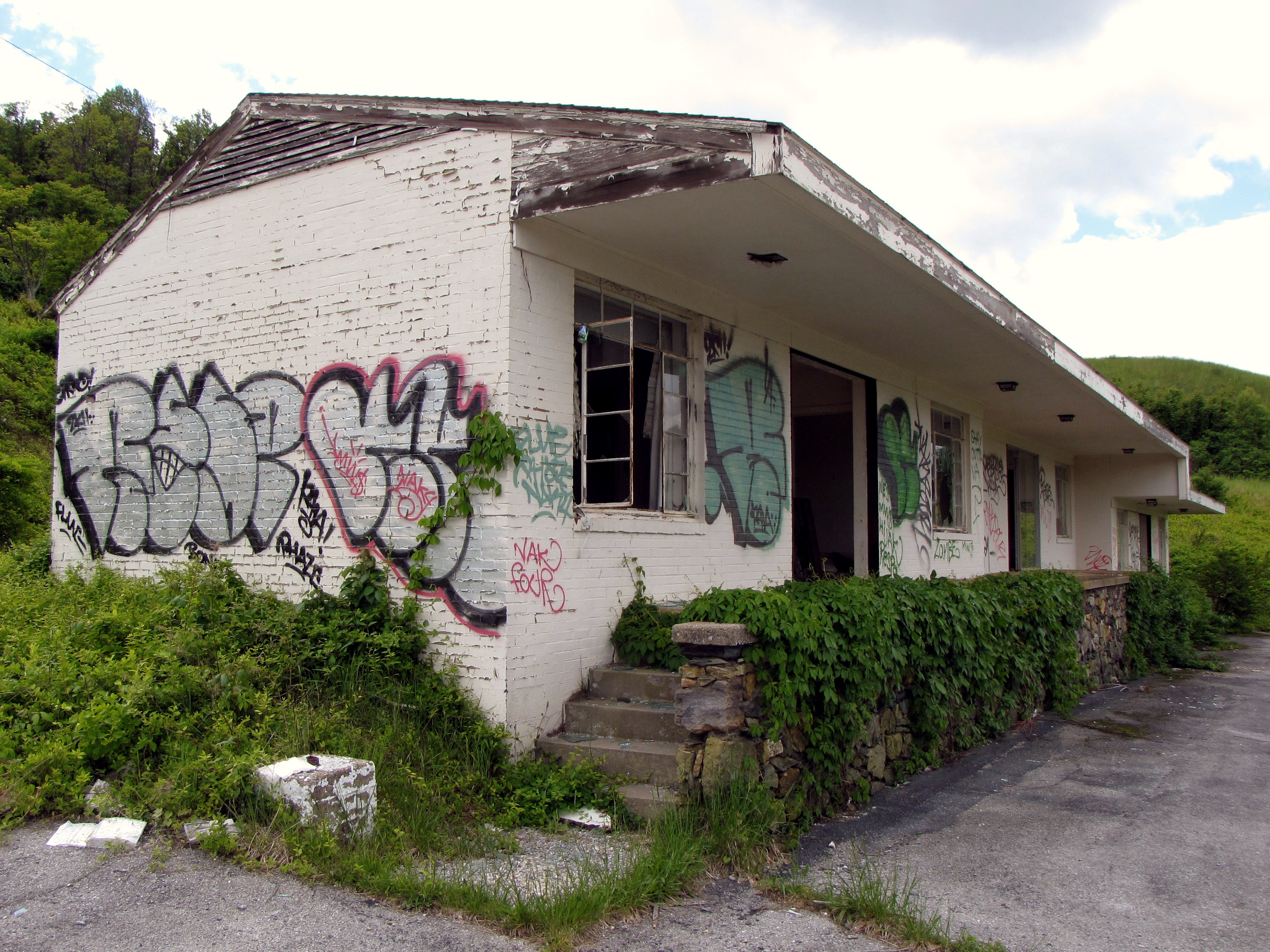


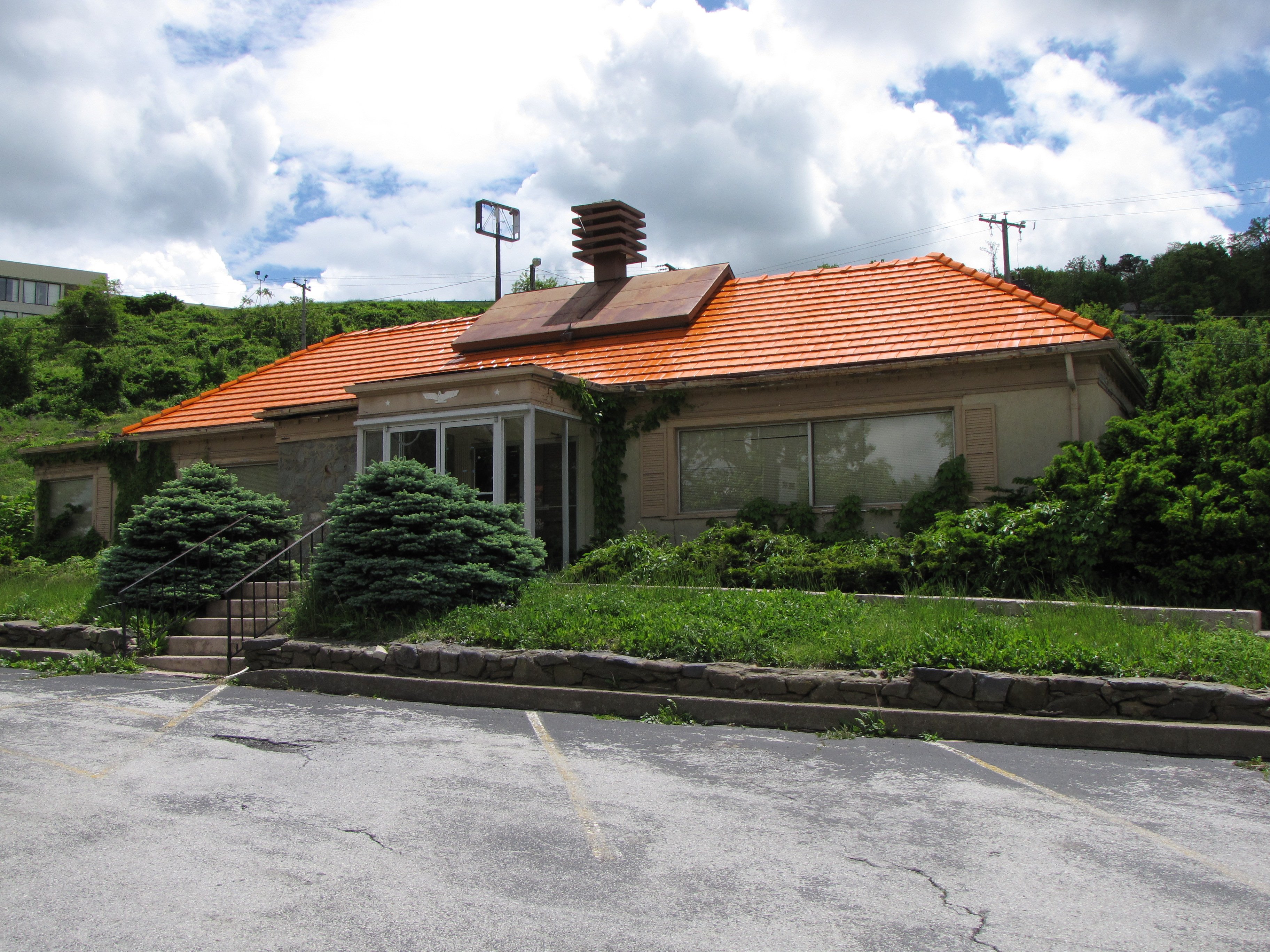
The Inn at Afton, meanwhile, actually looks like a modern hotel – essentially a very large Hampton Inn or Holiday Inn Express. I know that it’s The Inn at Afton, though, because that crappy kidney-shaped pool is still there.
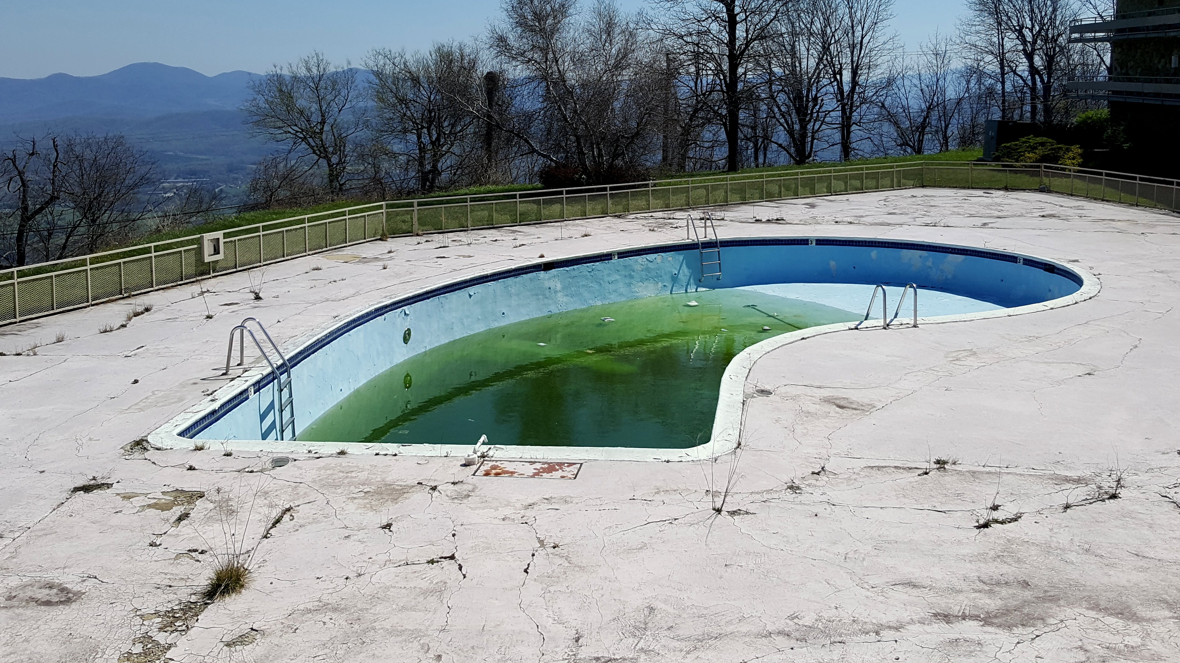
We then flew over to Staunton, where we visited DeJarnette. The game gets it in this case:

Even in the game, DeJarnette is abandoned, with several windows boarded up. Compare to what it looks like in real life:

It may look completely different, but at least they got the main thrust of it, that the building is abandoned.
And finally, we flew up to Harrisonburg and saw JMU. First, the lake area:

Of these, they got it half correct. Except for the gable roof, Chandler Hall, at front left, is accurate enough, having the right number of floors and shape. However, that building now no longer exists to make way for a College of Business expansion. Then to the right of Chandler Hall is Zane Showker Hall, where I had many classes. Showker has been reduced to a one-level building. Looks like a lovely office building, but not the Zane Showker Hall that I knew. Likewise for Eagle Hall behind Showker. That’s an eight-story dorm building, and it’s also a single-story building in this rendering. How they manage that, I don’t know. Shorts Hall, to the left of Eagle, looks pretty close, though it’s missing a level. Half credit here.
And here’s Potomac Hall:

Potomac Hall looks like a Marriott Residence Inn! Compare to Potomac Hall (now Chandler Hall) in real life:

And here’s the College Center:
")
Pretty accurate compared to real life, though the rendering engine walled in a lot of windows.
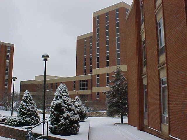
And then here’s my freshman dorm, McGraw-Long Hall:

It looks like an apartment complex, but with no parking lots or anything around it, it looks like a building that has been abandoned for many years. Compare to real life:

I suppose that they got the outline of the building right, but that’s about it.
So all in all, I had fun giving Elyse the aerial tour of some of the areas where I grew up. I still have no interest in actually flying the planes in the simulator like I mean it, but I enjoyed seeing how the game rendered real-life locations that I was familiar with. The results were amusing as we found that everything was the right shape, but looked completely different. I hope that the map data eventually improves to the point where they show the actual buildings rather than the renderings like Howard County has, but I imagine that it will be a very long time before that happens.
Categories: Afton Mountain, Harrisonburg, Staunton, Stuarts Draft, Video games, Waynesboro