


A lovely little road trip to West Virginia and back…
6 minute read
July 23, 2017, 3:53 AM
This past Wednesday, Elyse, Aaron Stone, and I took a little road trip to Jefferson County, West Virginia. There was some stuff for all of us, as Aaron wanted to see some stuff that Elyse and I had seen before, I wanted to see some stuff that I had spotted in some Instagram pix, plus wanted to get newer photos of some areas where I had been before.
But first, food. We designed our trip to take us to Sunshine General Store, which is this little hole in the wall restaurant north of Brookeville, at the intersection of Georgia and New Hampshire Avenues. Their hamburgers are to die for – thick and juicy. However, you really have to know that they’re there, because at first glance, the place looks abandoned.
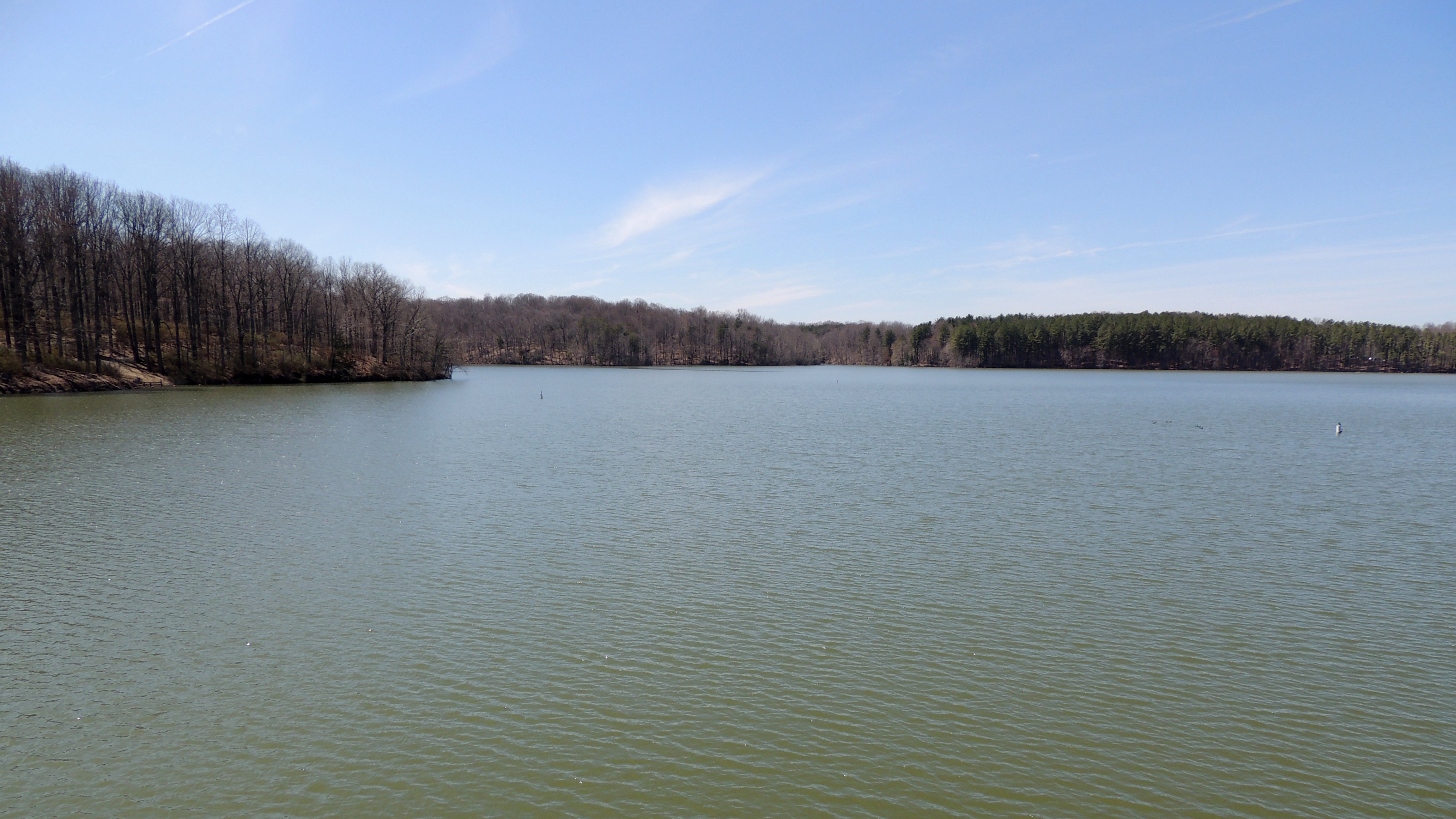
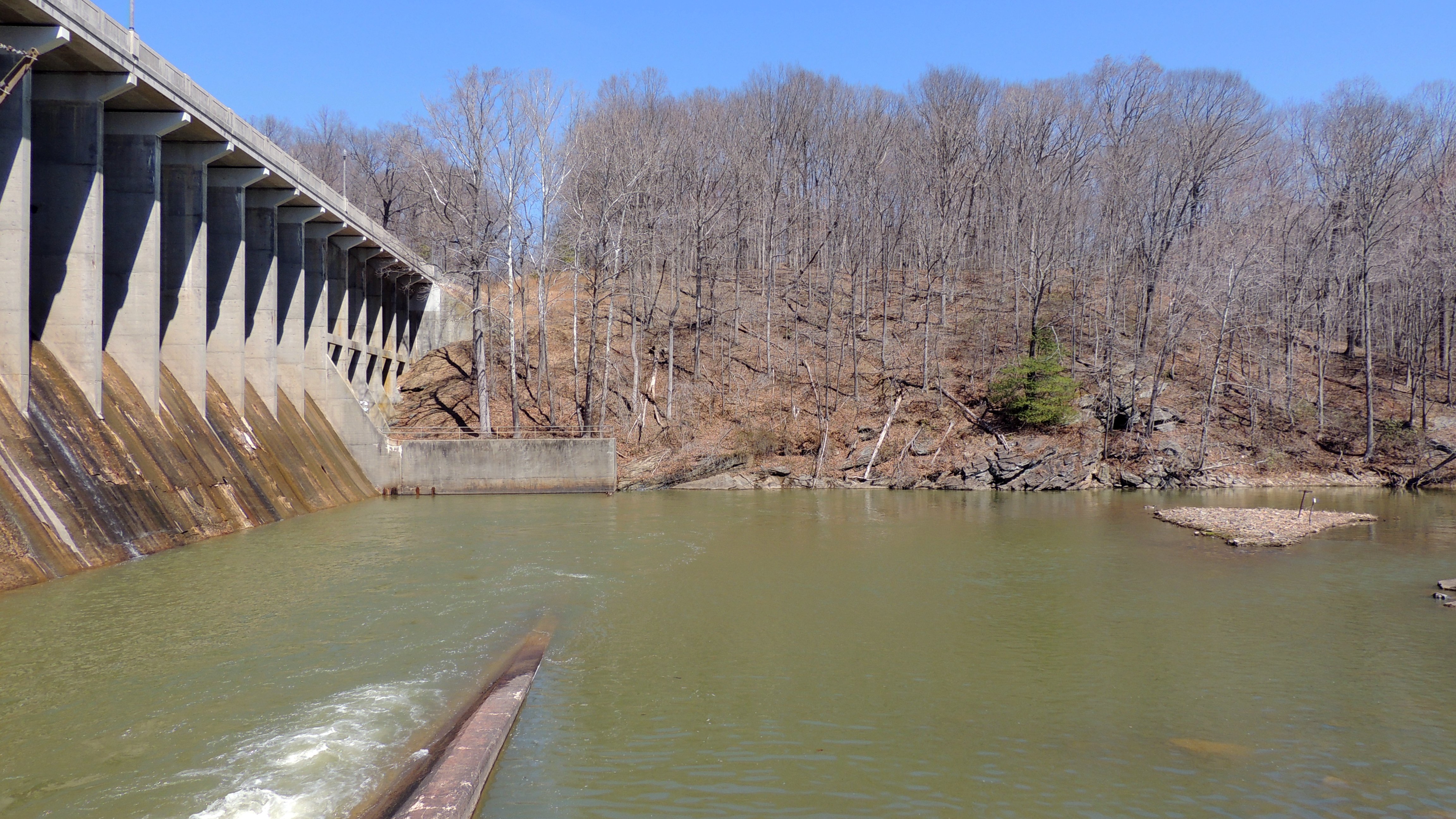
After we had our hamburgers, we headed over to Brighton Dam. The intent was to get some new photos of the dam, but much to my surprise, a dam rehabilitation project was underway, and the park where you got the best views of the dam was closed in order to accommodate the construction work. The level of Triadelphia Reservoir was much lower as well, presumably because of the dam project, and from the looks of the now-exposed land, it had been lower for quite a while:

Triadelphia Reservoir, with the lower water level. Compare to the water level in April 2014.

The water in the Patuxent River downstream from the dam was very muddy. Guessing that this has to do with the rehabilitation project as well, since the water was clearer with a greenish tinge to it in my previous visits.
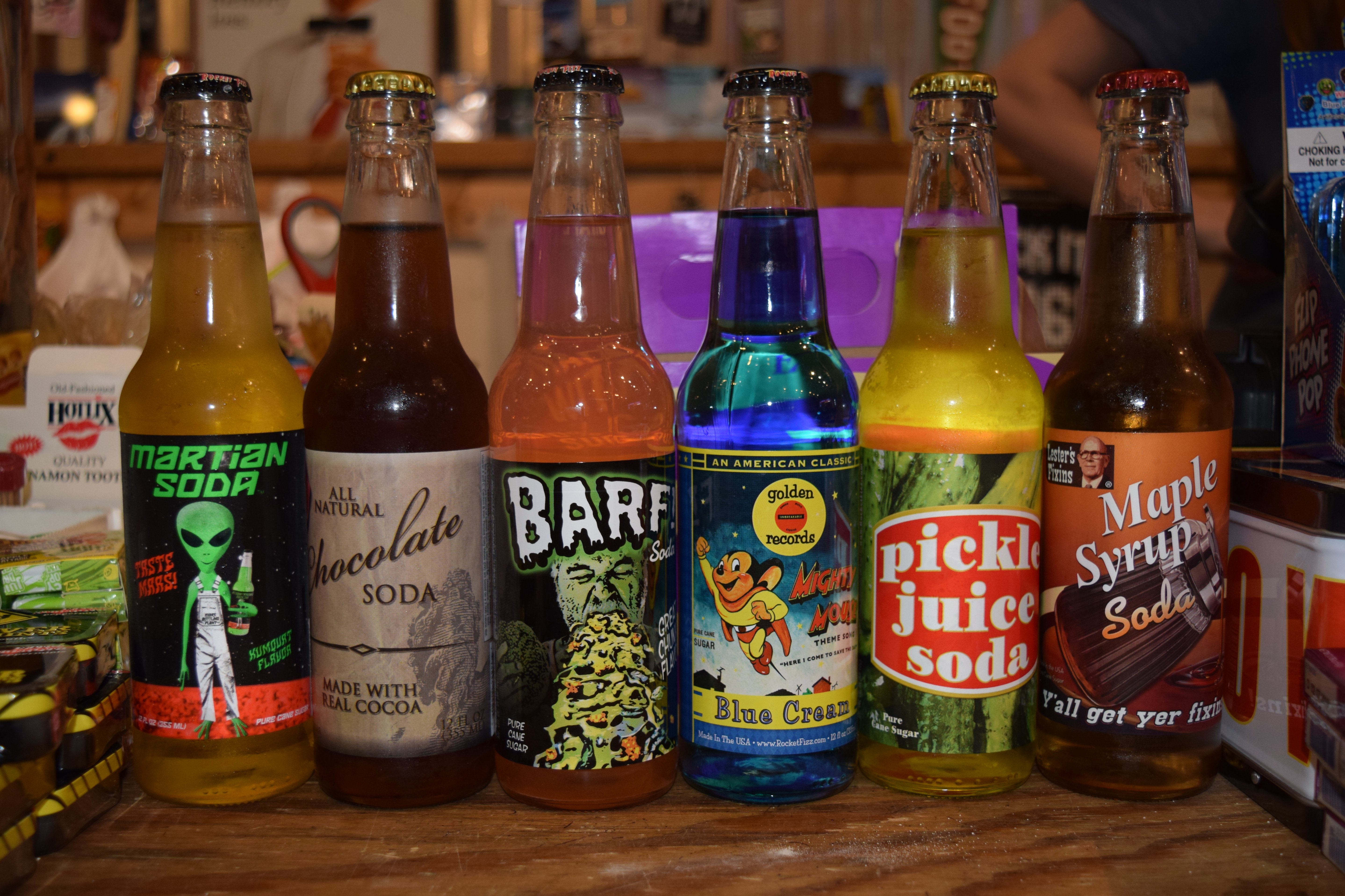
After seeing Brighton Dam, we headed out to Frederick. There, we headed up to the North Market Pop Shop, which is a soda shop similar to Rocket Fizz, which sells novelty sodas and such. Check these out:

A wall of root beer. So many different kinds of root beers.

A wall of fruit sodas, ginger beers, and novelty sodas.
We didn’t buy anything on this visit, though. This visit was just to scope the place out, as I still have four of the six novelty sodas from Rocket Fizz that we got on the way back from the Outer Banks.
We then headed over to Frederick Towne Mall, because Aaron had not yet seen this now-disused mall. The best view of the interior is inside Boscov’s, where part of the gate is papered over, a lot of it isn’t, and you can see the interior of the mall. Check it out:

All of this should have been gone by now, replaced by a parking lot for a Walmart store that was to be built behind the mall footprint. However, Walmart pulled out of the project in late 2016 despite a groundbreaking ceremony, and as far as I can tell, that put the kibosh on the whole redevelopment. The mall is not abandoned, though. The security cameras and siren are new since Elyse and I last visited back in April.
Leaving the mall, we headed out to West Virginia – specifically, Shepherdstown. I had, by sheer chance, spotted photos of a railroad bridge piggybacked on an Instagram post about an ice cream shop in nearby Sharpsburg, Maryland. I interacted with the poster, and learned the location of the bridge and the vantage points that were shown. So we went to look and photograph.

Elyse smiles next to the railroad tracks.

Aaron photographs the railroad bridge.

The bridge. Needless to say, considering the length of the bridge and its height, you never want to foul the tracks here unless you can get confirmation that all traffic is stopped.

Sign denoting the Maryland state line, across the track from our location, and a reminder that Maryland starts on the far banks of the Potomac River, i.e. the river belongs entirely to Maryland.

The track, facing the other way, with the bridge behind me.
Then we headed over to the Rumsey Memorial, and I got this photo of the bridge:

Not bad. We probably came too late in the day to get great shots, but the site definitely has potential. Seems worth revisiting, though earlier in the day, and when it’s not so humid out.
Otherwise, Elyse got some photos of me getting in position to get that last photo:


Sexy. This, by the way, is what happens when you hand Elyse your camera to hold while you climb through the railings. Then she also got this photo of me before coming back through the railings:

There you go, I suppose.
We then left Shepherdstown and headed over to Charles Town. After the whole dust-up with the death metal band over the cemetery pic, Elyse wanted to see the “historic French cemetery” that’s actually in West Virginia. So we headed over to Edge Hill Cemetery and took a look. Much to my surprise, there was an open grave at the east end of the cemetery:

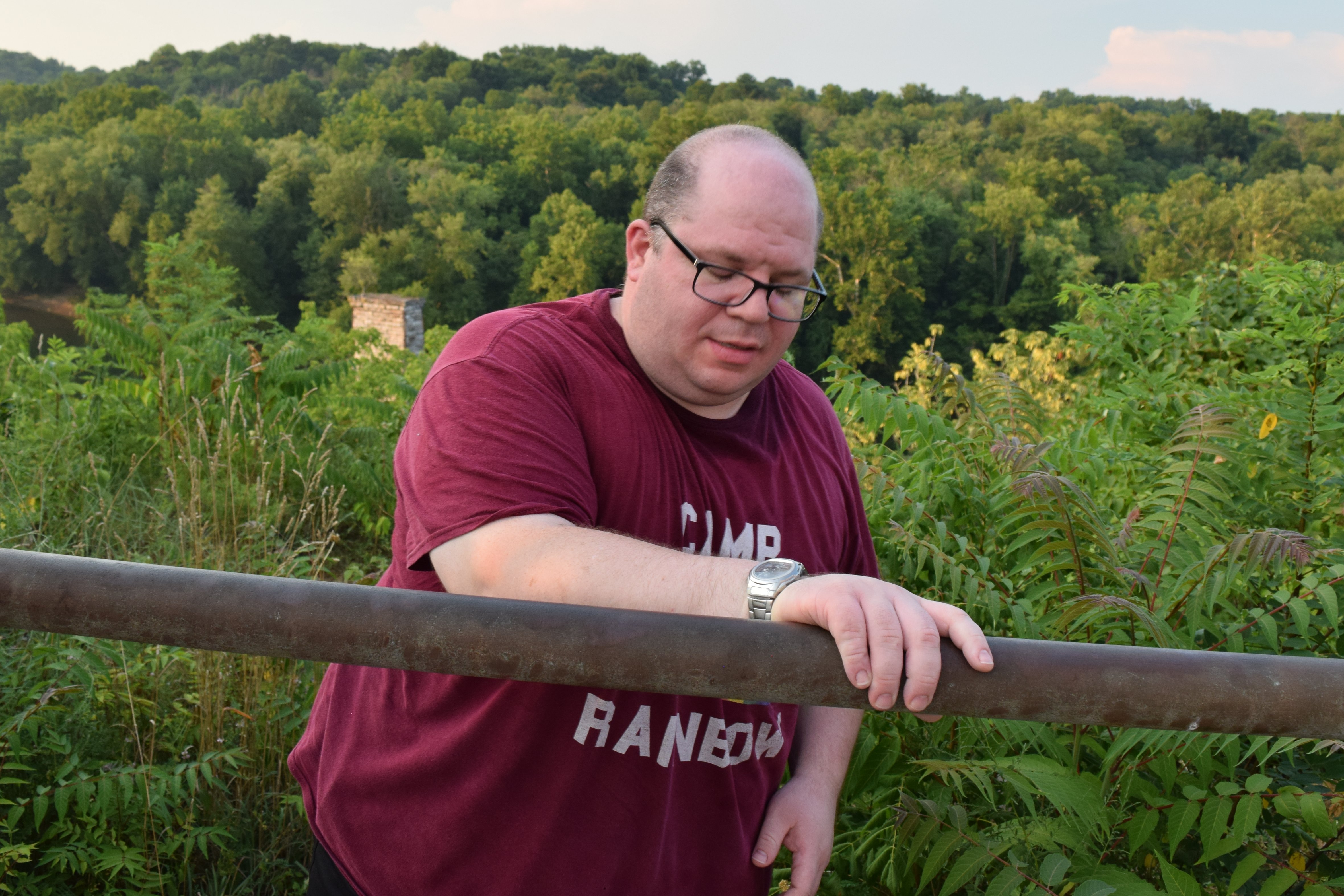
I never really thought about the depth of a grave, other than the whole “six feet under” thing. But it’s deep. If you fall into an open grave, there’s a good chance that you won’t be able to climb back out of it on your own. Then I also got a photo of Aaron standing next to the open grave, contemplating life:

I don’t know whose grave this is, but next time I’m out here, I’ll update, since I want to do more photography in Edge Hill Cemetery.
Otherwise, I got a few photos of the older part of the cemetery, or as Elyse called it, “the French part of the cemetery”:

Photo taken from a similar angle as the photo feature from October 2013. Notice that they added some poles and chains around some of the graves. I wish that they hadn’t done that, because it destroys the scene.

Photo taken facing east, past the last chain.

Headstones for Cleon and Ellen Moore. Ellen’s stone irks me a little, though, because it sort of indicates that her identity is completely tied to her husband, and that she is not an individual in her own right. It’s kind of like people who sign their name “Mrs. John Doe” instead of “Jane Doe”.

Headstone for the Reverend Sydnor Gilbert Ferguson. I’m no expert on these things, but the top half of this headstone appears to be a lot more modern than the bottom half. I wonder if it wasn’t replaced at some point.
From here, we headed out to Harpers Ferry to show Aaron the train station, and then we headed back. All in all, not a bad day.
Categories: Elyse, Frederick, Friends, Montgomery County, West Virginia