


Outer Banks
Part 2
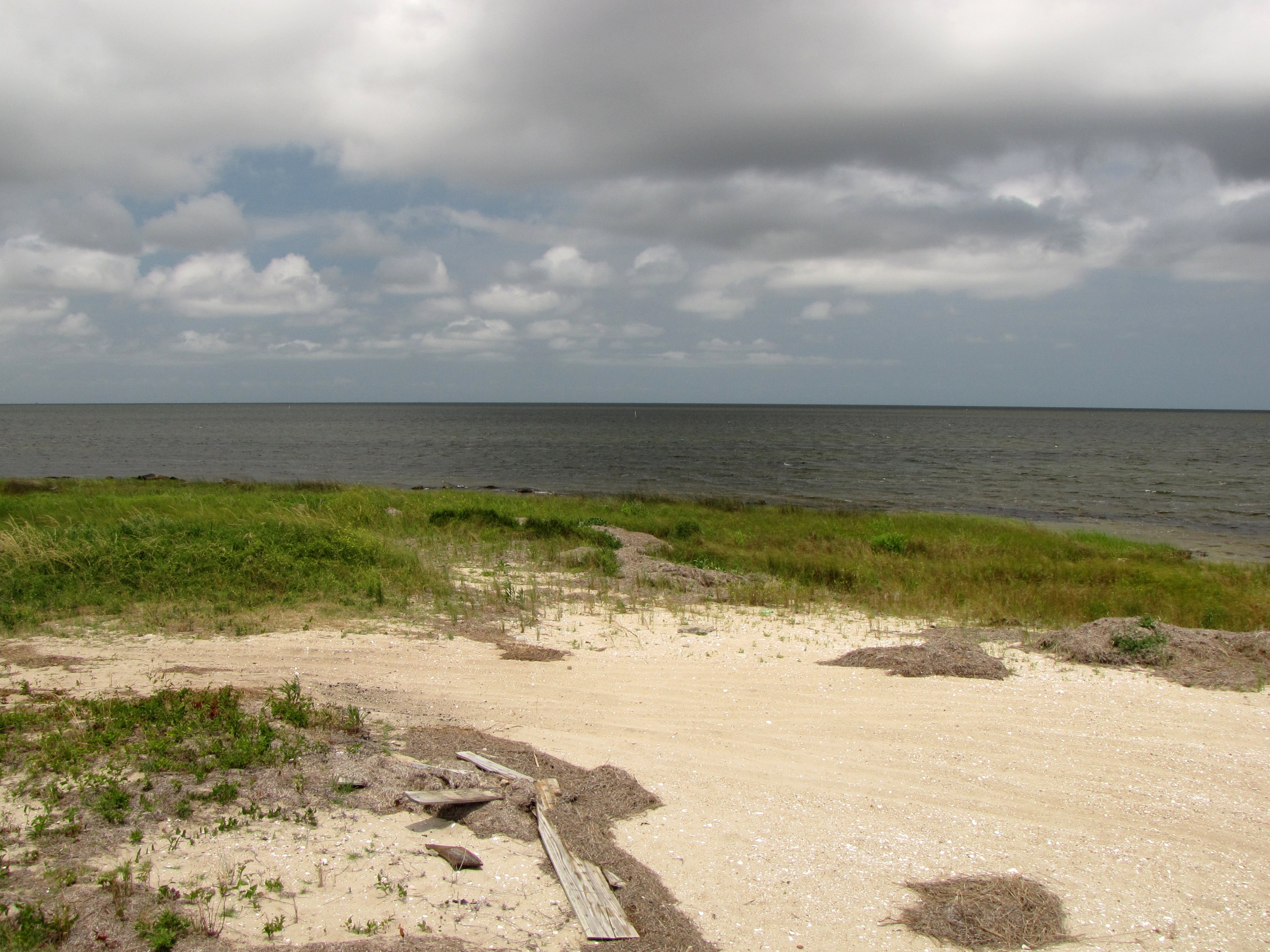
On Saturday, the first thing that Pete and I did was head back over to Diamond Shoals for breakfast, where we had a pretty good meal, complete with a few cups of coffee. Then our plan for the morning was to enjoy a couple of things separately. Pete wanted to hit the beach for a few hours, and I wanted to do the Cape Hatteras Lighthouse. It worked out, because the beach and the lighthouse are right next to each other. So I dropped Pete off at the old lighthouse site, and then headed over to the new lighthouse site. We agreed to meet back up in two hours.

At the parking lot, I found a “Soul mate”.


This person put those “family” decals on the back of their Soul. This was right around the time when the ridiculous rumors were circulating that these stickers were dangerous, so it was worth a photo. Apparently these people like Disney. Now I know who to rob for the Disney swag that I neither want nor need. Right on.
This would be my third time going up the Cape Hatteras Lighthouse. I went up in 1996 and 1997 with my mother and sister, but that was at the lighthouse’s old site. This would be my first time climbing the lighthouse at its new location. The new site had a visitor center, which was clearly built for the new site, and then beyond that was the lighthouse, along with the lighthouse keeper’s quarters, which were moved along with the lighthouse, and placed in the same orientation relative to the lighthouse as before. It was free to visit the grounds, but it cost $8.00 to climb the lighthouse.

Two people up on the balcony, viewed from the ground.
Going up the lighthouse this time was surprisingly easy. I remember the ascent’s being something of an ordeal the last two times that I went up. This time, I was at the top in no time, and surprised to have reached the top so soon. I believe that a few factors contributed to its being so much easier this time. First, I am in far better physical shape than I was in when I was 15 and 16. When I was 15 and 16, I was not at all interested in exercise and physical activity, preferring to spend much of my time developing a then-new website that you may have heard of before called “Schumin Web”, and so climbing the requisite 257 steps was certainly a challenge. In addition, my mother was very much interested in getting up to the top in as little time as possible. Thus it ended up being an ordeal because Mom didn’t want to make stops partway up, so we’d go past the landings without stopping. My sister and I just about had to beg for a break at one or two of the landings, and then it wasn’t really long enough for us to fully catch our breath. Not fun. This time, I had no problems, plus pacing came naturally as I stopped to take photos out of the windows on the way up. Amazing how being in shape and pacing yourself makes climbing the lighthouse a breeze.

Entrance to the lighthouse.

The entrance, from just inside.

Looking up from the bottom.

Plaque next to the entrance, showing the date the lighthouse was built, and the coordinates where it was originally located. The printed sign on the wall next to this marker shows the new coordinates following the lighthouse’s 1999 relocation.

View looking downward from about three landings up.

Sign on the wall at a landing at the lighthouse’s midpoint, encouraging visitors to pace themselves on the way up. Pacing yourself certainly makes climbing the lighthouse a breeze!

View from a window on one of the landings.

View from a window on the opposite side.
At the top of the lighthouse, I noticed that the systems up there were different. Back in 1997, there was a board next to the balcony door that was full of electrical boxes. Now, the board was still there, but the electrical boxes were gone. I don’t know if the wiring and such was redone during the move or if it happened later, but it was different now.

That gray wooden board used to be filled with electrical boxes and such. Now it’s fairly minimal.

The lights at the top of the Cape Hatteras Lighthouse. I asked the park ranger about the possibility of getting a closer look at the light assembly, and she was quite nice in declining my request saying that only the Coast Guard is allowed up there. I responded by saying, “So in other words, you’re not even allowed up there, so there’s no way that you’re able to let me up there.” I understand.
That said, depending on how geeky I feel next time I plan to visit this area, it might be worth writing the Coast Guard in advance to discuss whether or not they would be willing to let me have ten minutes or so up there. Just a thought.

Ladder up to the aforementioned lights.

Another view up towards the lights.

Signage next to the door out to the balcony, asking that visitors limit their balcony time to five minutes, which seems awfully short to me. However, this was a non-issue on this particular day, because as it turns out, Saturdays and Sundays are the lighthouse’s slow days, especially in the earlier part of the season.
The view from the balcony felt very different than before. The lighthouse had been moved 2,900 feet to the southwest, and was now 1,600 feet away from the ocean. While the beach was quite visible from the old location, since it used to be practically on the beach after decades of erosion, the beach was not very visible now, as much of it was obscured by trees and topography, plus it was much further from the beach than it used to be. So I couldn’t even try to see if I could see Pete from the lighthouse.

View from the Cape Hatteras Lighthouse balcony.


A park ranger helps a family get a photo on the balcony.

The path that the lighthouse took going from the old location to the new in 1999.

This additional railing, obviously not part of the original construction, serves a purpose that you might not think about: to prevent visitors from tossing items off of the balcony, as this area is directly over the entrance to the lighthouse, which receives a lot of foot traffic.

The lighthouse balcony on the other side, without additional adornment.
, and it had gone away by the time that I finished on the balcony.")
The imprint that the floor of the balcony left on my knee after getting the previous photo. It looks worse than it actually was. It didn’t hurt by any means, but it was an interesting feeling to touch (both on my fingers and on my knee), and it had gone away by the time that I finished on the balcony.


After I was finished on the lighthouse balcony, I headed back down.


At the bottom of the lighthouse, facing outside.

The lighthouse, viewed from below.
Reaching the bottom, I headed over to the lighthouse keeper’s quarters, which now housed a museum. The museum was much the same as it was in 1997, however, the fresnel lens was gone. As it turned out, this lens had been relocated to the Graveyard of the Atlantic Museum in Hatteras Village. I also noticed something new: a fire alarm system. The museum didn’t have a fire alarm system when it was at the old location. Now it did. Considering that it had Ademco (Wheelock) pull stations and SpectrAlert classic notification appliances, I’m guessing that this alarm system was installed around the time that the building was moved.

The Museum of the Sea, in the old lighthouse keeper’s quarters.


SpectrAlert classic horn/strobe, and Ademco pull station.
Finishing up at the museum, I headed back towards the lighthouse, and then followed the track that had been cut through the trees in 1999 for the move, which was adjacent to the visitor center. There, I met up with Pete, who had finished up at the beach and come over to the lighthouse.

Pete in front of the lighthouse.

The lighthouse, with darker clouds’ beginning to arrive from the west.
(For more lighthouse photos, check out my Flickr page.)
From there, we headed back to the room so that Pete could change, and then headed out again. Our plan was to head down to Ocracoke to visit two places: Oinc’s BBQ, a Carolina-style barbecue place, and Village Craftsmen, which was a store full of handcrafted items.
Our first stop, however, was unexpected. At the end of Ballance Drive, I spotted Pilot House, the restaurant where we went on our last night at the Outer Banks in 1996. Much to my surprise, it was abandoned. We stopped for a moment there so I could take some pictures of it. Kind of a shame to see such a beautiful facility be abandoned like that, though, and by the looks of things, it had been abandoned for a number of years.
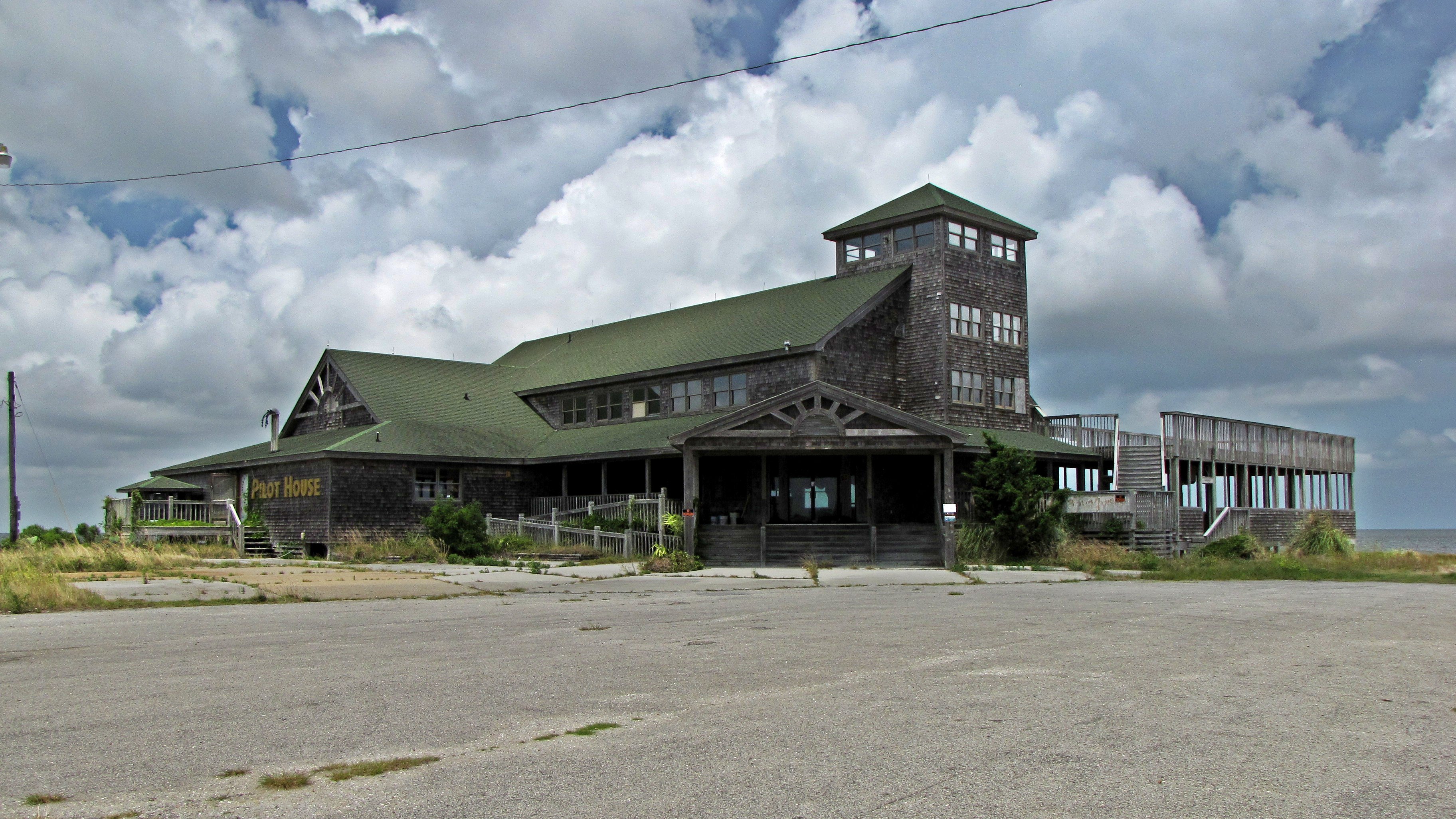

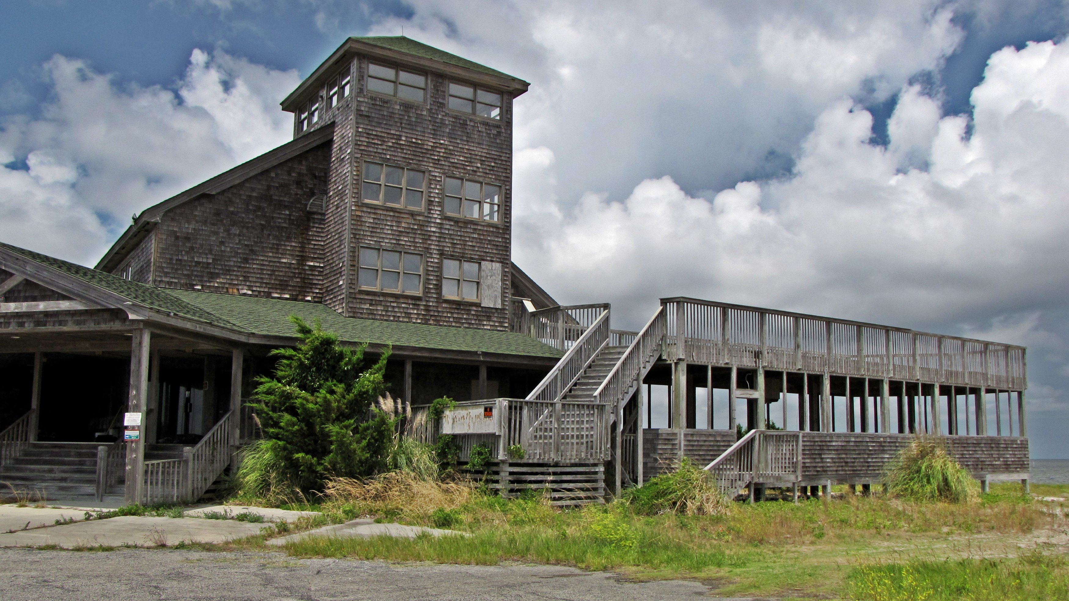


Surprise: a fire alarm pull station visible through a window was down! Noting that no alarm was sounding, that indicated to me that the building had no electricity. It was also a sign to me that this building had probably been abandoned for a long time.
Just as I had finished up, another car came up Ballance Drive. In it was a middle-aged woman, who asked what we were up to, and then, after I explained (a little photography), attempted to lecture us about how we weren’t supposed to be there. The woman was absolutely right in that we weren’t supposed to be there (it was private property), but I didn’t appreciate the overly confrontational tone that she took with us. In any case, we left, and that was the end of that. And the pictures that I got were stunning.
After this, we continued south on Route 12, through Frisco and towards Hatteras Village to meet the ferry to Ocracoke. For those not familiar with the area, Ocracoke is the next island south from Hatteras, separated by Hatteras Inlet, which was created during a violent gale on September 7, 1846, separating Hatteras and Ocracoke islands. There is no highway access to Ocracoke Island, and therefore access to the island is accomplished by ferryboat, operated by the North Carolina Department of Transportation’s Ferry Division. We arrived just as a ferryboat was leaving, and therefore we had to wait for the next one.

The gates to the ferries.

My car, while waiting to board the ferry. Pete is in the passenger seat.

Cars drive off of the Floyd J. Lupton.
Eventually, it was time to board, and so I drove the car onto the deck of the W. Stanford White, a River Class ferry built in 2003. Vehicles line up in four rows. Three are to one side of the superstructure, while one is partially enclosed, on the other side of the superstructure. We were in the fourth, partially enclosed row. Riding in the 1990s on the Alpheus W. Drinkwater and the Frisco, I remember the ferry crew’s using chocks on all of the vehicles. Either my memory is incorrect on this point, or the policy changed since 1997, because this time, they only chocked the wheels of the vehicles at the ends of the deck.
Once we got the car parked, we were free to wander around the ferry. While Pete decided to stay in the car, I wandered around with my real camera and my phone, taking photos of the ferry and the waters of Hatteras Inlet.


The Soul on the deck of the W. Stanford White. I was parked at the forward end of a partially-enclosed part of the deck.

The final stages of boarding prior to departure.

Sailing out of Hatteras, past the Coast Guard station.


Upper deck outside the passenger lounge.

A Hose-McCann bell, used as the general alarm.


Passenger lounge, one deck above the cars.

My glasses, messed up from the salt spray. I ended up cleaning them using stuff on a nearby custodial cart.

Navigation lights on the superstructure.


Door open to the engine room below decks, marked with a handmade restricted area sign. I assume that this door is normally kept closed. I can only speculate as to why, and I’d guess most likely it’s to provide additional ventilation for this space.

Escape hatch for below decks.

Bogen horn-style speaker.

North Carolina flag flying from the mast.


Cars lined up on the open part of the deck.

 above the uppermost passenger deck.")
Life rafts in round “cans” (my term) above the uppermost passenger deck.


Fire station and fire axe aboard the W. Stanford White.

Coin-operated viewer on the upper deck.
The ferry ride itself felt longer than I remembered from the 1990s. Turned out that there was a very good reason for this: it was. Since December 2013, ferries on the Hatteras-Ocracoke service have been running on an alternate route due to insufficient water depths on the regular route. The NCDOT Ferry Division conducted test runs through the area during the week prior to our arrival, and found that the regular route was still not safe for regular ferry operations.


The waters of Hatteras Inlet.


Note the storm clouds gathering in the distance.

Passing another ferryboat, the Croatoan.


Sea gulls trailing our boat.

A family feeds the sea gulls from the stern.

Passing another ferryboat, this time the Roanoke.

The ferry ride was also a little wetter than I remember from the 1990s as well. I don’t recall getting much salt spray back as a teen, but I definitely got some this time around. I also found out that it’s a bad idea to leave the windows of the car open if you’re next to the side of the boat, as I got some minor salt spray in the car. I also managed to get salt spray on my glasses and on the lens of my camera, which required some cleaning.

Salt spray in the car.

Arriving at Ocracoke.
Arriving at the Ocracoke terminal around 2:20 in the afternoon, we got off the ferry and continued south on Route 12 towards the village of Ocracoke, at the south end of the island. There, we finally felt the presence of the clouds that we had seen building on the ferry, as we encountered a downpour as we headed down the island.

Heading south on Route 12 on Ocracoke Island, after getting through the rain.
Arriving in the village of Ocracoke, our first goal was to find Oinc’s. We knew approximately where it was, but due to the lack of reliable mobile service, we couldn’t GPS it. We initially overshot it, and then, after realizing that we’d gone too far, backtracked and found it.
Oinc’s was not quite what I expected, but it was still awesome. I believe that one of the reasons that we missed it on our first pass was that we were looking for a building. Oinc’s foodservice operation is based out of a small trailer on the property, it has all outdoor seating, and is somewhat set back from the road, with only a sign visible from Route 12. The food was excellent. Pete and I each got a barbecued pork sandwich and red potato salad.

The trailer out of which Oinc’s is operated.

Tiki bar located on the same property as Oinc’s.

Seating area at Oinc’s.

My meal at Oinc’s.


Route 12, also known as Irvin Garrish Highway through Ocracoke, in front of Oinc’s. The road was less busy than on Hatteras Island, and contained a large number of cyclists.

From there, we headed over to Village Craftsmen. It’s located down a very bumpy dirt road. Owing to the rain that had fallen earlier, it was also a very muddy dirt road with some big puddles. Going down that road, I figured that I had nothing to lose, because the car had already been slimed by the salt on the ferry. Thus since it already needed to be washed, what’s a little mud, right?

“Drive Real, Real SLOW” as seen on a sign on the narrow dirt road leading to Village Craftsmen.
, indicating how to park at the store's small parking lot, indicated that we were to park facing the green house (below), using a swatch of color to indicate which house. I found this to be less than intuitive, because I read it as \"Please park cars facing house\" and figured that the green swatch was something that was marked out on the sign, and the arrow was pointing at the Village Craftsmen building. So I ended up being a bit confused, as I assumed that they meant parking cars to the right in the lot, facing their building (which looked houselike). Pete eventually set me straight on this matter, and I got pointed the right way.")
This sign (above), indicating how to park at the store’s small parking lot, indicated that we were to park facing the green house (below), using a swatch of color to indicate which house. I found this to be less than intuitive, because I read it as “Please park cars facing house” and figured that the green swatch was something that was marked out on the sign, and the arrow was pointing at the Village Craftsmen building. So I ended up being a bit confused, as I assumed that they meant parking cars to the right in the lot, facing their building (which looked houselike). Pete eventually set me straight on this matter, and I got pointed the right way.
If there had been a car in the lot, this confusion would have never occurred, as I would have parked next to that car. However, the lot was empty at the time of our arrival, thus the confusion on my part.
, indicating how to park at the store's small parking lot, indicated that we were to park facing the green house (below), using a swatch of color to indicate which house. I found this to be less than intuitive, because I read it as \"Please park cars facing house\" and figured that the green swatch was something that was marked out on the sign, and the arrow was pointing at the Village Craftsmen building. So I ended up being a bit confused, as I assumed that they meant parking cars to the right in the lot, facing their building (which looked houselike). Pete eventually set me straight on this matter, and I got pointed the right way.")
Signs marking the high tide line for various hurricanes that have struck Ocracoke over the years. Apparently 2004’s Hurricane Alex has the record at Village Craftsmen thus far.
The store itself was pretty neat. Lots of handmade crafts throughout the store, along with handmade soap and other consumables.

This jar, labeled for “Ashes of difficult bosses,” amused me, as I started thinking of past bosses that I’ve had that were difficult to work with. Mecca Marsh from Potomac Hall and Lane Brooks from Food & Water Watch came to mind as people that would be quite at home in this jar.
. No one said that a trip to the Outer Banks was a clean experience, I suppose.")
. No one said that a trip to the Outer Banks was a clean experience, I suppose.")
The Soul, parked next to the green house, just before we departed. Yes, the Soul was pretty messy by this point, having gotten slimed in and out (but nothing that a little cleaning couldn’t fix). No one said that a trip to the Outer Banks was a clean experience, I suppose.
Leaving the Village Craftsmen, we headed over to Ocracoke Lighthouse. This stop wasn’t really in the plan for the day, but since it was right there, we stopped over. I was a little disappointed about what there was to see at Ocracoke Lighthouse, but not too surprised about it. It’s a relatively short lighthouse (Cape Hatteras is 2½ times taller), and the lighthouse itself is not open to the public, as it lacks a substantial staircase. The visit involves taking a raised walkway from the small parking area across a lawn to the door of the lighthouse, where the path ends at a locked door. It’s definitely worth a few minutes while you’re already in Ocracoke, but it’s not worth making a special trip out just to see it.

A vintage Volkswagen bus parked outside Ocracoke Lighthouse.

Ocracoke Lighthouse in the distance, with the lighthouse keeper’s house in front. The keeper’s house is now a private residence. The raised walkway is visible at far left, beyond the white fence.

Ocracoke Lighthouse. If you ask me, it looks like a giant salt shaker.

“USLHE” on a gate next to the lighthouse. USLHE stands for “United States Lighthouse Establishment“, which originally operated the lighthouse. The lighthouse is now operated by the United States Coast Guard, as is also the case with Cape Hatteras.
We then went to the end of Ocracoke Island, where the island’s other ferry services operate. Those operate to Cedar Island and Swan Quarter. Unlike the ferry between Hatteras and Ocracoke Islands, these are toll ferries, each costing $15 to ride and requiring reservations. We weren’t interested in riding those ferries (too far afield and too much time commitment), but we can at least say that we drove the whole length of the island.